Category Archives: Newburyport History Map – Keeping the Story Alive

Three Years Working on the Interactive Newburyport History Map

Things I’ve learned over the last 3 years working on the Newburyport Interactive History Map – Keeping the Story Alive.

Bossy Gillis, the conflict between the wealthy and the working class

I started the interactive history map 3 years ago in 2019 because the new folks in town didn’t know the basic stories, like Bossy Gillis’s Gas Station on the corner of State and High Streets, that is a story of the class warfare between the wealthy people along the Ridge and the rest of the city, working class folks. That dynamic in 2022 has changed.

Newburyport History Map

Newburyport History Map

The ebb and flow of Newburyport’s well being

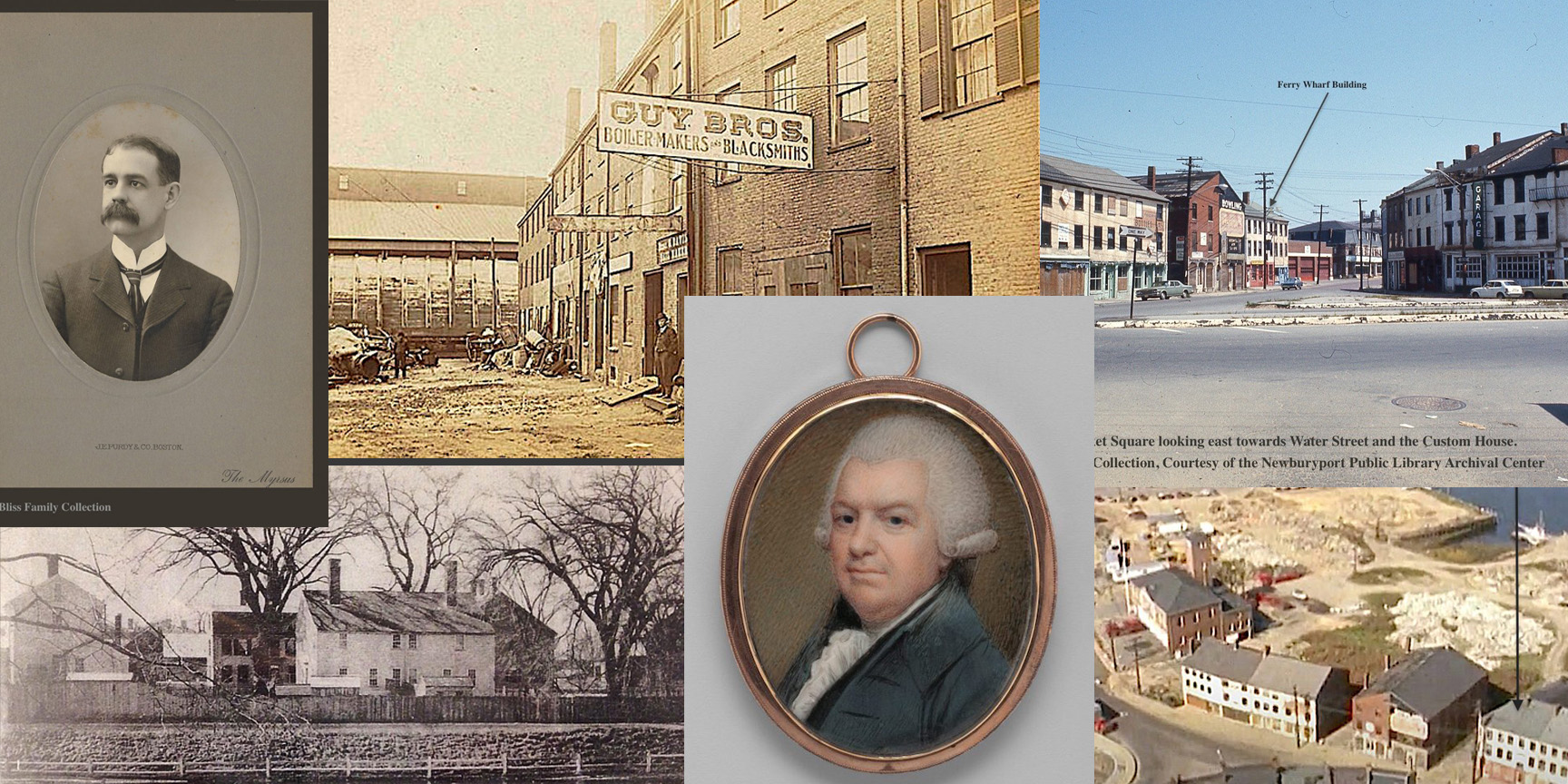
The story of Ferry Wharf that tells the ebb and flow of Newburyport’ success, decline and renewal, from the clipper ships and wealthy merchants, to the filling in of the wharfs near Market Square and the arrival the railroad and coal, to the decline and revival during Urban Renewal.

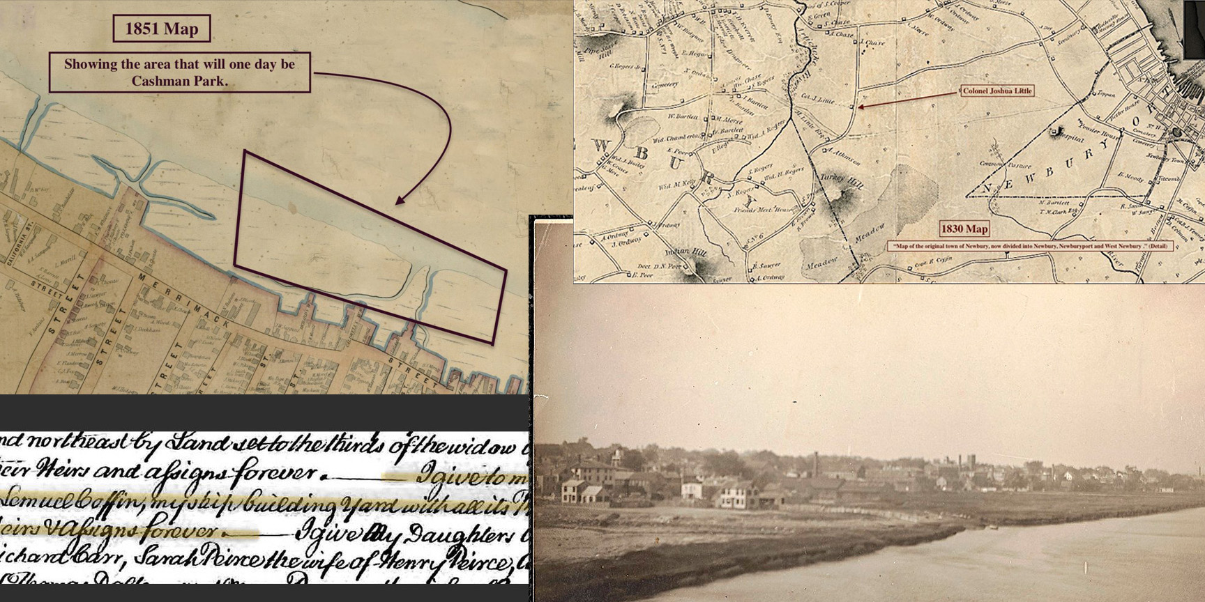
The story of Cashman Park, which was once just marsh and water, that became an eyesore. Of a second generation immigrant in Newburyport, Michael Cashman, who through hard work and smarts became one of the richest coal and oil dealers in Essex County. He had come up with a vision for the park in 1912, worked quietly for a decade and when he decided to serve his community and became mayor, he made Cashman Park a reality ten years later, a park that has enriched people’s lives for generations.

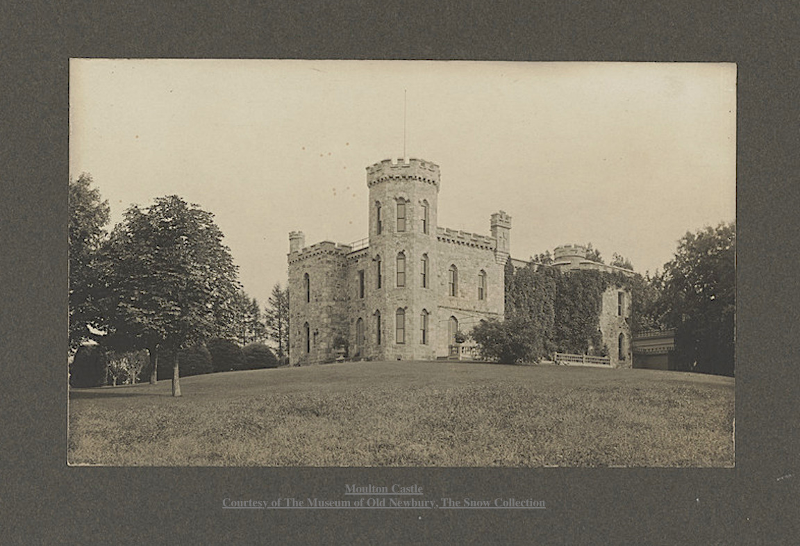
Henry Moulton who came to town in 1855, built himself a castle, wanted to build a whole community in the North End of the City, Moutonville, named after himself, and through bad luck, maybe hubris, maybe bad business, everything he built has faded from the landscape.

The story of Turkey Hill, which had been farm land since the 1600s. In the 1960s when the Newburyport’s Historic District had fallen on hard times, suburban development in the West End of the city seemed to be a way to save the town. Ten years later, the city decided to restore downtown, and what was a blighted area in 2022 is now an extremely desirable place to live.

Newburyport History Map

Forgotten Men

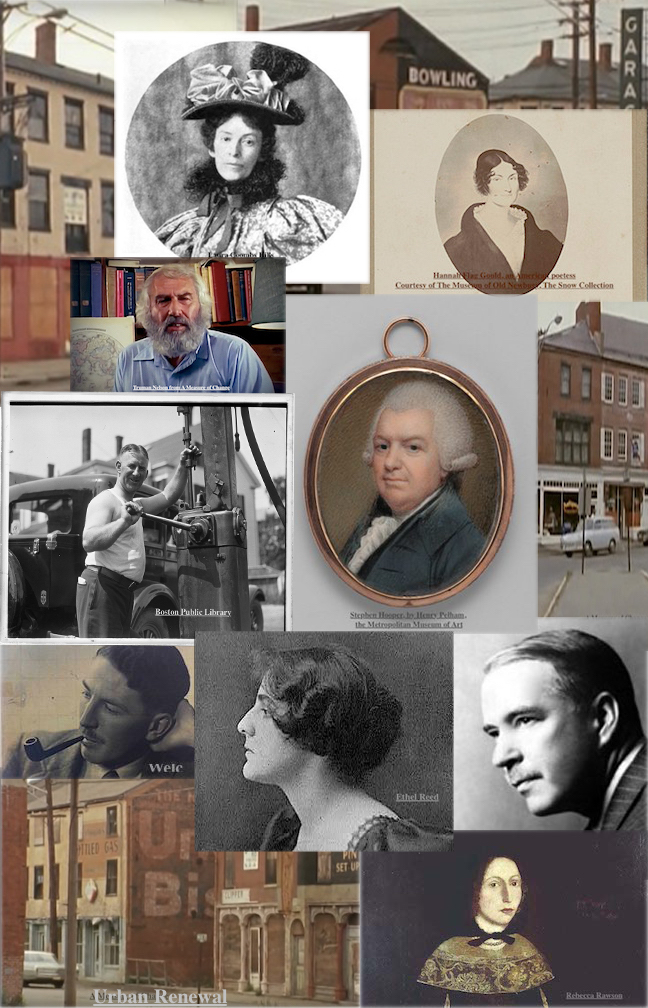
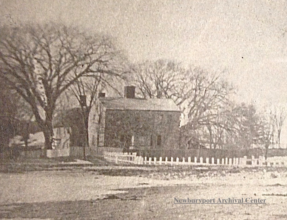
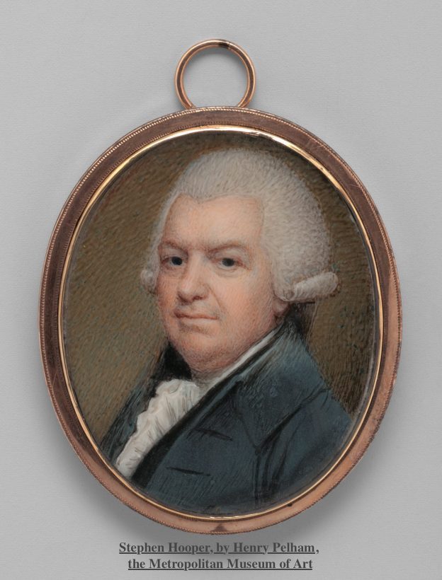
The wealthy and important men that no-one thought would ever be forgotten. Stephen Hooper one of the wealthiest men in Newburyport, a merchant and shipbuilder who married into one of Newburyport’ most important families and lived on a house on the Mall. No-one remembers him or the house that he lived in. Charles Bliss, one of the most beloved citizens in Newburyport, who died in in 1920, in 2021 no-one knew that he even existed. I managed to find and connect with his descendants and get some family photos and hopefully he and Stephen Hooper will now be remembered.

Newburyport History Map

The Women

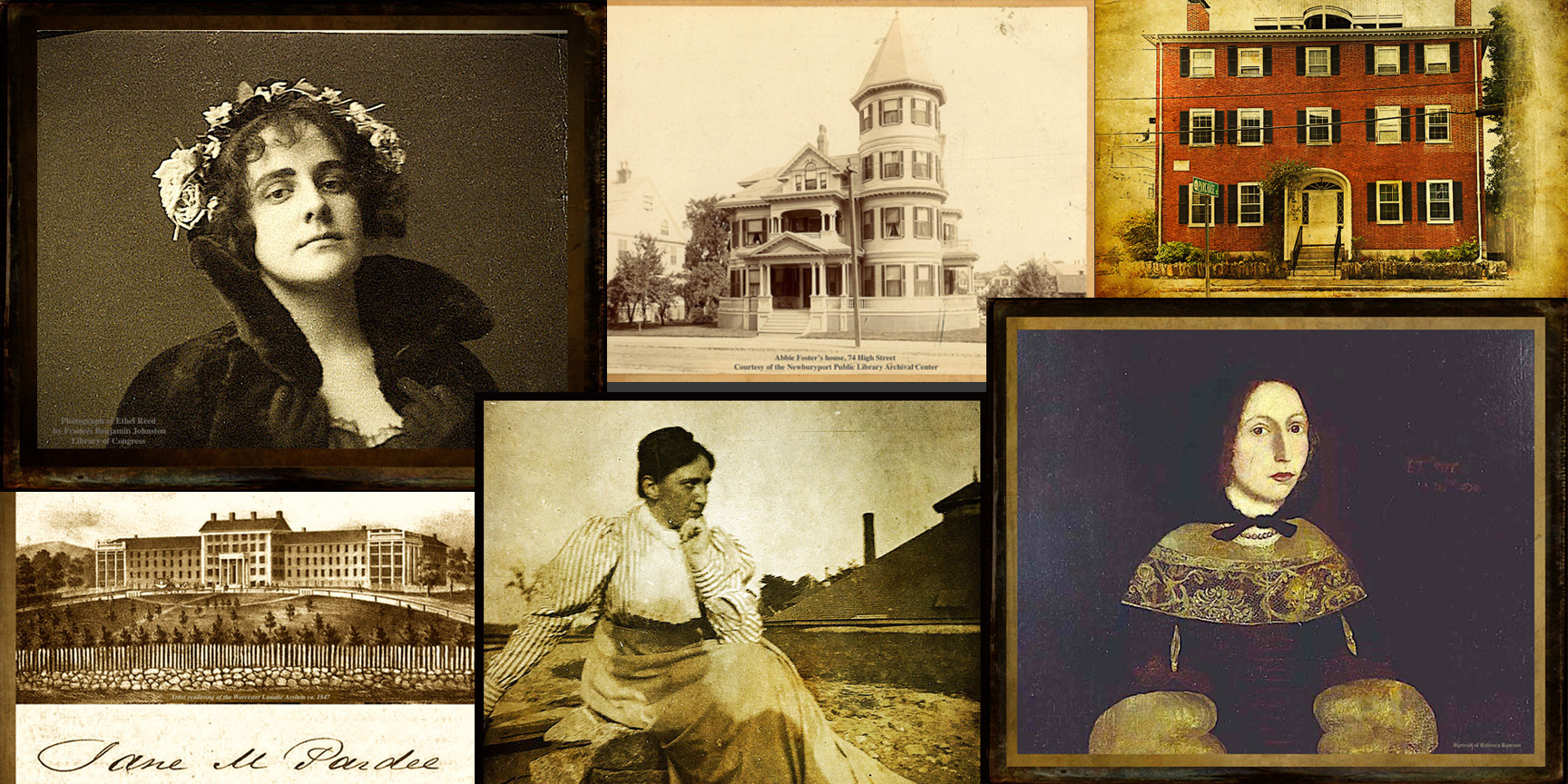
All the stories of the women. Rebecca Rawson who was deceived by a cad and abandoned. Ethel Reed who earned brief international fame as a poster artist in 1895, who was gilted by a rich Bostonian, and who died at the age of 36 somewhere in London.

Abbie Foster, the daughter of a shoemaker, who married Daniel Foster later in life. After her husband died, after two years of marriage, she built a gorgeous fancy mansion at 74 High Street. She probably was not welcomed by the people who challenged her husband’s will and maybe not the Newburyport’s upperclass. She lived in the fancy mansion with her servant until her death in 1913. Foster Court is named after her, and the only indication of her fascinating life.

Ethel Parton who was a famous writer of children’s books about 19th-century life in Newburyport, which were published in the 1930s and 1940s. At 69, she turned to her family’s stories and Newburyport’s history and began writing books for young adults. Until recently her name and story and books have been completely forgotten.

Jane Pardee, sent to lunatic asylum, maybe for her money, to come back, marry her niece’s husband, who may have been one of the men to put her in the asylum; to die in child birth in1862, two years after her marriage. Her husband and all of his children from his first marriage got her entire estate.

Margaret Atwood whose story is one of resilience, strength, generosity to those less fortunate than her – orphan girls and Native Americans. She was an astute businesswoman who ran her husband’s business after his death, rebuilt the Atwood Wharf after the fire of 1811, and not only survived but flourished after many others suffered economic hardship. Atwood Street is named after her.

The interactive map and the website History~Newburyport that coordinates with it, now has more stories on its blog, is not about the rare and important folks, it is about the stories and people that are mostly forgotten, that I hope people will read and now remember. A lot of the stories and research have come about from looking at deeds and wills and old newspapers, where stories are often buried and hidden, like the shipyard at the end of Jefferson Street at existed at least as early as the 1700s. My plan is to keep on exploring and putting more stories on the Newburyport Interactive History Map and to see what I learn next.

Explore the Newburyport Interactive History Map – Keeping the Story Alive.

A list of all the entries (with links) on the Newburyport Interactive History Map can be found here.
Working with GridPlay Designs to Create the New Website History~Newburyport

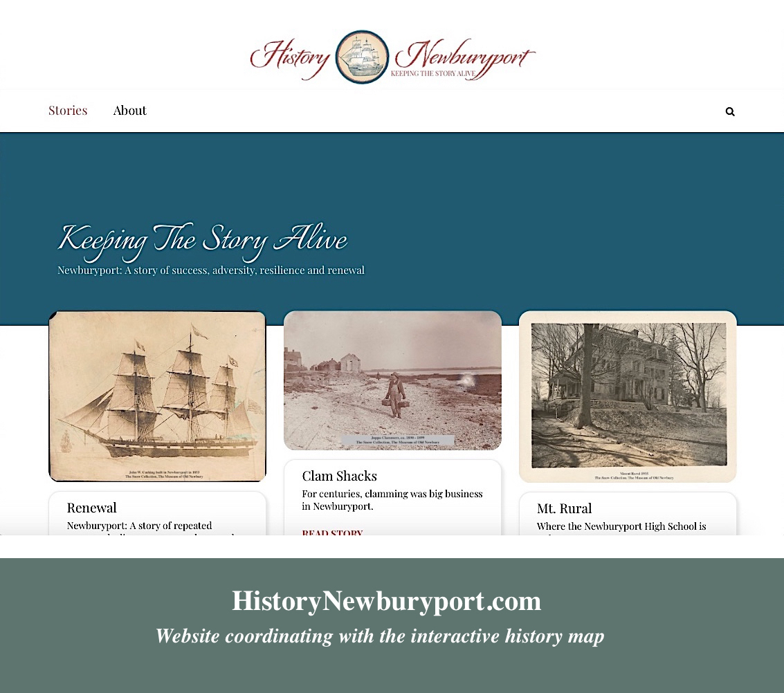
The home page of History ~ Newburyport

The home page of History ~ Newburyport. Both the beige and the dark teal color are from the 1851 map.

At the beginning of the pandemic I decided to create a new website that co-ordinated with the interactive history map, Newburyport – Keeping the Story Alive. I hired GridPlay Designs, and they did a gorgeous job in creating History ~ Newburyport.

It was a collaborative effort right from the start, I wasn’t even sure what the domain name should be, it is HistoryNewburyport.com, and it was so reassuring to have someone to think through that very basic and critical component.

slide show - GridPlay Designs

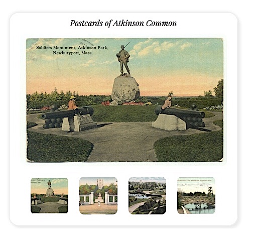
An example of the slide show that GridPlay Designs incorporated, postcards from Atkinson Common.

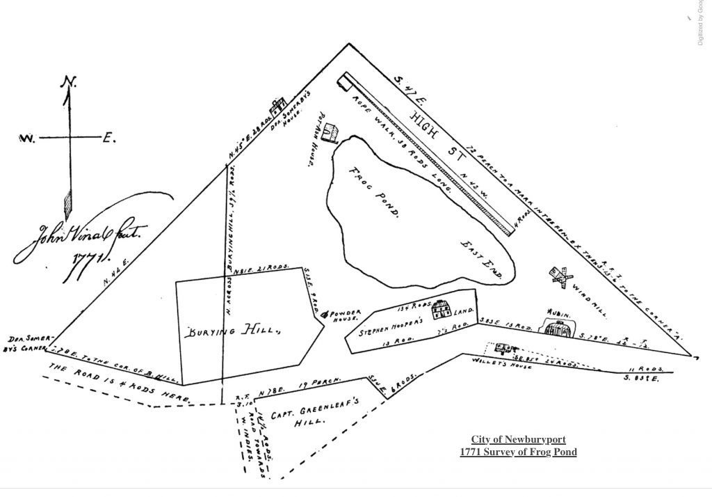
I gave them a section of the Newburyport 1851 map and a piece of the 1771 survey for Frog Pond, and told them I wanted it to be both historic and modern, I had no clue what it should look like. And they came up with this beautiful logo and design. They pulled the colors from the 1851 map and figured out how to use some of the calligraphy from the 1771 survey. I thought it was so elegant that I wasn’t sure I was worthy of the design.

GridPlay Designs incorporated the sage color

I love the way GridPlay Designs incorporated the sage color in the 1851 map in the design of every page.

They are very patient with me, I don’t process things in a linear fashion, but process things the way I would create a painting (I am a professional artist). It has been an ongoing collaborative achievement that has been both exciting and fun. We work together on every page, I provide the content and they create the page. I am always amazed at what they come up with. And if I think something needs to be tweaked, they are so patient and responsive, and things get thought through and updated immediately. It is rare, almost unheard, of to get such customer service.

Slide show - GridPlay Designs

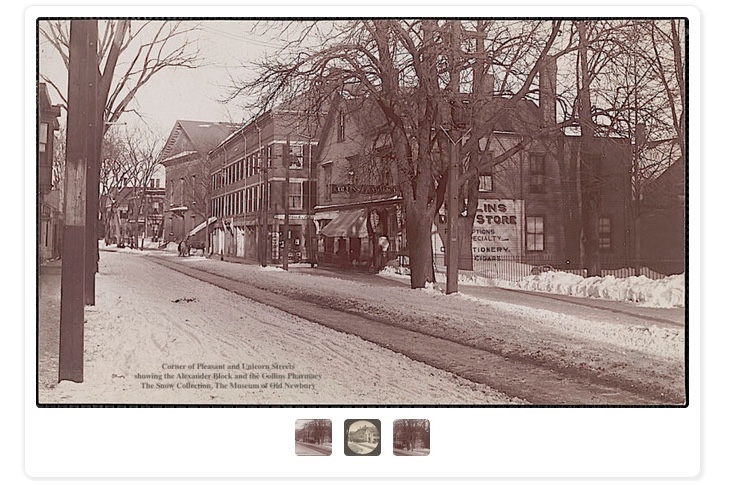
An example of the slide show that GridPlay Designs incorporated, old photographs of Unicorn Street.

We are still working on History ~ Newburyport and together we help it evolve. And the fact that together we were able to create a website, with 24 stories, full of content and historic photographs in two months, is remarkable. The website has been described as “beautiful,” “exciting,” “artistic,” and it would not have been any of those things without GridPlay Designs.

The home page of GridPlay Designs

The home page of GridPlay Designs

“We are passionate about working with entrepreneurs and small businesses that embody our values of honesty, integrity, kindness, creativity, and hard work.” ~ GridPlay Designs

History ~ Newburyport, a new website about Newburyport’s stories

History ~ Newburyport, a new Website about Newburyport's stories

History ~ Newburyport, a new Website about Newburyport’s stories

Ever since I started the interactive history map I’ve been thinking of doing this – creating a website that coordinates with the map. The pandemic has provided an opportunity to do that.

As I’ve been creating the interactive map, one story appears over and over again – Newburyport has been hugely successful and then faced crisis, often devastation and has always shown incredible resiliency, fortitude and the result has always been renewal. And as we are in the midst of this global pandemic, I thought it might be good story to emphasize.

I hired a professional web designer and graphic designer to do the website, GridPlay Designs. I think they did a gorgeous job. We are launching the site, HistoryNewburyport.com, Newburyport – Keeping the Story Alive with nine stories, but that’s just the start, there are so many stories to tell, and if you look at the interactive map, you will see, there are lots and lots and lots of stories.

Each page has a story, some are brief, some are longer. There are wonderful old photographs and maps, just like the interactive story map, and often a page also has a jigsaw puzzle about the story.

The website would not be possible without the incredibly generous help and use of the collection of both of the Museum of Old Newbury and the Newburyport Public Library Archival Center.

Puzzles During a Stressful Time from the Newburyport Interactive History Map map.historynewburyport.com

Around the end of the third week of March I made my first puzzle for map.historynewburyport.com. I started using online puzzles years ago, there is something about “putting the pieces together” that I find very calming. I thought maybe I could try an image from a story on the Newburyport interactive history map, so I did. I asked the Newburyport History Buffs, a Facebook group, to try it out and let me know if it worked, it did, and then I shared it with some other Facebook groups and people seemed to like it.

I’ve been trying to create a new puzzle every day, and here is a sample of some of the ones that I’ve created https://www.jigsawplanet.com/MaryBakerEaton

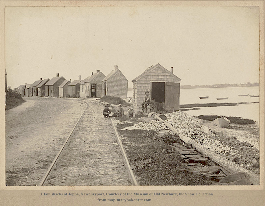
The Clam Shacks at Joppa

During the 1700s, 1800s and the beginning of the 20th century, clamming was a huge part of the South End neighborhood called Joppa. With the arrival of trucking and the automobile, clams gained wide popularity and the clammers of the area were able to make a significant amount of money.

There were at least a dozen clam shanties along Water Street where residents shipped as many as five tons of shucked clams from Newburyport to Boston, New York and other cities every day. The pollutions of the Merrimack river by the 1920s lead to the closing of the clamming beds, and the collapse of the industry brought economic devastation to the local community. Most of the clam shanties were knocked into the river by cars or washed away by storms. Only one clam shanty remains today. ~ History from the Newburyport Clipper City Rail Trail (the plaque on Water Street)

Clam shacks at Joppa, Newburyport
Courtesy of the Museum of Old Newbury, the Snow Collection

Joppa Clam Shacks - map.marybakerart.com

Joppa Clam Shacks – map.marybakerart.com

Joppa Clam Shacks – map.marybakerart.com

The link to the puzzle is here:
https://www.jigsawplanet.com/?rc=play&pid=25a28acc6350

Abbie Foster’s House

Abbie Foster was born in Newburyport to David Currier a shoe maker and his wife Mary Currier in 1846. Abbie had one brother and two sisters. Her sister Helen Currier never married and they lived together all of their lives, either with their parents, and then boarding with their mother on Spring Street and stayed there after their mother’s death until they moved to 74 High Street.

Abbie had her own business on the corner of Pleasant and State Streets (which is now 52 State Street) called “Miss A. L. Currier” where she sold lace trimmings and jewelry,

Abbie was single until she was 44, and in 1891 she married Daniel Foster who was 60. This was Daniel’s second marriage, there were no children from his first marriage. He came back to Newburyport in 1887 and seems to have boarded in different places, including where Abbie’s family lived, which was 14 Spring Street (now 12 Spring Street). Daniel died in 1893 only 2+ years after they were married. Abbie was a widow for 20 more years.

AFTER Daniel died, in 1894 the heirs of Solomon Haskell and Mark Haskell gave Abbie the land that she built her house on on High Street for $1. Abbie gave the right of way to the City of Newburyport in 1898 and Foster Court is named after her.

In his will, Daniel Foster left Helen, Abbie’s sister, $6,000, which was a whole lot of money back then. Daniel left Abbie the rest of his estate and made her the executor of his will. He left various family members very small amounts of money.

Daniel’s money came from his father Thomas Foster, who was a Revolutionary War hero, and owned N & T Foster with his brother Nathaniel Foster. Thomas was one of the “old time” silver smiths, before Towle Silver existed, and many people apprenticed with him.

Daniel’s family, according to the newspapers, contested the will. They lost. Daniel clearly loved Abbie and her family a whole lot better than his own.

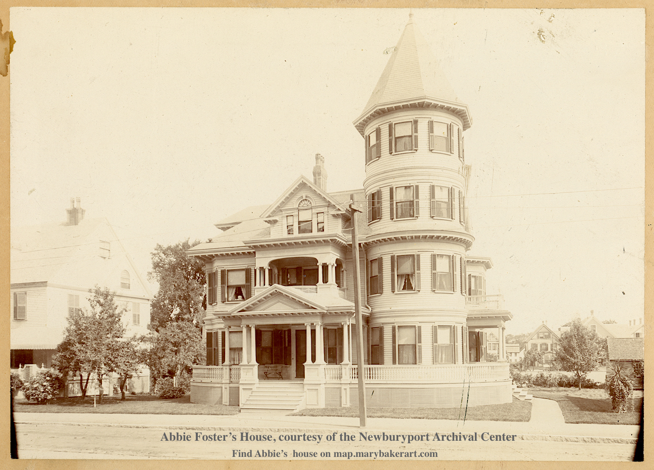
That is how Abbie Foster came to be able to build the gorgeous Queen Anne Victorian at 74 High Street. Abbie lived there for 17 years with her sister and one servant until her death in October 1913.

Abbie Foster’s house, 72 High Street
Courtesy of the Newburyport Archival Center

Abbie Foster’s House - map.marybakerart.com

Abbie Foster’s House – map.marybakerart.com

The link to the puzzle is here:
https://www.jigsawplanet.com/?rc=play&pid=17eb0de8161d

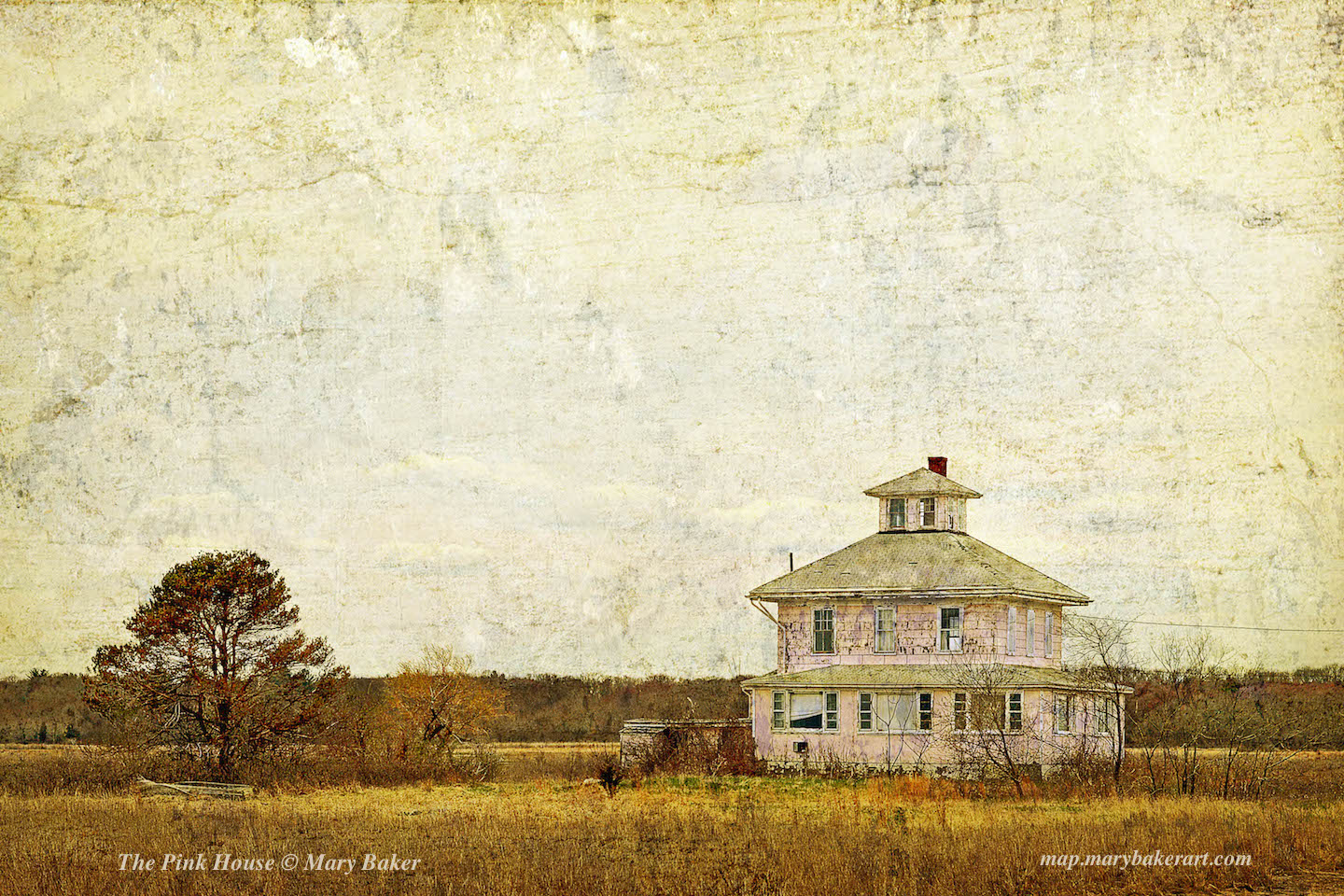
The Pink House

The Pink House is located on Plum Island Turnpike. The house’s notoriety is in part due to a popular local urban legend about its creation. The story suggests the house’s location was a result of a divorce in which the wife demanded an exact replica of their Newburyport house, but failed to specify the location, resulting in the spiteful husband building it on the edge of town, in the Great Marsh with saltwater plumbing. For this reason, the building is often listed as an example of a spite house. An effort is being made to save the Pink House.

The Pink House - map.marybakerart.com

The Pink House – map.marybakerart.com

The Pink House – map.marybakerart.com

The digital image/painting of the Pink House is © Mary Baker

The link to the puzzle is here:
https://www.jigsawplanet.com/?rc=play&pid=19ac5747e386

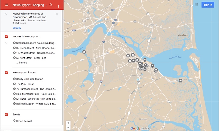
Newburyport Map - Keeping the Story AliveHere is the link to the map: Newburyport – Keeping the Story Alive, Mapping historic stories of Newburyport, MA houses and places, with photos, paintings, videos, old maps, history and anecdotes. Created by The Newburyport Blog, Mary Baker Eaton, editor. (This is one of the many stories that is on the map.)

map.historynewburyport.com


The new website HistoryNewburyport.com that coordinates with the interactive history map has a puzzle for each story on every page. To find the puzzles put “puzzle” into the search box on the new website.

History ~ Newburyport, a new Website about Newburyport's stories

History ~ Newburyport, a new Website about Newburyport’s stories

Moulton Castle is on the Newburyport Interactive History-Story Map

Newburyport Map - Keeping the Story AliveHere is the link to the map: Newburyport – Keeping the Story Alive, Mapping historic stories of Newburyport, MA houses and places, with photos, paintings, videos, old maps, history and anecdotes. Created by The Newburyport Blog, Mary Baker Eaton, editor. (This is one of the many stories that is on the map.)

map.historynewburyport.com

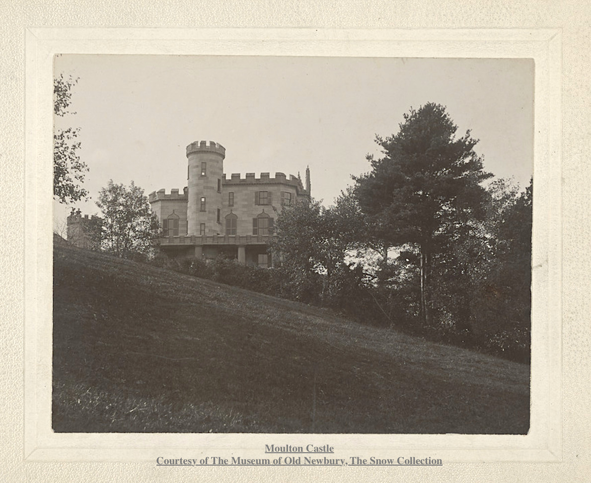
Moulton Castle Courtesy of The Museum of Old Newbury, The Snow Collection

Moulton Castle
Courtesy of The Museum of Old Newbury, The Snow Collection

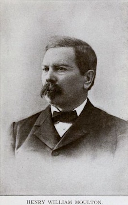
Henry William Moulton (1833 -1896)

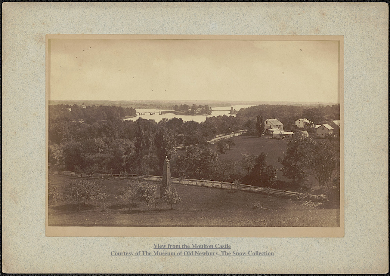
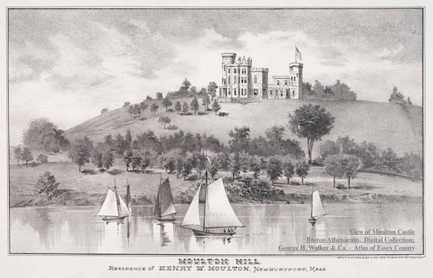
Captain Henry William Moulton returned to Newburyport after the the Civil War in 1865. He came into possession of Moulton Hill, overlooking the Merrimac River, which had been in different branches of Moulton family for six generations. The top of Moulton Hill was said to have the most beautiful landscape in all of New England. In 1868 he built a Gothic-style, 22-room wooden mansion, described as a “noble and picturesque home” on top of the hill, which became known as Moulton Castle.

View from Moulton Castle Moulton Castle Courtesy of The Museum of Old Newbury, The Snow Collection

View from Moulton Castle
Moulton Castle
Courtesy of The Museum of Old Newbury, The Snow Collection

Captain Moulton had six children, his only son died when he was less than a year and there was no son to assume his name and the estate.

View of Moulton Castle Boston Athenaeum, Digital Collection: George H. Walker & Co.'s Atlas of Essex County, Massachusetts. Boston, 1884, p. 143.

View of Moulton Castle
Boston Athenaeum, Digital Collection:
George H. Walker & Co.’s Atlas of Essex County, Massachusetts. Boston, 1884, p. 143.

Following Captain Moulton’s death in 1896, the property was bought by financier Charles W. Moseley who tore down Moulton Castle in December 1900. The site of the mansion is now known as Castle Hill and is part of Maudslay State Park.

Moulton Castle Courtesy of The Museum of Old Newbury, The Snow Collection

Moulton Castle
Courtesy of The Museum of Old Newbury, The Snow Collection

Part of the Poem called “Moulton Castle,” by Charles Clinton Jones

“It stood on a pine fringed hill-top
O’er looking the ancient town,
And the winding course of the river;
That turreted castle brown.
For more than a generation
It guarded the country-side,
The city and bay and islands,
And the marshes low and wide.”

Henry William Moulton (1833 -1896)

Henry William Moulton (1833 -1896)

History from The Moulton Family Search and the Boston Athenaeum and History of Maudslay State Park in Newburyport by Rebecca Beatrice Brooks

Photographs:
Courtesy of The Museum of Old Newbury, The Snow Collection
Boston Athenaeum, Digital Collection:
George H. Walker & Co.’s Atlas of Essex County, Massachusetts. Boston, 1884, p. 143.

This story is also now on the new website that coordinates with the interactive history map, History ~ Newburyport at  HistoryNewburyport.com.

History ~ Newburyport, a new Website about Newburyport's stories

History ~ Newburyport, a new Website about Newburyport’s stories

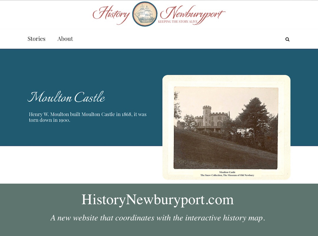
The story on Moulton Castle can be found here at the new website History ~ Newburyport HistoryNewburyport.com.

Story on Moulton Castle on the new website, History ~ Newburyport

Story on Moulton Castle on the new website, History ~ Newburyport

Eliphalet Griffin is on the Map, The Home for Aged Men, 5 Columbus Ave, 31-35 Pleasant Street

Newburyport Map - Keeping the Story AliveHere is the link to the map: Newburyport – Keeping the Story Alive, Mapping historic stories of Newburyport, MA houses and places, with photos, paintings, videos, old maps, history and anecdotes. Created by The Newburyport Blog, Mary Baker Eaton, editor. (This is one of the many stories that is on the map.)

map.historynewburyport.com

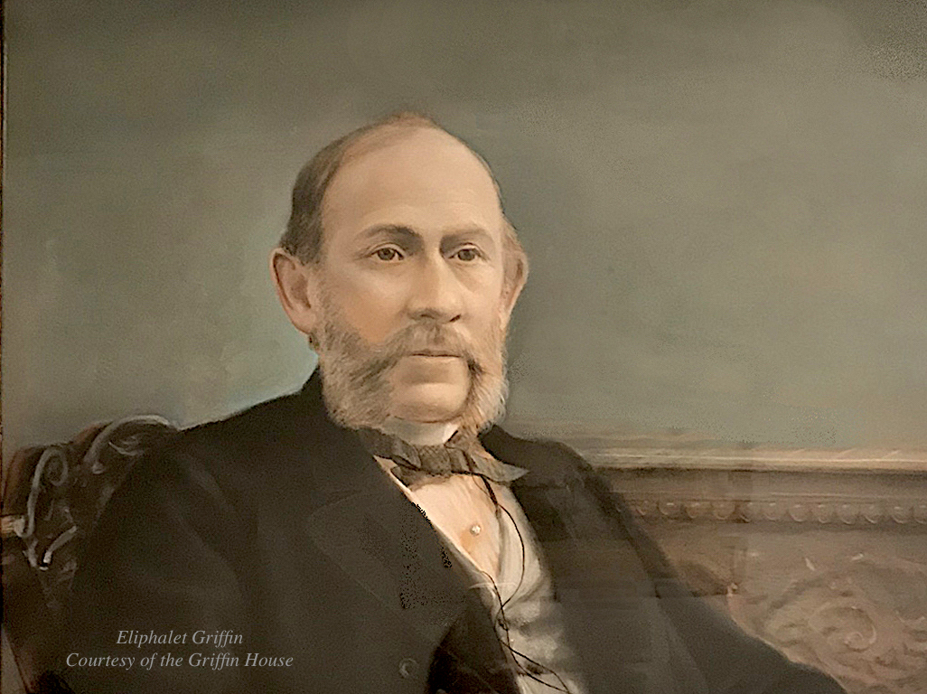
Portrait (detail) of Epliphet Griffin courtesy of The Griffin House

Portrait (detail) of Epliphet Griffin courtesy of The Griffin House

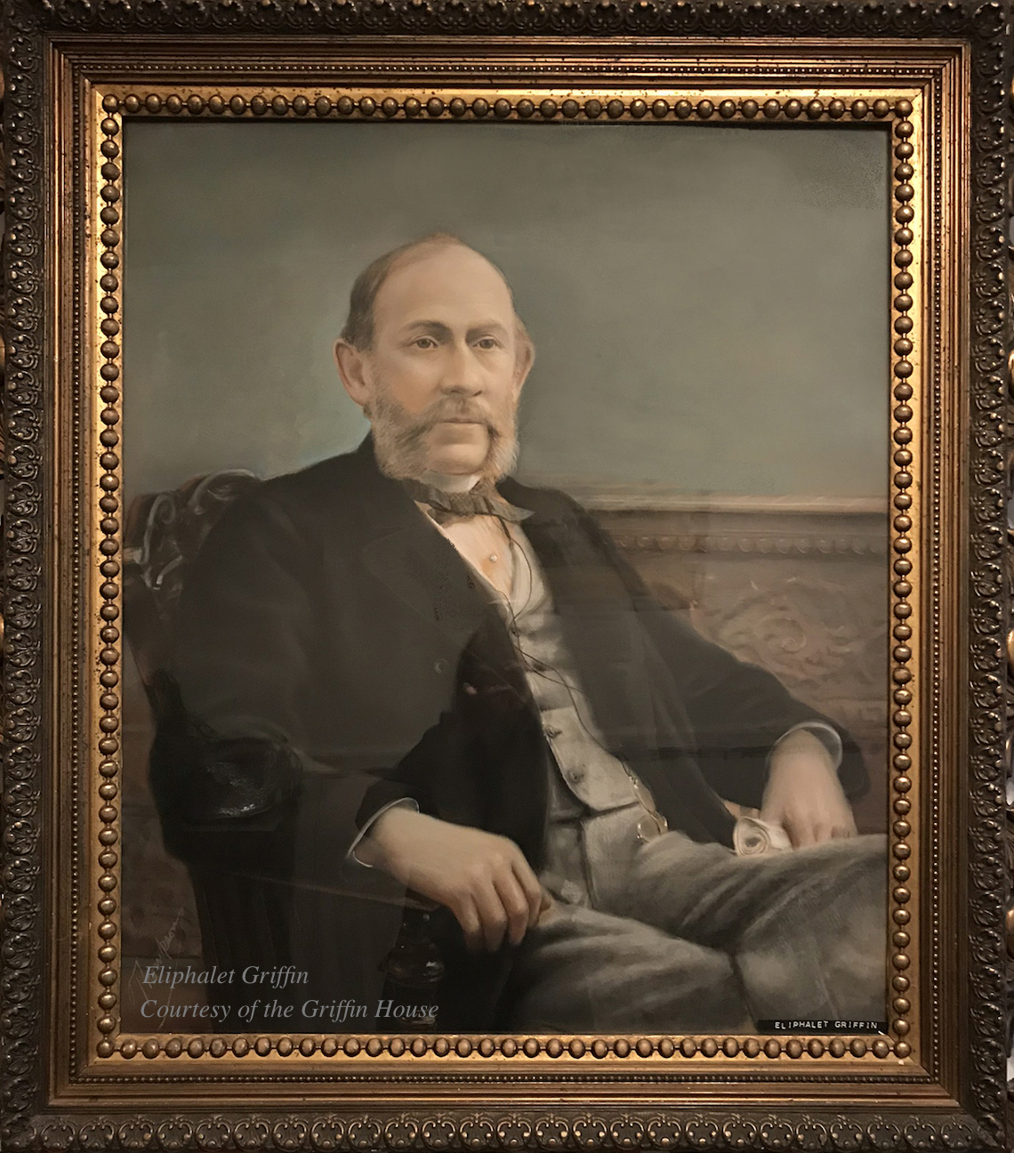
Eliphalet Griffin (1824 – 1899) was born in Newburyport in 1824. He started out as a clerk for a dry goods store and then opened his own store downtown. The Newburyport Daily News reported that in the early 1850s he went to California, which would have been during the California Gold Rush and opened a successful and prosperous wholesale clothing house. When he returned to Massachusetts he worked for a firm in Boston that had a large contract during the Civil War that sold uniforms for the United States government. Eliphalet Griffin returned to Newburyport in the 1860s a wealthy man.*

Portrait (detail) of Epliphet Griffin courtesy of The Griffin House

Portrait (detail) of Epliphet Griffin courtesy of The Griffin House

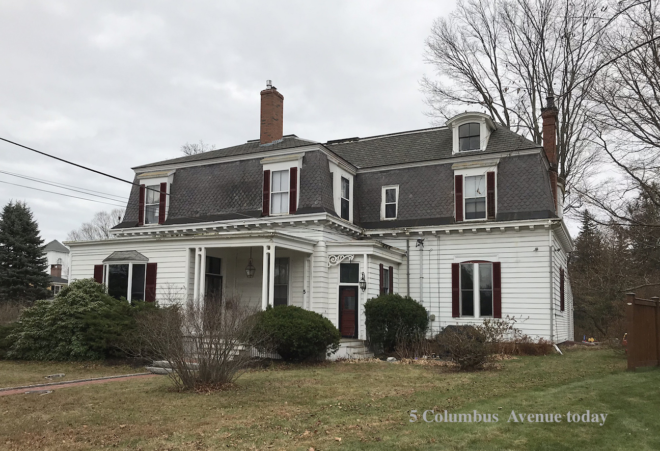
In 1863 he married Elizabeth Balch of Newburyport and they had two children. The City Directories show Eliphalet living at 31 Tyng Street, however in 1869 he built a Second Empire style house on what was then the corner of High Street and Columbus Avenue, and upon completion it was reported in the Newburyport Herald that it was “one of the best Newburyport houses in modern times.”** The 1870 Census shows that Eliphalet is 44, Elizabeth is 40, their daughter Hannah is 5 and their son Eliphalet is 3.

Epliphet Griffin's house, 5 Columbus Ave, today

Epliphet Griffin’s house, 5 Columbus Ave, today

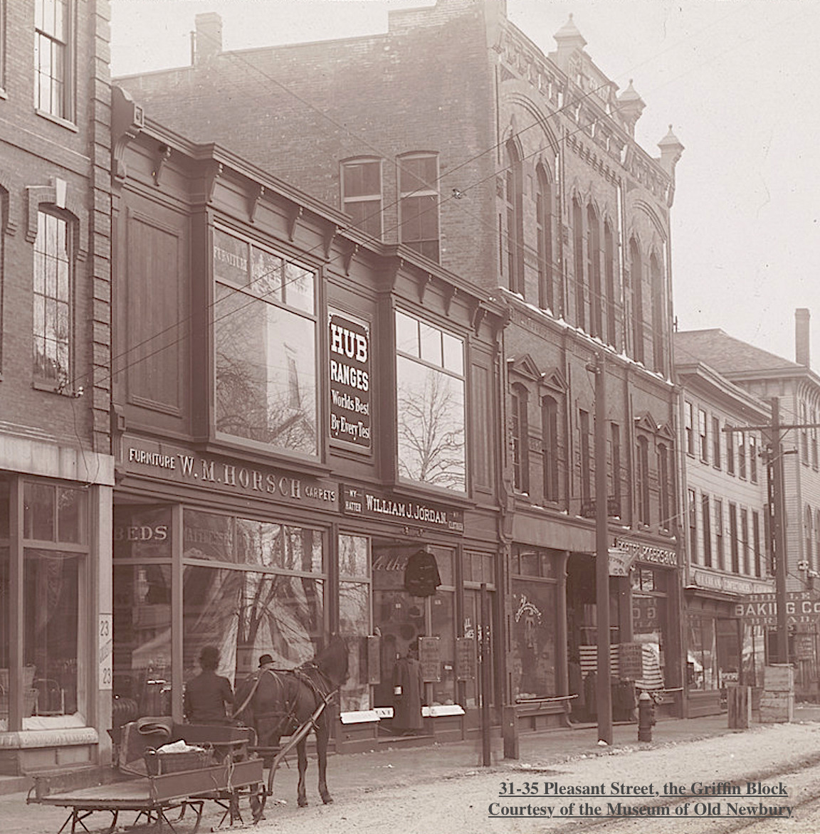
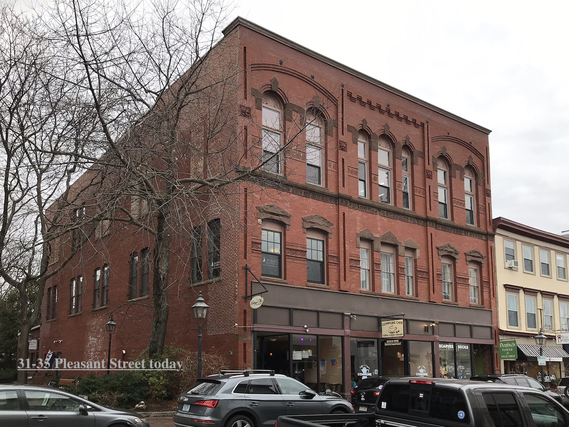
Epliphet built a beautiful three story, Queen Anne/Panel Brick style building on Pleasant Street, now 31-35 Pleasant Street, completed in 1889 which still stands today. The first floor contained two storefronts, a series of offices on the second floor and a large hall on the third floor. The hall was known as Griffin Hall and was the scene of many dances in the 1950s, it also showed moving pictures before a law was passed that movie theaters must be on the ground floor. In the 1890 the ground floor was occupied by the Boston Boot & Shoe Company and Kent & Bolton clothiers and finishers. Later it was leased to Woolworth’s and to Boxer’s Furniture among other establishments. ***

The photograph of the Griffin Block ca. 1890–1899 is courtesy of the Museum of Old Newbury.

The photograph of the Griffin Block ca. 1890–1899 is courtesy of the Museum of Old Newbury.

31-35 Pleasant Street today

31-35 Pleasant Street today

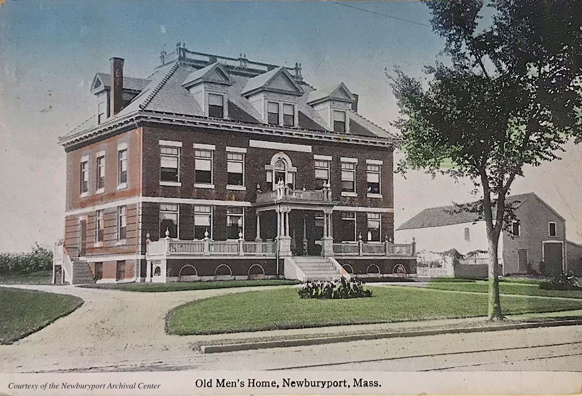
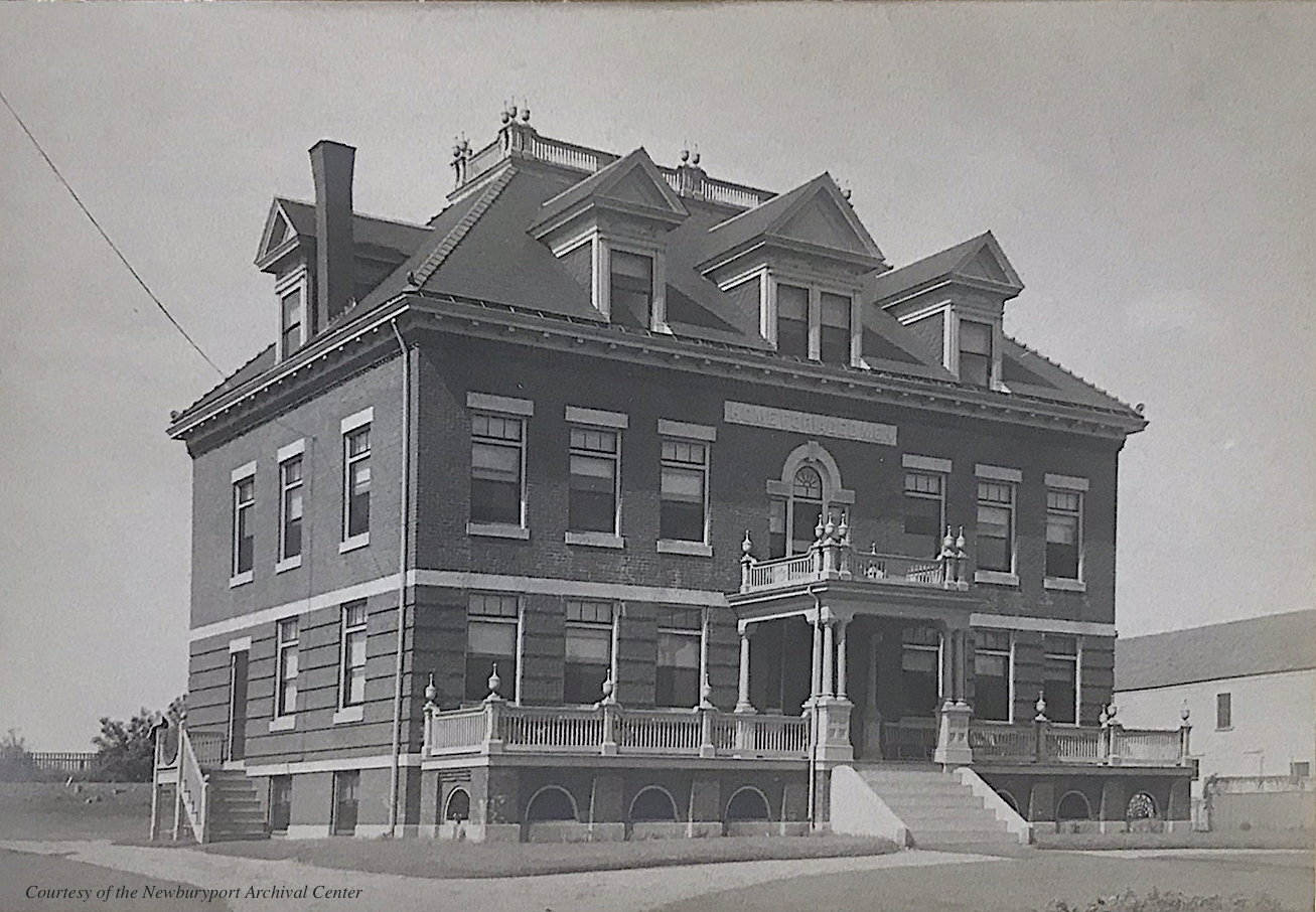
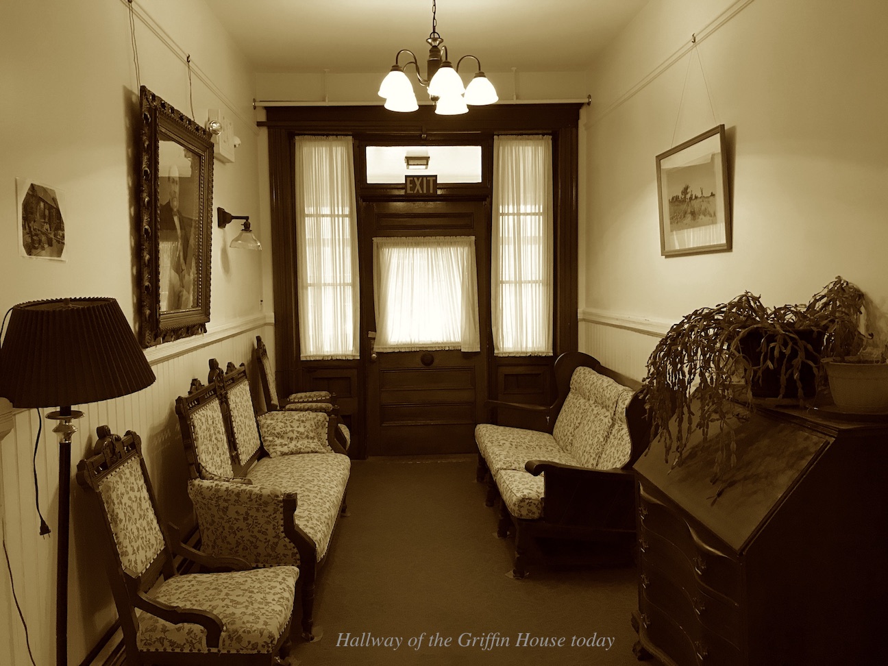
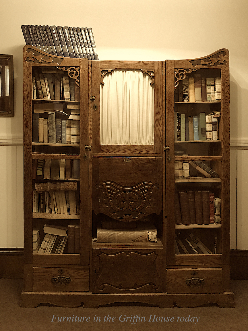
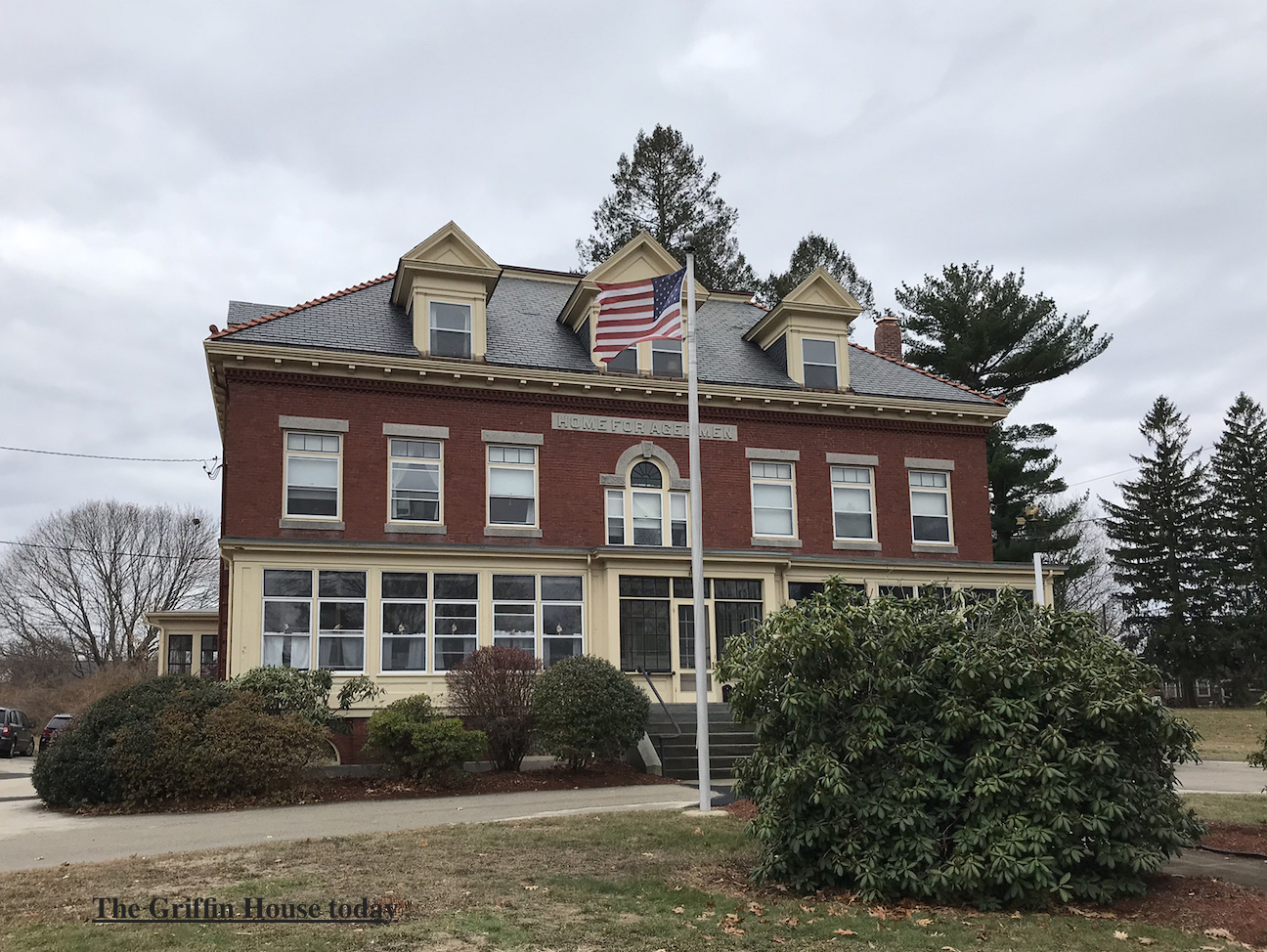
Epliphet’s great passion, however, was building the Griffin House, the Home for Aged Men at 363 High Street across from Atkinson Common. In 1886 along with Albert W. Greenleaf and Lawrence B. Cushing, Epliphet created the Newburyport Society for the Relief of Aged Men. Epliphet gave the society the lot of land and built the foundation of the brick building at his own expense in 1896. The building was completed two or three years later. Mr Griffin died in 1899. Due to lack of funds the home remained unfurnished and unoccupied until 1902. ^* Much of the original furniture and woodwork remains in the house today. The Griffin House contains 9 rooms, the men must be 65 and able to take care of themselves. Some of the staff have been there for over 3 decades, the home is a family and the inside feels and looks very much like it must have looked in 1906. It is a wonderful place.

The postcard of the Griffin House, courtesy of the Newburyport Archival Center

The postcard of the Griffin House, courtesy of the Newburyport Archival Center

The postcard of the Griffin House, courtesy of the Newburyport Archival Center

The postcard of the Griffin House, courtesy of the Newburyport Archival Center

The hallway of The Griffin House today

The hallway of The Griffin House today

Furniture in The Griffin House today

Furniture in The Griffin House today

The Griffin House today

The Griffin House today

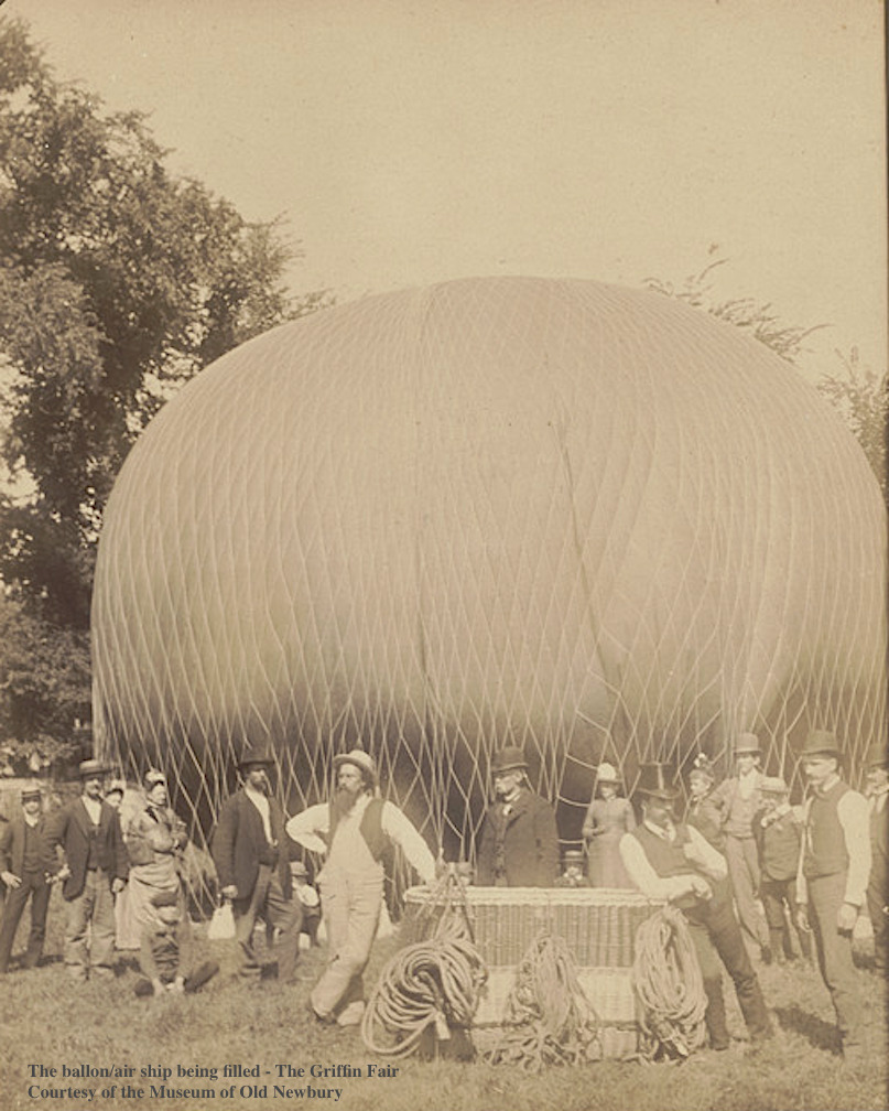
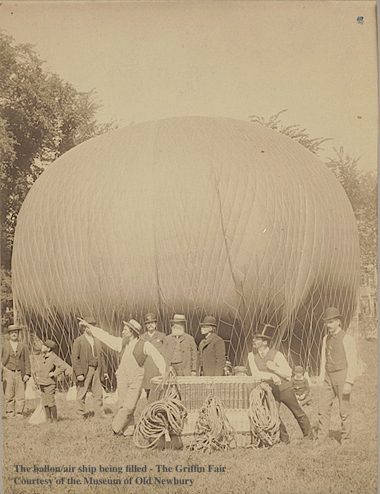
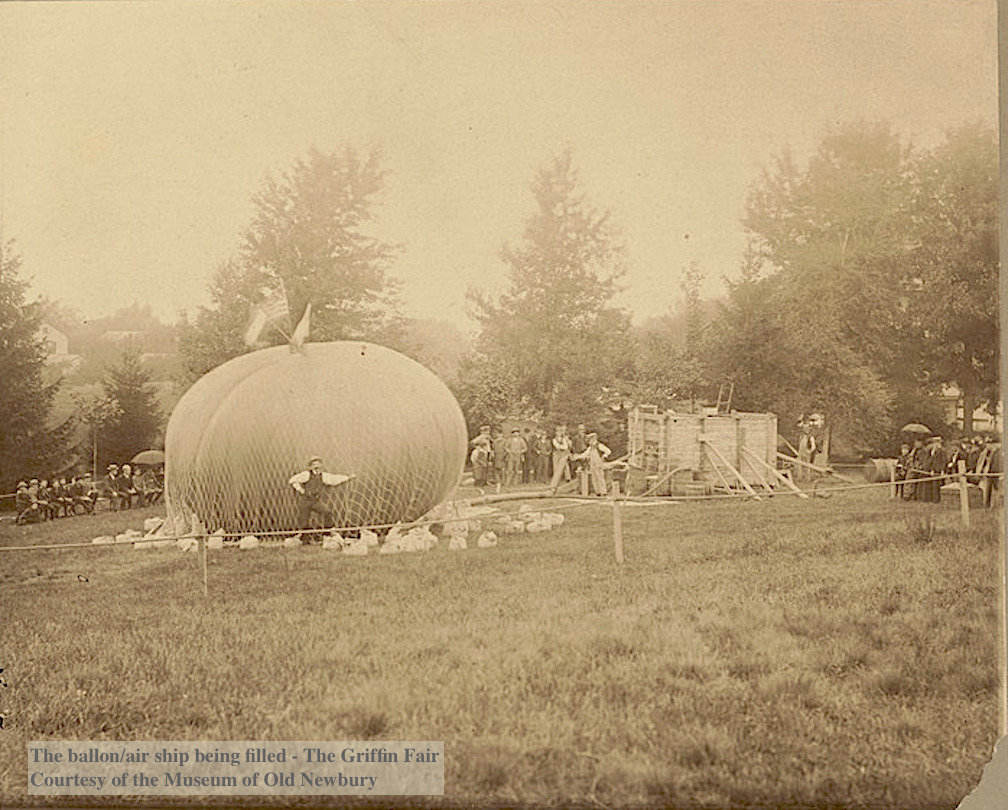
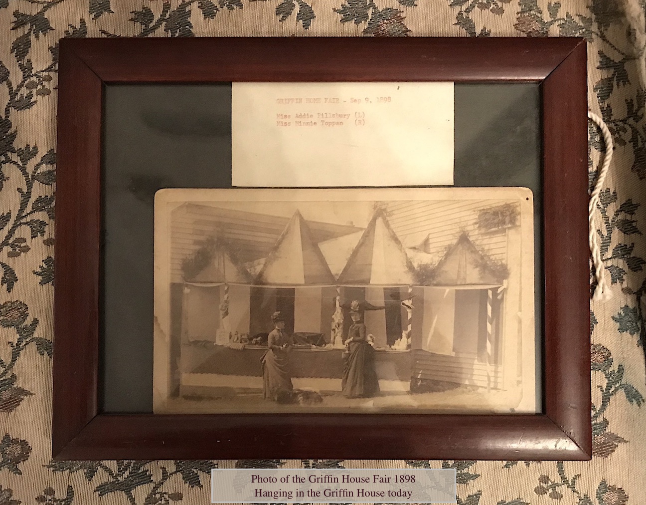
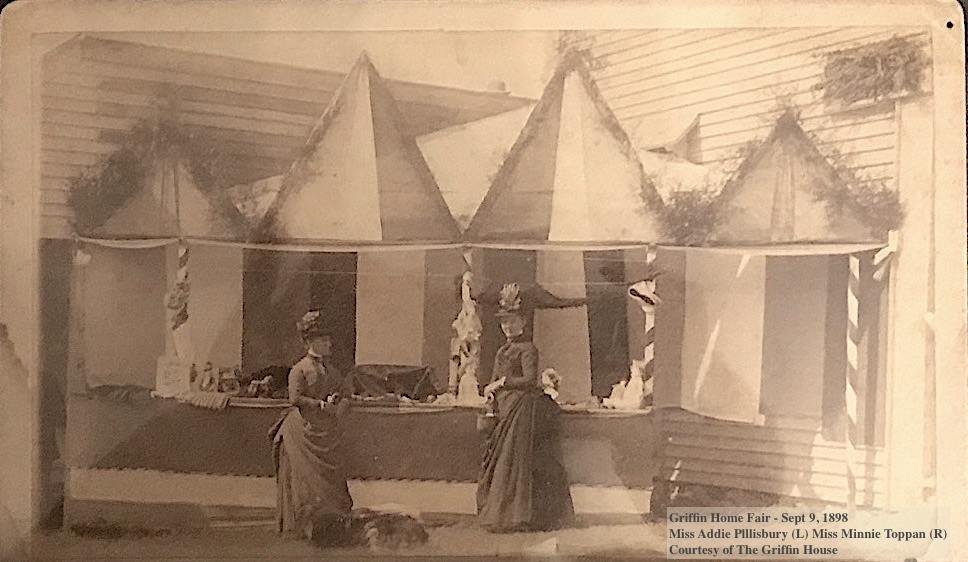
Epliphet Griffin organized the most amazing fairs at his home on High Street to raise funds for the Home for Aged Men. One fair is described in the Newburyport Herald, Sept 21, 1887 in which 5000 – 6000 people attended. The main attraction was a “great air ship” 126 feet in circumference and 42 feet in diameter. Ultimately the balloon did not ascend, it was not able to be filled with the 150,000 feet of gas that was required. The Museum of Old Newbury has three photographs of the balloon.

The photograph of the the ballon/air ship being filled is courtesy of the Museum of Old Newbury.

The photograph of the the ballon/air ship being filled is courtesy of the Museum of Old Newbury.

The photograph of the the ballon/air ship being filled for the Fair is courtesy of the Museum of Old Newbury.

The photograph of the the ballon/air ship being filled for the Fair is courtesy of the Museum of Old Newbury.

The photograph of the the ballon/air ship being filled for the Fair is courtesy of the Museum of Old Newbury.

The photograph of the the ballon/air ship being filled for the Fair is courtesy of the Museum of Old Newbury.

There were many attractions, however, beside the balloon – a concert, various booths and tents, dancing, ice cream, candy, soda and fruit; a supper that provided cold roast chicken, ham, corned beef, lamb, baked beans, rolls, bread, oysters, chicken and lobster salad, many kinds of cake, cream cakes and pies. The large barn was filled to overflowing for the dances, there were floral processions by 500 children, and a band played both in the afternoon and evening. ^** Eliphalet Griffin knew how to throw a great party and raised a great deal of money for the Home for Aged Men. How wonderful that the Griffin House still exists today, basically unchanged.

Griffin Home Fair - Sept 9, 1898, hanging in The Griffin House today Miss Addie Plllisbury (L) Miss Minnie Toppan (R) Courtesy of The Griffin House

Griffin Home Fair – Sept 9, 1898, hanging in The Griffin House today
Miss Addie Plllisbury (L) Miss Minnie Toppan (R)
Courtesy of The Griffin House

Griffin Home Fair - Sept 9, 1898, hanging in The Griffin House today Miss Addie Plllisbury (L) Miss Minnie Toppan (R) Courtesy of The Griffin House

Griffin Home Fair – Sept 9, 1898, hanging in The Griffin House today
Miss Addie Plllisbury (L) Miss Minnie Toppan (R)
Courtesy of The Griffin House

* Newburyport Daily News, July 11, 1899
** The Historical Society of Old Newburyport
*** City of Newburyport Historical Property Surveys
^* John J. Currier, History of Newburyport, Vol II
^** Newburyport Herald, Sept 21, 1887

Portrait of Epliphet Griffin courtesy of the Griffin House

The photographs of the the ballon/air ship being filled are courtesy of the Museum of Old Newbury.

The postcards of the Griffin House are courtesy of the Newburyport Archival Center

The photograph of the Griffin Block ca. 1890–1899 is courtesy of the Museum of Old Newbury.

Griffin Home Fair – Sept 9, 1898
Miss Addie Plllisbury (L) Miss Minnie Toppan (R)
Courtesy of The Griffin House 

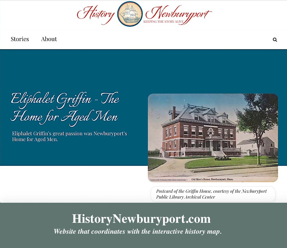
The story on the Griffin House can be found here at the new website History ~ Newburyport HistoryNewburyport.com.

Story on the Griffin House on the new website, History ~ Newburyport

Story on the Griffin House on the new website, History ~ Newburyport

Newburyport Map – The Corner of Harris and State Streets – the Dodge House, the YMCA, the Library

Newburyport Map - Keeping the Story AliveHere is the link to the map: Newburyport – Keeping the Story Alive, Mapping historic stories of Newburyport, MA houses and places, with photos, paintings, videos, old maps, history and anecdotes. Created by The Newburyport Blog, Mary Baker Eaton, editor. (This is one of the many stories that is on the map.)

map.historynewburyport.com

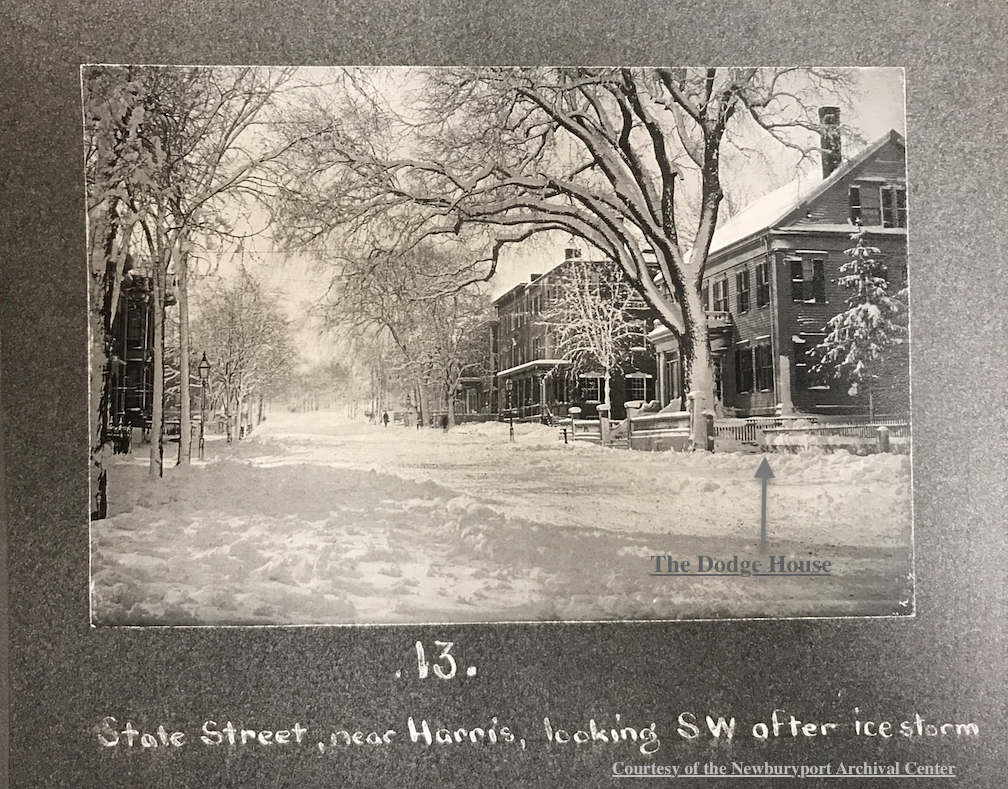
The Dodge House, State Street

The Dodge House, State Street

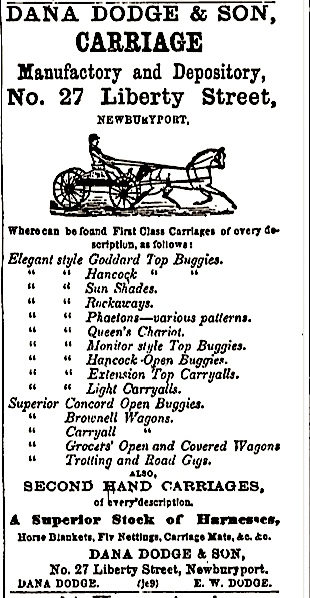
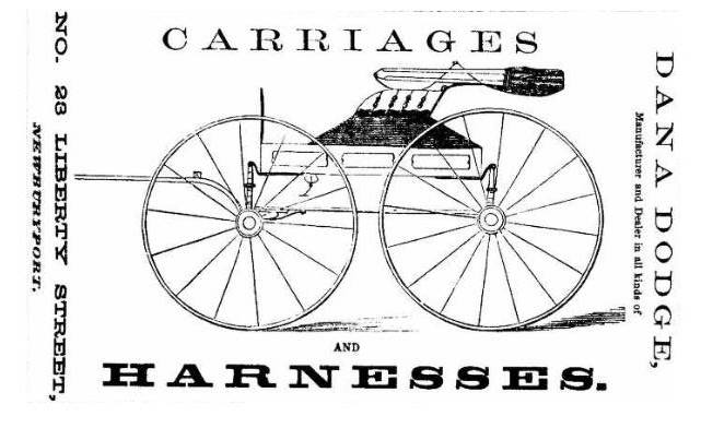
William and Dana Dodge, who were brothers, built a beautiful double house around 1846 on the corner of Harris and State Streets. William and his wife Ruth had no children, Dana was married to Abby and they had a large family. Dana manufactured and sold carriages on Liberty Street, tragically died at age 56 of a compound fracture of the leg and pneumonia leaving debts and his wife and children. 

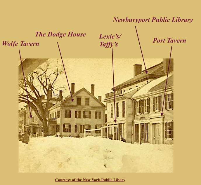
Detail of State Street Courtesy of the New York Public Library

Detail of State Street
Courtesy of the New York Public Library

The Dodge House, State Street Courtesy of the Newburyport Archival Center

The Dodge House, State Street
Courtesy of the Newburyport Archival Center

Ruth, Abby’s sister-in-law, bought Dana’s side of the house with all the belongings. Abby and her children were forced to move out to 2 Harris Street, a smaller house behind the large Dodge House on State Street. Ruth and William rented out Dana and Abby’s side of the house in 1874, with Dana and Abby’s furnishings, the ad says “The house is in first rate order, containing eleven furnished rooms. Gas throughout, a good furnace and  every way fitted for a genteel family.” It seems that over her life time Abby went to live with different sons and outlived them all except one. Abby Dodge died in Haverhill, living with her youngest son John. 

Advertisement for Dana Dodge Carriages

Advertisement for Dana Dodge Carriages

Advertisement for Dana Dodge Carriages

Advertisement for Dana Dodge Carriages

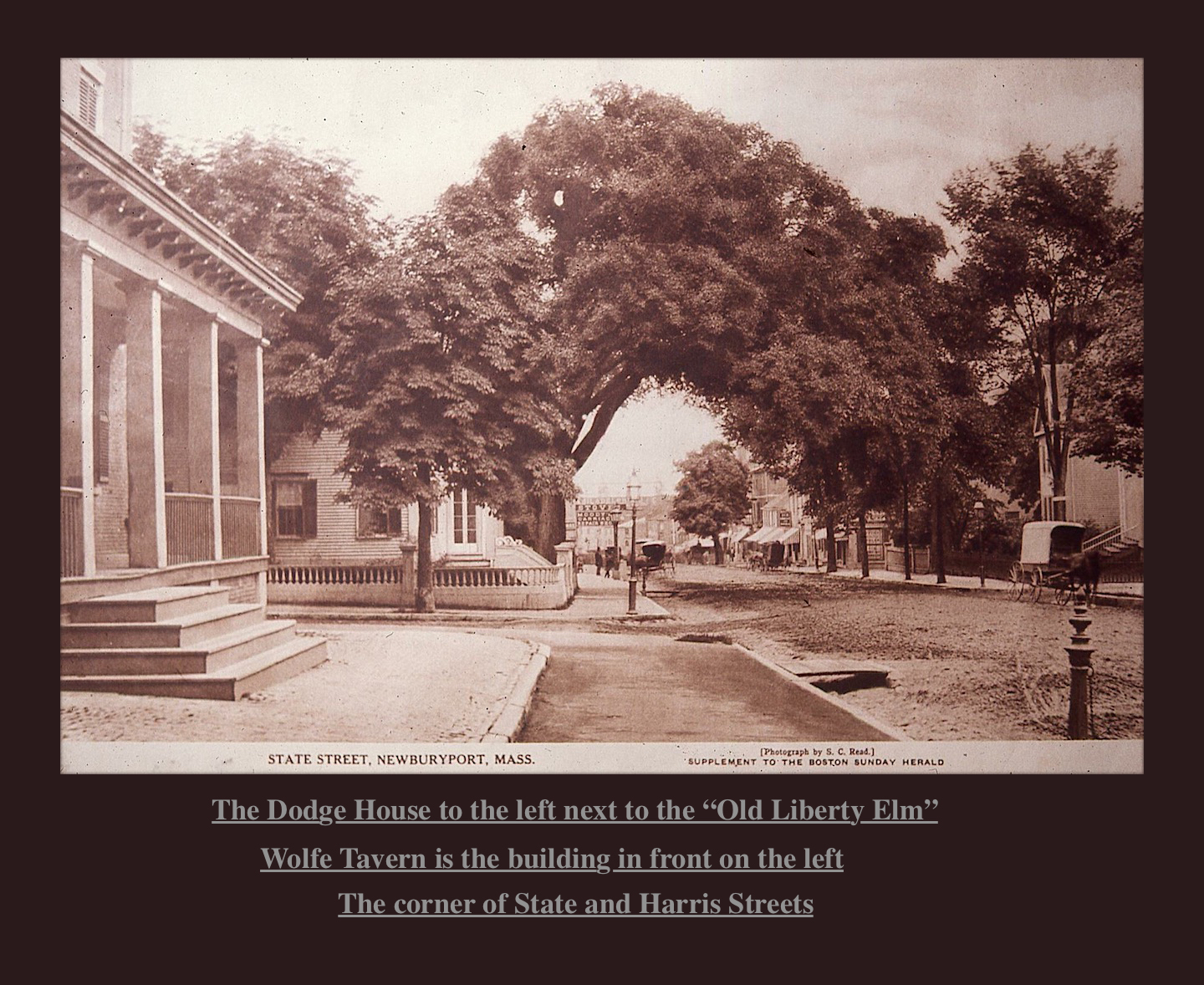
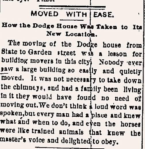
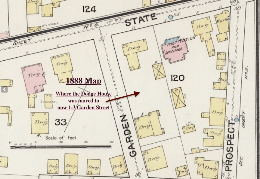
It was decided that the YMCA would be built on the site of the Dodge House. In 1889 the Dodge house was moved, with its chimneys, to1-3 Garden Street where it exists in its altered form today as apartments. The large “Old Liberty Tree Elm” was cut down to move the house and to build the new structure.

Description of moving the Dodge House in the local Newspaper, August 23, 1889

Description of moving the Dodge House in the local Newspaper, August 23, 1889

“The moving of the Dodge house from State to Garden street was a lesson for building movers in this city. Nobody ever saw a large building so easily and quietly moved. It was not necessary to take down the chimneys, and had a family been living in it ethyl would have found no need of moving out. We don’t think a loud word was spoken, but every man had a place and knew what and when to do, and even the horses ere like trained animals that knew the master’s voice and delighted to obey.” – August 23, 1889

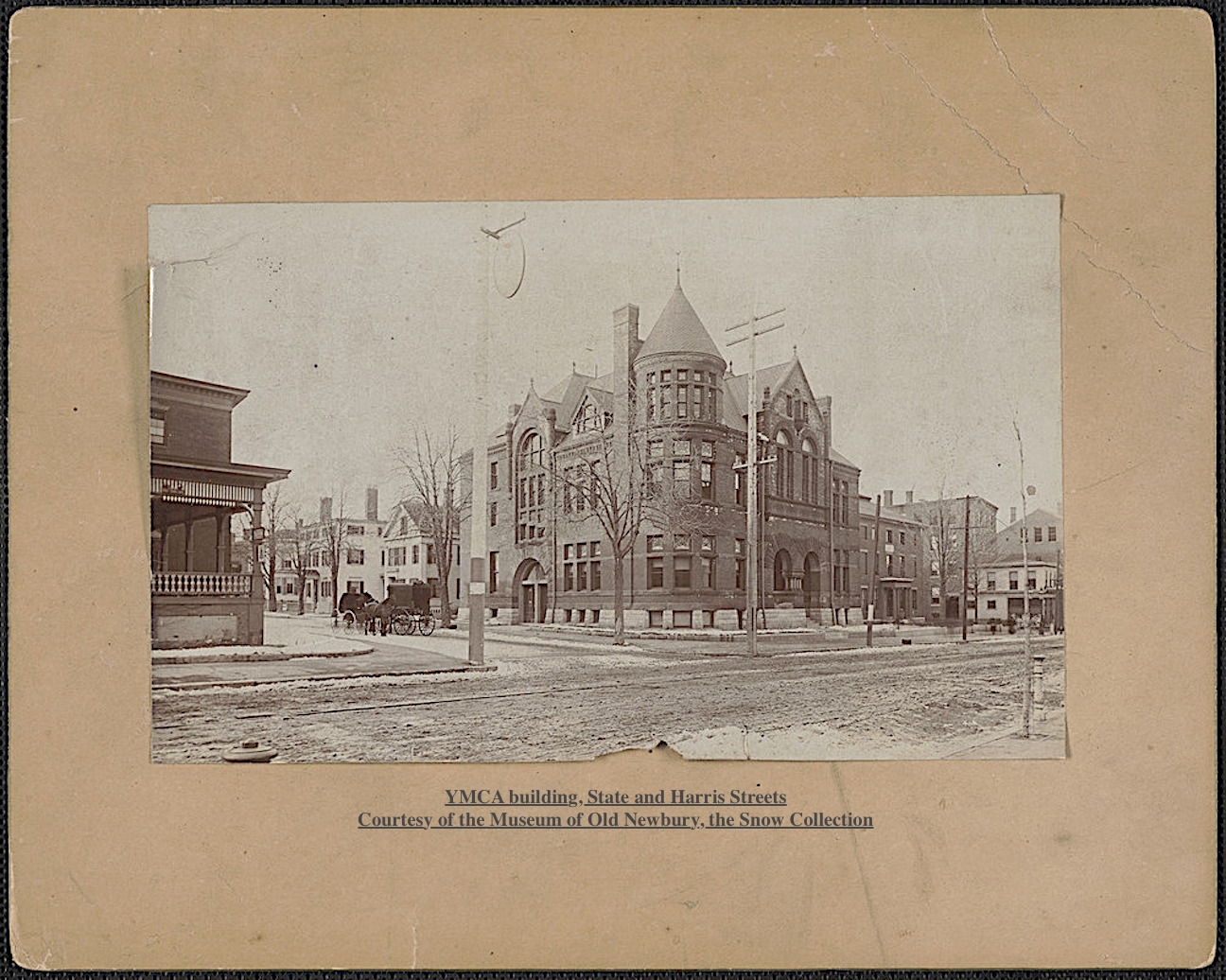
YMCA building, State and Harris Streets Courtesy of the Museum of Old Newbury, the Snow Collection

YMCA building, State and Harris Streets
Courtesy of the Museum of Old Newbury, the Snow Collection

The YMCA was completed in 1891, it was destroyed by a fire July 1987. On May 6, 2001 the newly expanded library opened and exists today at the corner of Harris and State Street. ~ History and research by Mary Baker Eaton

1888 Map of where the Dodge House was located on Garden Street

1888 Map of where the Dodge House was located on Garden Street

YMCA building, State and Harris Streets
Courtesy of the Museum of Old Newbury, the Snow Collection

State Street
Courtesy of the Newburyport Archival Center 

Detail of State Street
Courtesy of the New York Public Library

Many thanks to the Newburyport Archival Center for all their help in researching this story.

History Map of Newburyport – Inn Street

Newburyport Map - Keeping the Story AliveHere is the link to the map: Newburyport – Keeping the Story Alive, Mapping historic stories of Newburyport, MA houses and places, with photos, paintings, videos, old maps, history and anecdotes. Created by The Newburyport Blog, Mary Baker Eaton, editor.

map.historynewburyport.com

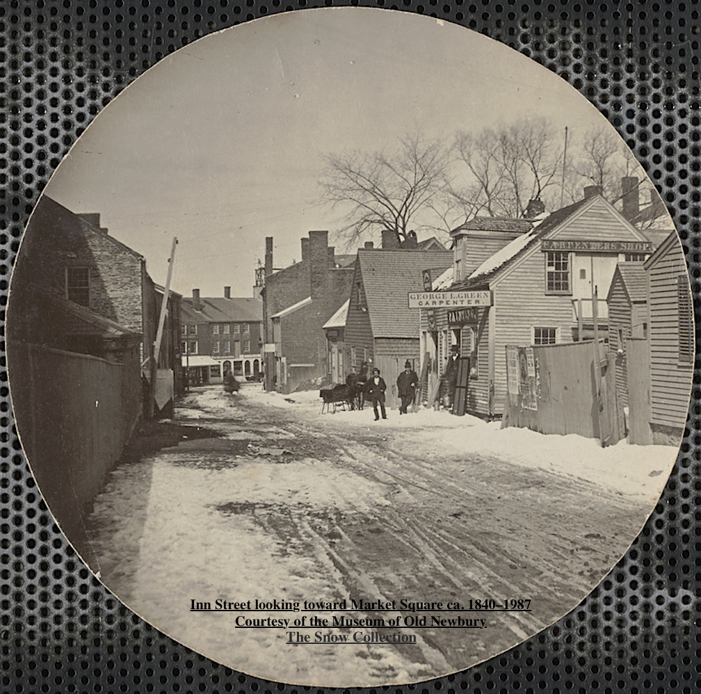
Inn Street looking toward Market Square ca. 1840–1987 Courtesy of the Museum of Old Newbury, the Snow Collection

Inn Street looking toward Market Square ca. 1840–1987
Courtesy of the Museum of Old Newbury, the Snow Collection

What is now Inn Street is roughly the area where the fire started in l811destroying much of Market Square. Inn Street was laid out in l8l8 as part of the reconstruction on the area after the fire.

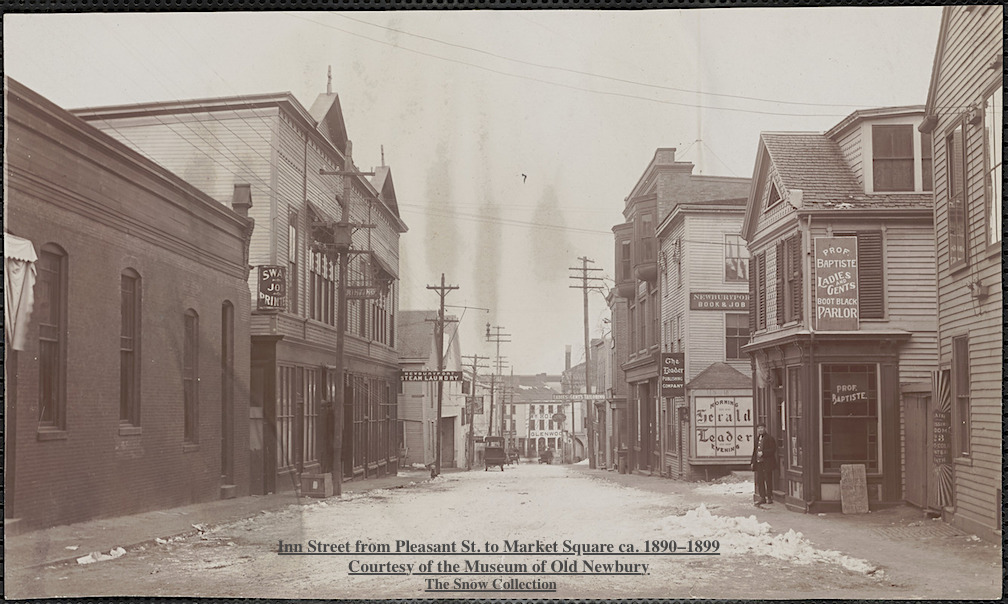
nn Street from Pleasant St. to Market Square ca. 1890–1899 Courtesy of the Museum of Old Newbury, the Snow Collection

nn Street from Pleasant St. to Market Square ca. 1890–1899
Courtesy of the Museum of Old Newbury, the Snow Collection

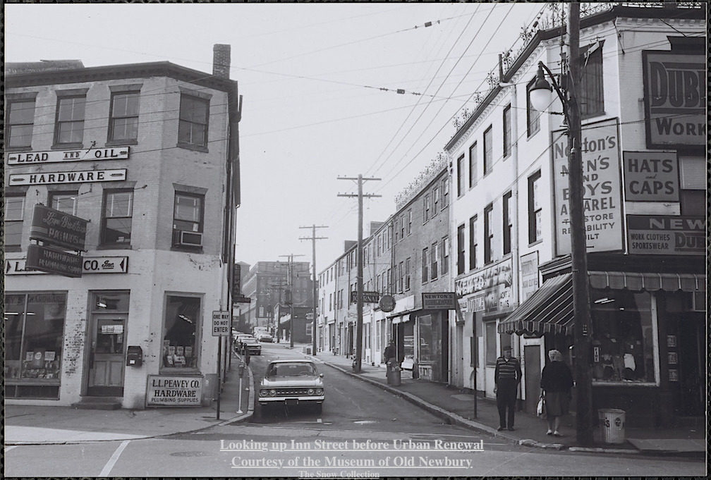
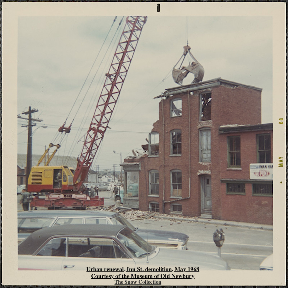
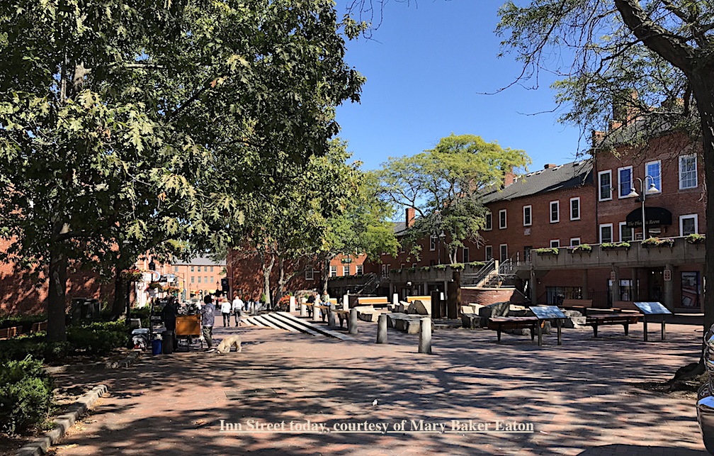
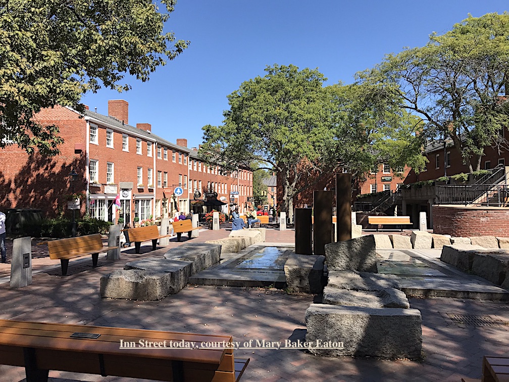
Most of the buildings on Inn Street were demolished as part of Urban Renewal in the late 1960s and early 1970s. The demolition of the area was stopped and restoration and renewal was adopted. Today Inn Street is a thriving pedestrian mall, it was completed in 1974 and downtown Newburyport is a national example of historic preservation. ~ History courtesy of the City of Newburyport, Historic Property Surveys

Looking up Inn St. before Urban Renewal Courtesy of the Museum of Old Newbury, the Snow Collection

Looking up Inn St. before Urban Renewal
Courtesy of the Museum of Old Newbury, the Snow Collection

Urban renewal, Inn St. demolition, May 1968 Courtesy of the Museum of Old Newbury, the Snow Collection

Urban renewal, Inn St. demolition, May 1968
Courtesy of the Museum of Old Newbury, the Snow Collection

Inn Street today, courtesy of Mary Baker Eaton

Inn Street today, courtesy of Mary Baker Eaton

Inn Street today, courtesy of Mary Baker Eaton

Inn Street today, courtesy of Mary Baker Eaton

Photographs courtesy of the Museum of Old Newbury, the Snow Collection, and Mary Baker Eaton

Where to find Walking Maps about Newburyport’s History

Newburyport Map - Keeping the Story AliveHere is the link to the map: Newburyport – Keeping the Story Alive, Mapping historic stories of Newburyport, MA houses and places, with photos, paintings, videos, old maps, history and anecdotes. Created by The Newburyport Blog, Mary Baker Eaton, editor.

map.historynewburyport.com

HistoryWalkingTourNewburyport

The editor of The Newburyport Blog, me, Mary Baker Eaton, has decided to map all the research that I’ve done over the years for The Newburyport Blog and for “If This House Could Talk – Newburyport,” and then some more researching and mapping after that. The stories are from all walks of life and from different periods during Newburyport’s history. The stories are about houses, people, places and events told and illustrated with photographs, paintings, videos, old maps, history and anecdotes (and even a poem). They are about are men and women, eccentric and proper, rich and poor, successful and those who have fallen on hard times. And the history of Newburyport mirrors the themes and places of the people who have lived here.
Newburyport Keeping the Story History Alive Map
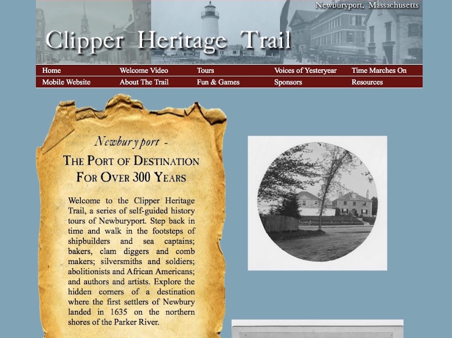
Ghlee Woodworth created the most amazing project in 2012 – the Clipper Heritage Trail. You can download different maps from different areas of the city and learn all about Newburyport’s fascinating history.

Clipper City Heritage Trail


The Clipper Heritage Trail

“Welcome to the Clipper Heritage Trail, a series of self-guided history tours of Newburyport. Step back in time and walk in the footsteps of shipbuilders and sea captains; bakers, clam diggers and comb makers; silversmiths and soldiers; abolitionists and African Americans; and authors and artists. Explore the hidden corners of a destination where the first settlers of Newbury landed in 1635 on the northern shores of the Parker River.”  ~ Ghlee Woodworth, The Clipper City Heritage Trail

The link to the Clipper Heritage Trail can be found here: http://www.clipperheritagetrail.com

Newburyport History Map – Keeping the Story Alive

Newburyport Map - Keeping the Story AliveHere is the link to the map: Newburyport – Keeping the Story Alive, Mapping historic stories of Newburyport, MA houses and places, with photos, paintings, videos, old maps, history and anecdotes. Created by The Newburyport Blog, Mary Baker Eaton, editor.

map.historynewburyport.com

Newburyport History

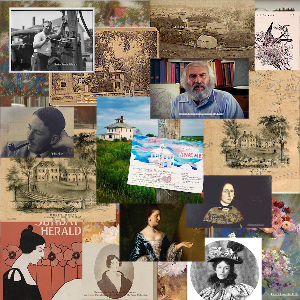
There are so many Newburyport stories that are being lost or have been lost. People are forgetting Newburyport’s history, from Urban Renewal in the late 1960s early 1970s, to Bossy Gillis, Truman Nelson, Alice Hooper Fowle Cutler, painter Laura Coombs Hills, poet Hannah Flagg Gould, Rebecca Rawson, Mt. Rural, writer John P. Marquand, Curzon Mill, artist Ethel Reed, The Old Pillsbury House.

Go to the map to find out all about these stories and where the people lived or where the stories took place in Newburyport.

The historic/story map is an outgrowth of Newburyport’s “If This House Could Talk” and all the research that has been done on stories and history for the Newburyport Blog since 2006. The concept of This House Could Talk is to collect and present local history, and historical anecdotes, through a collaborative activity in which residents and businesses post hand made signs and graphics in front of their homes and businesses, telling stories and offering information from the recent or not-so-recent past. It does not matter if the house and/or story is old or new, ordinary or rare and important. The signs have a range of information from the architectural history, to personal experiences and stories of the current or historic residents of a particular house. If This House Could Talk offers neighborhood residents a way to present historical information with a personal voice. This type of free and accessible presentation of information in public places encourages walking and exploration of a neighborhood in order to discover and learn from the signs and artworks. The hope is that the sharing of local history might bring the community together through the engagement with the stories, and contribute to building a sense of place. An increased appreciation for historical preservation can also be a byproduct. The hope is that the interactive history/story map is an ongoing continuation of this objective.

Mapping Newburyport – Keeping the Story Alive

Newburyport Map - Keeping the Story AliveHere is the link to the map: Newburyport – Keeping the Story Alive, Mapping historic stories of Newburyport, MA houses and places, with photos, paintings, videos, old maps, history and anecdotes. Created by The Newburyport Blog, Mary Baker Eaton, editor.

map.historynewburyport.com

There are so many Newburyport stories that are being lost or have been lost. People are forgetting the story of Urban Renewal in the late 1960s early 1970s. And there are so many stories that over this next year will be added to the map.

Newburyport Stories

Go to the map to find out all about these stories and where the people lived or where the stories took place in Newburyport.

The historic/story map is an outgrowth of Newburyport’s “If This House Could Talk” and all the research that has been done on stories and history for the Newburyport Blog since 2006. The concept of This House Could Talk is to collect and present local history, and historical anecdotes, through a collaborative activity in which residents and businesses post hand made signs and graphics in front of their homes and businesses, telling stories and offering information from the recent or not-so-recent past. It does not matter if the house and/or story is old or new, ordinary or rare and important. The signs have a range of information from the architectural history, to personal experiences and stories of the current or historic residents of a particular house. If This House Could Talk offers neighborhood residents a way to present historical information with a personal voice. This type of free and accessible presentation of information in public places encourages walking and exploration of a neighborhood in order to discover and learn from the signs and artworks. The hope is that the sharing of local history might bring the community together through the engagement with the stories, and contribute to building a sense of place. An increased appreciation for historical preservation can also be a byproduct. The hope is that the interactive history/story map is an ongoing continuation of this objective.

Mapping Newburyport – Keeping the Story Alive – 267 High Street, Rebecca Rawson

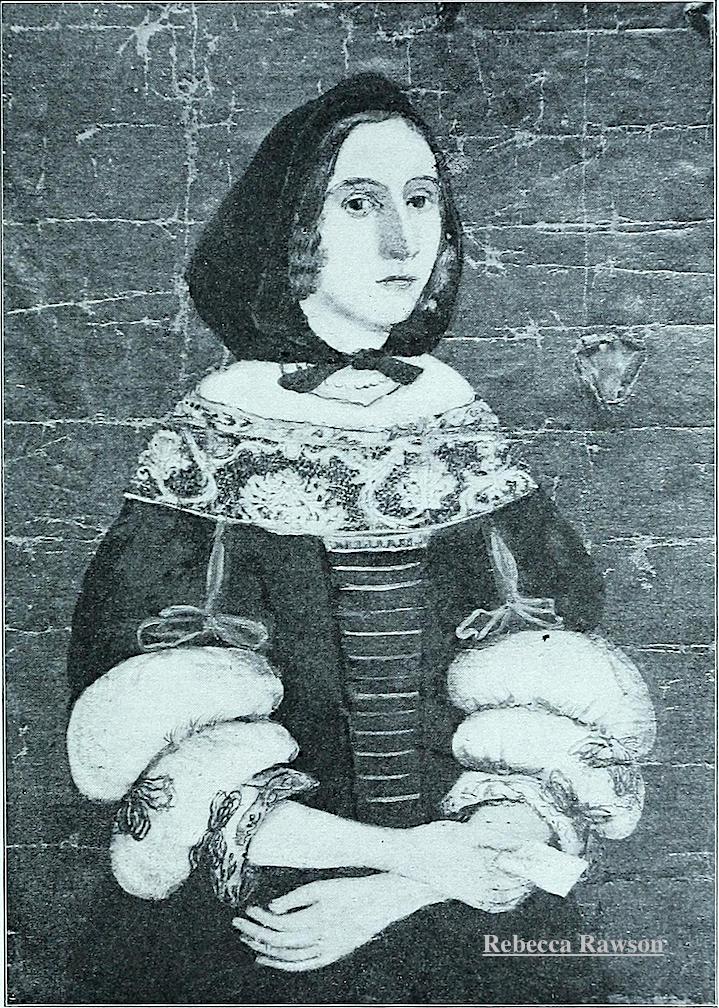
267 High Street – The tragic story of Rebecca Rawson (1656–1692)

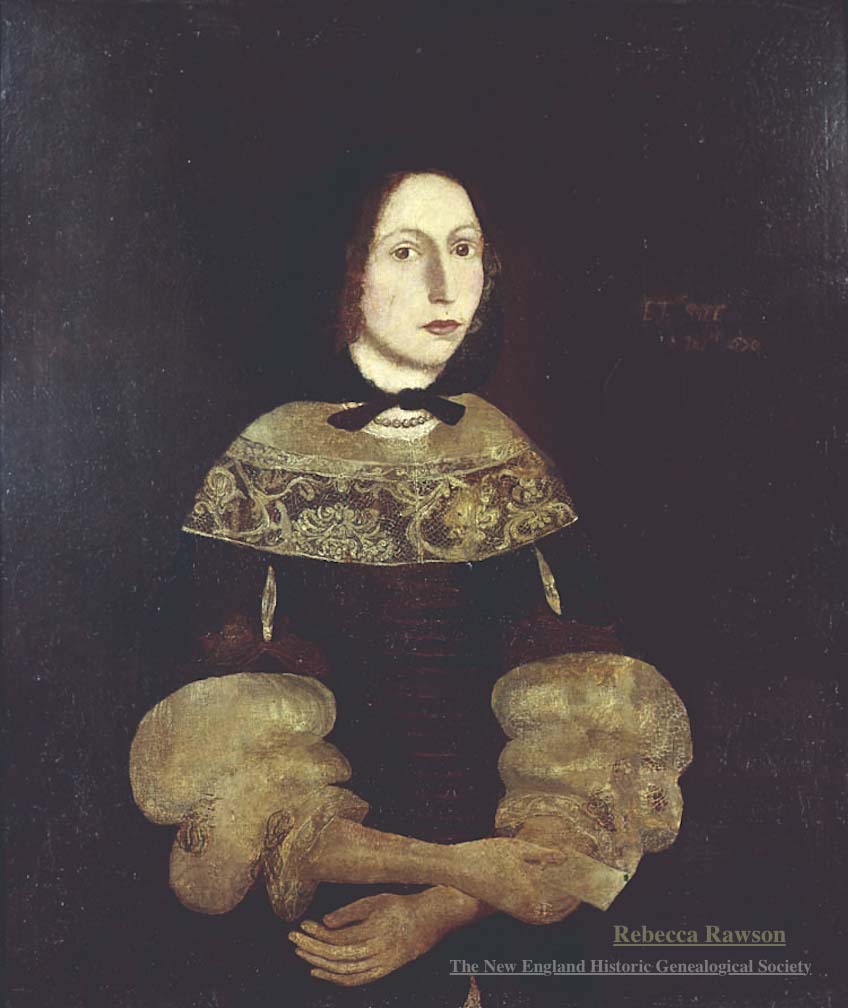
Portrait of Rebecca Rawson c.1670, oil on canvas, courtesy of The New England Historic Genealogical Society

Portrait of Rebecca Rawson c.1670, oil on canvas, courtesy of The New England Historic Genealogical Society

The story of Rebecca Rawson is one of great love, betrayal and cruelty by a con artist and a hustler, and then even more tragedy.

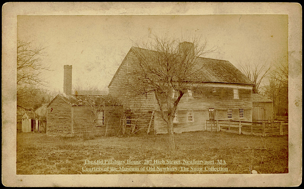
The Old Pillsbury House, 267 High Street, Newburyport, MA Courtesy of the Museum of Old Newbury, The Snow Collection

The Old Pillsbury House, 267 High Street, Newburyport, MA Courtesy of the Museum of Old Newbury, The Snow Collection

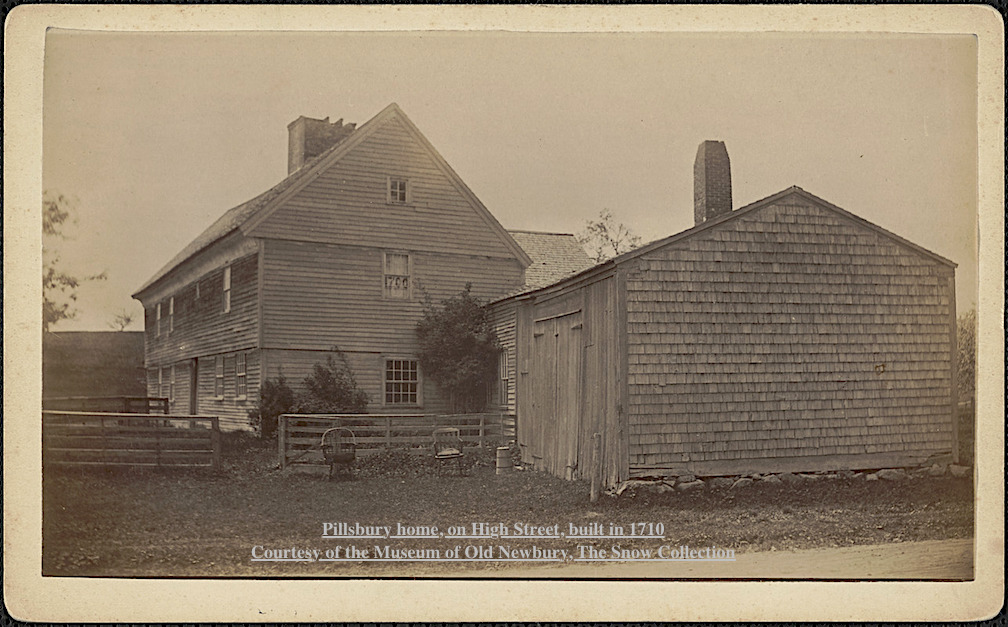
Edward Rawson, Rebecca’s father, sold his house and forty acres of land in Newbury in 1651 to William Pillsbury of Dorchester, and that is why it is known as the Pillsbury House. 

The story can be read on the History ~ Newburyport website here.
Pillsbury home, on High Street, built in 1710 Courtesy of the Museum of Old Newbury, The Snow Collection

Pillsbury home, on High Street, built in 1710
Courtesy of the Museum of Old Newbury, The Snow Collection


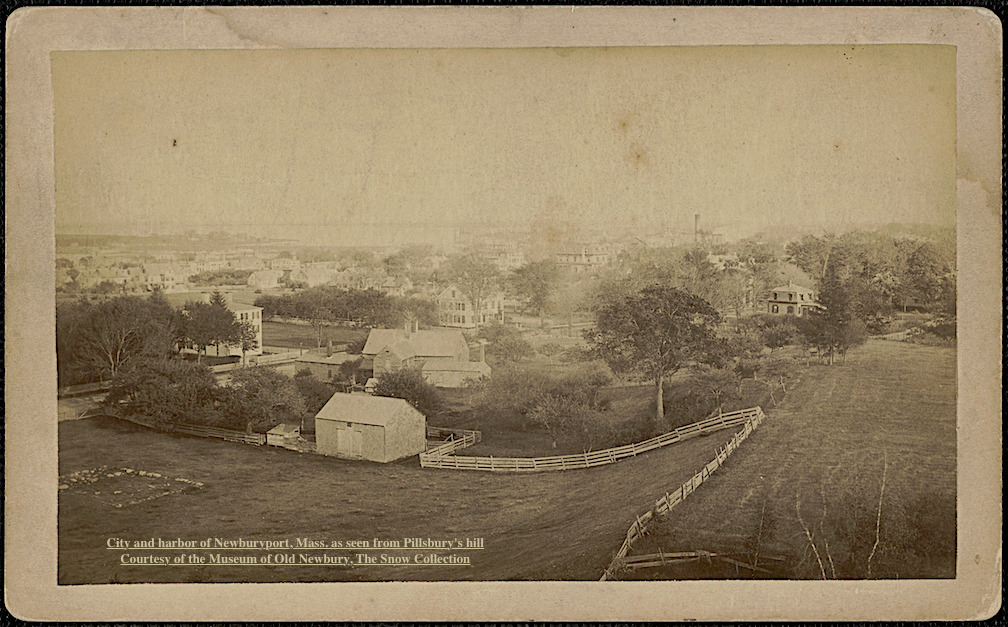
City and harbor of Newburyport, Mass. as seen from Pillsbury's hill Courtesy of the Museum of Old Newbury, The Snow Collection

City and harbor of Newburyport, Mass. as seen from Pillsbury’s hill
Courtesy of the Museum of Old Newbury, The Snow Collection

Newburyport Map - Keeping the Story AliveHere is the link to the map: Newburyport – Keeping the Story Alive, Mapping historic stories of Newburyport, MA houses and places, with photos, paintings, videos, old maps, history and anecdotes. Created by The Newburyport Blog, Mary Baker Eaton, editor.

map.historynewburyport.com

Rebecca Rawson (1656–1692)

Rebecca Rawson (1656–1692)

Mapping Newburyport – Keeping the Story Alive – John P. Marquand, 82 Curzon Mill Rd

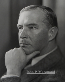
82 Curzon Mill Rd – John P. Marquand (1893-1960)

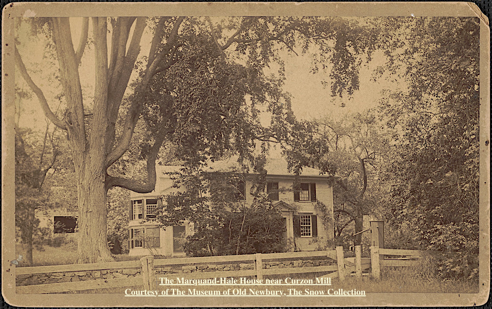
Marquand-Hale House near Curzon Mill

Marquand-Hale House near Curzon Mill
Courtesy of The Historical Society of Old Newbury, The Snow Collection

“When financial reverses broke up the family’s comfortable household, John P. Marquand was sent to Newburyport, Massachusetts, where he was raised by his eccentric aunts, who lived in a crumbling Federal Period mansion surrounded by remnants of the family’s vanished glory. Marquand’s ancestors had been successful merchants in the Revolutionary period; Margaret Fuller and other aunts had been actively involved with the Transcendentalist and abolitionist movements.

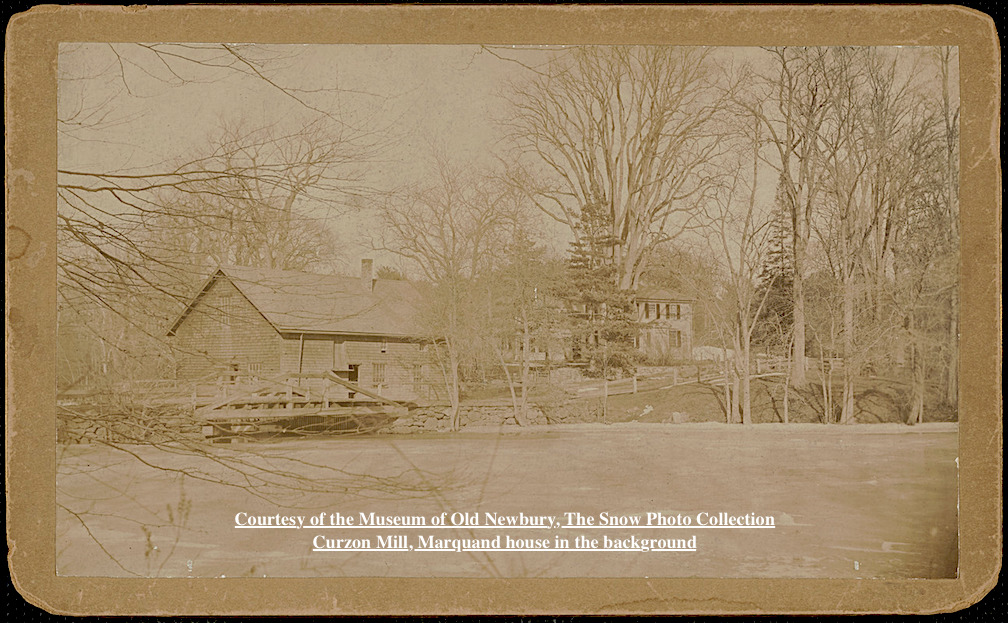
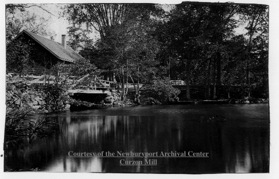
Curzon Mill, Marquand house in the background

Curzon Mill, Marquand house in the background
Courtesy of The Historical Society of Old Newbury, The Snow Collection

Marquand attended Newburyport High School, where he won a scholarship that enabled him to attend Harvard College.
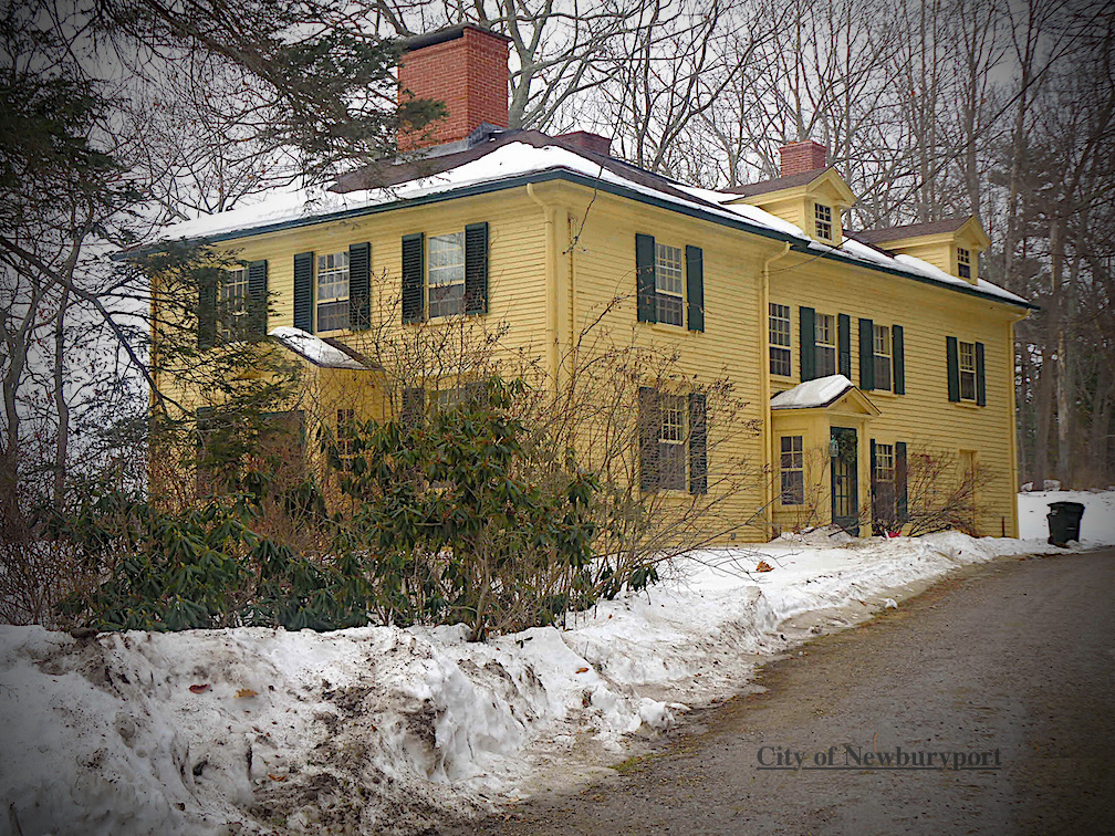
82 Curzon Mill Road, Newburyport, MA today

82 Curzon Mill Road today

In the late 1930s, Marquand began producing a series of novels on the dilemmas of class, most centered on New England. The first of these, The Late George Apley (1937), a satire of Boston’s upper class, won the Pulitzer Prize for the Novel in 1938. Other Marquand novels exploring New England and class themes include Wickford Point (1939), H.M. Pulham, Esquire (1941), and Point of No Return (1949).” ~ Wikipedia
John P. Marquand

John P. Marquand

Newburyport Map - Keeping the Story AliveHere is the link to the map: Newburyport – Keeping the Story Alive, Mapping historic stories of Newburyport, MA houses and places, with photos, paintings, videos, old maps, history and anecdotes. Created by The Newburyport Blog, Mary Baker Eaton, editor.

map.historynewburyport.com

Curzon Mill, Courtesy of the Newburyport Archival Center

Curzon Mill, Courtesy of the Newburyport Archival Center

Mapping 32 Green Street home of Alice Hooper Fowle Cutler

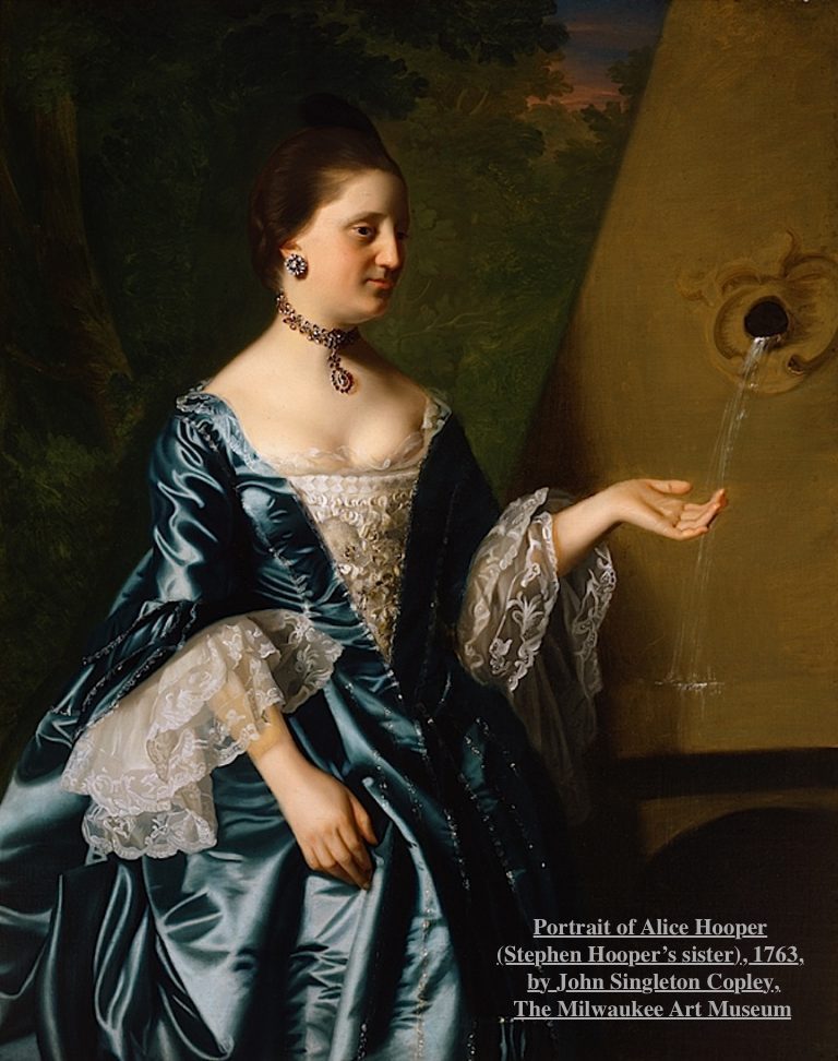
Portrait of Alice Hooper by John Singleton Copley

Portrait of Alice Hooper by John Singleton Copley

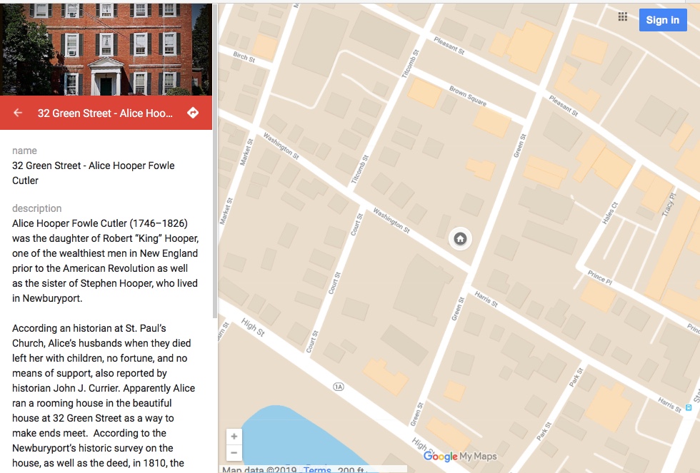
Alice Hooper Fowle Cutler (1746–1826) was the daughter of Robert “King” Hooper, one of the wealthiest men in New England prior to the American Revolution as well as the sister of Stephen Hooper, who lived in Newburyport.

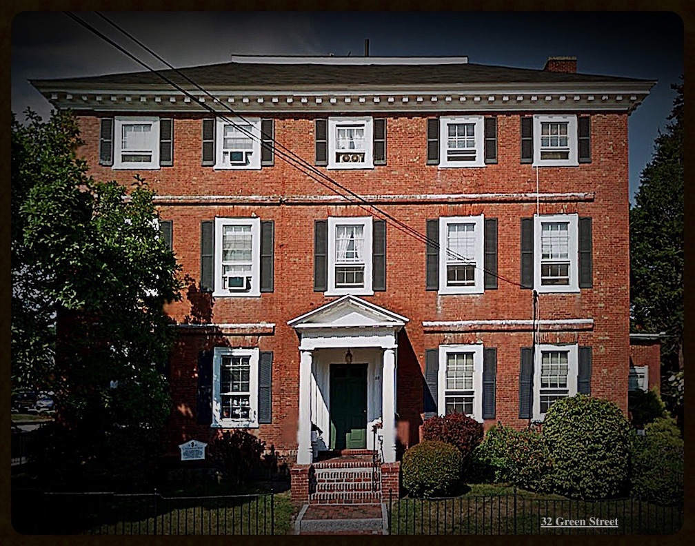
32 Green Street, Newburyport, MA

According an historian at St. Paul’s Church of Alice’s husbands when they died left her with children, no fortune, and no means of support, also reported by historian John J. Currier. Apparently Alice ran a rooming house in the beautiful house at 32 Green Street as a way to make ends meet.  According to the Newburyport’s historic survey on the house, as well as the deed, in 1810, the house was divided in two, and Alice must have lived in one half and the wife and heirs of Joseph Bartlett lived in the other half.

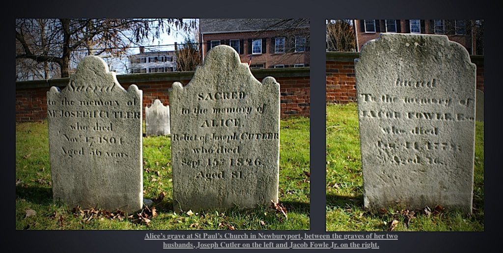
 Alice is buried at St. Paul’s church between her two husbands,

Alice is buried at St. Paul’s church between her two husbands,

Alice died in 1826 at the age of 81. Alice is buried at St. Paul’s church between her two husbands, Joseph Cutler on the left and Jacob Fowle Jr on the right. ( Joseph Cutler died in 1801 and her first husband Jacob Fowle Jr died in 1778.)

Mapping of 32 Green Street

Newburyport Map - Keeping the Story AliveHere is the link to the map: Newburyport – Keeping the Story Alive, Mapping historic stories of Newburyport, MA houses and places, with photos, paintings, videos, old maps, history and anecdotes. Created by The Newburyport Blog, Mary Baker Eaton, editor.

map.historynewburyport.com

Mapping of 32 Green Street

Mapping of 32 Green Street

Mapping Newburyport’s Historic Places, Keeping the Story Alive – Starting with Stephen Hooper

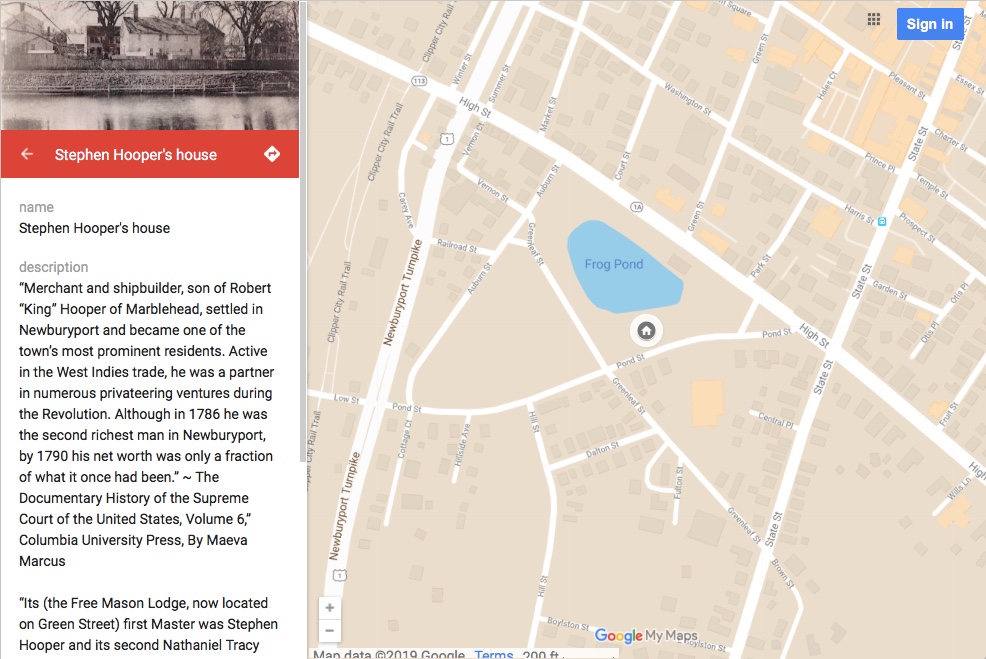
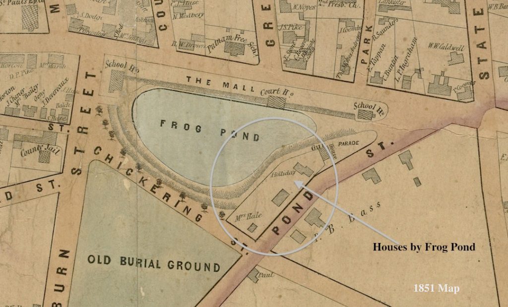
In thinking about how to keep Newburyport’s history alive, I thought I might try mapping historic places in Newburyport. I started with Stephen Hooper’s house on Frog Pong.

Mapping History of Newburyport, starting with Stephen Hooper's house

Mapping History of Newburyport, starting with Stephen Hooper’s house

“Merchant and shipbuilder, son of Robert “King” Hooper of Marblehead, settled in Newburyport and became one of the town’s most prominent residents. Active in the West Indies trade, he was a partner in numerous privateering ventures during the Revolution. Although in 1786 he was the second richest man in Newburyport, by 1790 his net worth was only a fraction of what it once had been.” ~ The Documentary History of the Supreme Court of the United States, Volume 6,” Columbia University Press, By Maeva Marcus

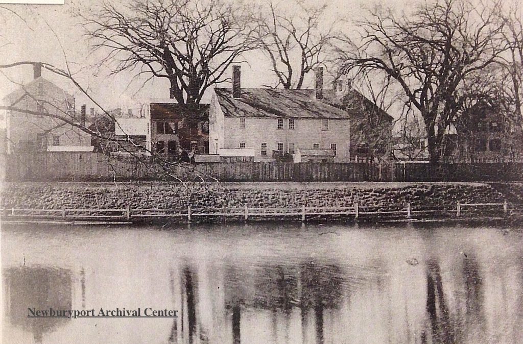
Buildings by Frog Pond - Stephen Hooper's house

Buildings by Frog Pond – Stephen Hooper’s house

 “Its (the Free Mason Lodge, now located on Green Street) first Master was Stephen Hooper and its second Nathaniel Tracy two eminent and wealthy merchants who will always be remembered in our history.” ~ The Newburyport Daily Herald 1856

Stephen Hooper's House, Pond Street

Stephen Hooper’s House, Pond Street

The portrait of Stephen Hooper is painted by Henry Pelham (the stepbrother of John Singleton Copley), a miniature, set in gold, 1773, a watercolor on ivory in the Metropolitan Museum of Art.

Portrait of Stephen Hooper,painted by Henry Pelham (the stepbrother of John Singleton Copley), a miniature, set in gold, 1773, a watercolor on ivory in the Metropolitan Museum of Art.

1851 Map showing building by Frog Pond

1851 Map showing building by Frog Pond

Newburyport Map - Keeping the Story AliveHere is the link to the map: Newburyport – Keeping the Story Alive, Mapping historic stories of Newburyport, MA houses and places, with photos, paintings, videos, old maps, history and anecdotes. Created by The Newburyport Blog, Mary Baker Eaton, editor.

map.historynewburyport.com

Survey of Frog Pond 1771, City of Newburyport

Survey of Frog Pond 1771, City of Newburyport