Monthly Archives: September 2019

History Map of Newburyport – Inn Street

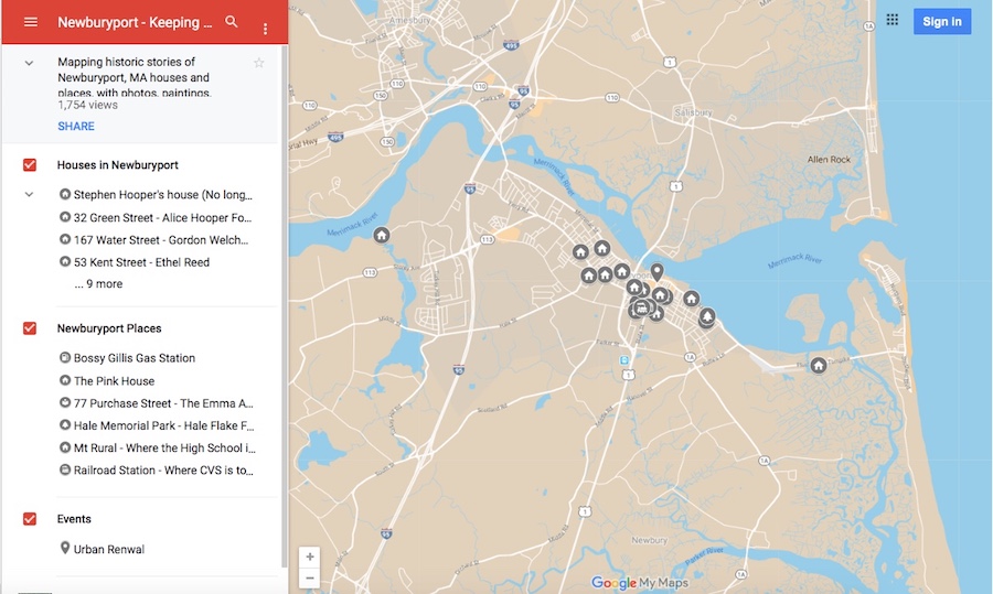
Newburyport Map - Keeping the Story AliveHere is the link to the map: Newburyport – Keeping the Story Alive, Mapping historic stories of Newburyport, MA houses and places, with photos, paintings, videos, old maps, history and anecdotes. Created by The Newburyport Blog, Mary Baker Eaton, editor.
map.historynewburyport.com

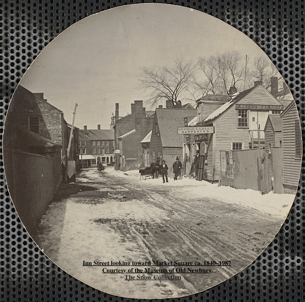
Inn Street looking toward Market Square ca. 1840–1987 Courtesy of the Museum of Old Newbury, the Snow Collection

Inn Street looking toward Market Square ca. 1840–1987
Courtesy of the Museum of Old Newbury, the Snow Collection

What is now Inn Street is roughly the area where the fire started in l811destroying much of Market Square. Inn Street was laid out in l8l8 as part of the reconstruction on the area after the fire.
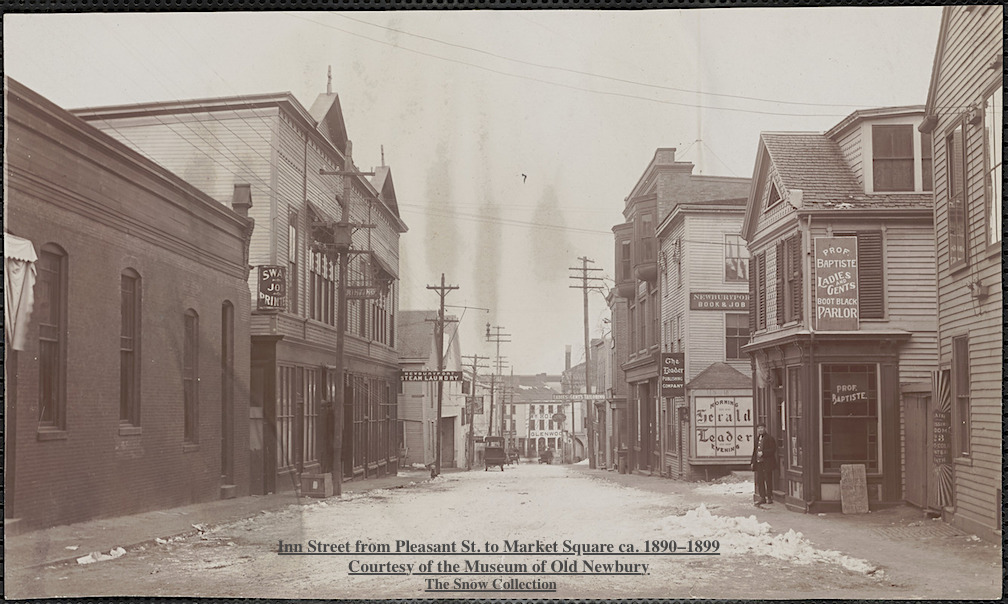
nn Street from Pleasant St. to Market Square ca. 1890–1899 Courtesy of the Museum of Old Newbury, the Snow Collection

nn Street from Pleasant St. to Market Square ca. 1890–1899
Courtesy of the Museum of Old Newbury, the Snow Collection

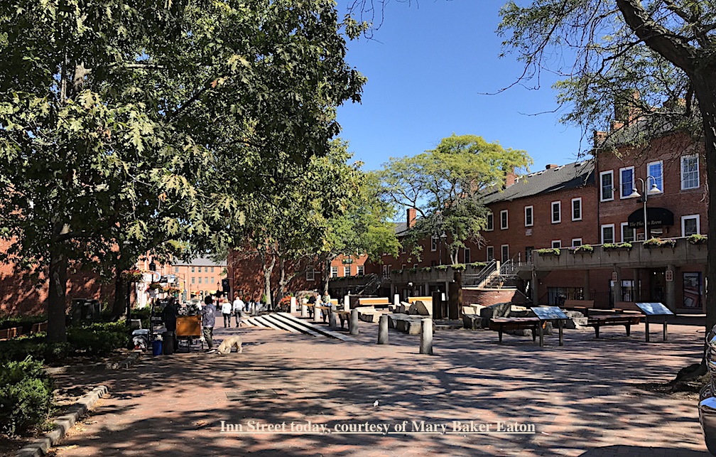
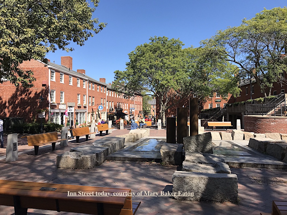
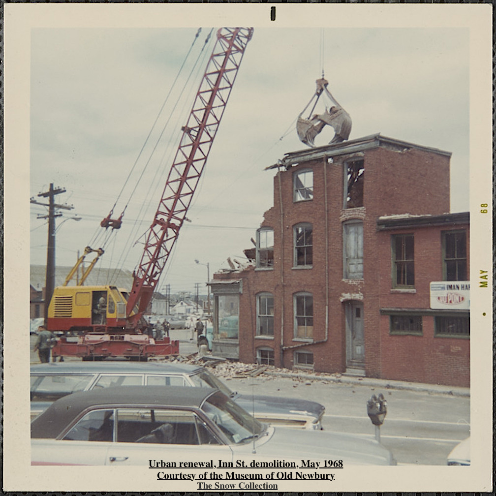
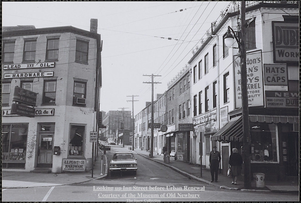
Most of the buildings on Inn Street were demolished as part of Urban Renewal in the late 1960s and early 1970s. The demolition of the area was stopped and restoration and renewal was adopted. Today Inn Street is a thriving pedestrian mall, it was completed in 1974 and downtown Newburyport is a national example of historic preservation. ~ History courtesy of the City of Newburyport, Historic Property Surveys
Looking up Inn St. before Urban Renewal Courtesy of the Museum of Old Newbury, the Snow Collection

Looking up Inn St. before Urban Renewal
Courtesy of the Museum of Old Newbury, the Snow Collection

Urban renewal, Inn St. demolition, May 1968 Courtesy of the Museum of Old Newbury, the Snow Collection

Urban renewal, Inn St. demolition, May 1968
Courtesy of the Museum of Old Newbury, the Snow Collection

Inn Street today, courtesy of Mary Baker Eaton

Inn Street today, courtesy of Mary Baker Eaton

Inn Street today, courtesy of Mary Baker Eaton

Inn Street today, courtesy of Mary Baker Eaton

Photographs courtesy of the Museum of Old Newbury, the Snow Collection, and Mary Baker Eaton
Where to find Walking Maps about Newburyport’s History

Newburyport Map - Keeping the Story AliveHere is the link to the map: Newburyport – Keeping the Story Alive, Mapping historic stories of Newburyport, MA houses and places, with photos, paintings, videos, old maps, history and anecdotes. Created by The Newburyport Blog, Mary Baker Eaton, editor.

map.historynewburyport.com

HistoryWalkingTourNewburyport

The editor of The Newburyport Blog, me, Mary Baker Eaton, has decided to map all the research that I’ve done over the years for The Newburyport Blog and for “If This House Could Talk – Newburyport,” and then some more researching and mapping after that. The stories are from all walks of life and from different periods during Newburyport’s history. The stories are about houses, people, places and events told and illustrated with photographs, paintings, videos, old maps, history and anecdotes (and even a poem). They are about are men and women, eccentric and proper, rich and poor, successful and those who have fallen on hard times. And the history of Newburyport mirrors the themes and places of the people who have lived here.

Newburyport Keeping the Story History Alive Map
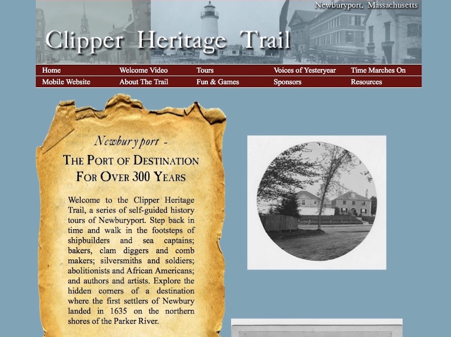
Ghlee Woodworth created the most amazing project in 2012 – the Clipper Heritage Trail. You can download different maps from different areas of the city and learn all about Newburyport’s fascinating history.

Clipper City Heritage Trail


The Clipper Heritage Trail

“Welcome to the Clipper Heritage Trail, a series of self-guided history tours of Newburyport. Step back in time and walk in the footsteps of shipbuilders and sea captains; bakers, clam diggers and comb makers; silversmiths and soldiers; abolitionists and African Americans; and authors and artists. Explore the hidden corners of a destination where the first settlers of Newbury landed in 1635 on the northern shores of the Parker River.”  ~ Ghlee Woodworth, The Clipper City Heritage Trail

The link to the Clipper Heritage Trail can be found here: http://www.clipperheritagetrail.com

Newburyport History Map – Keeping the Story Alive

Newburyport Map - Keeping the Story AliveHere is the link to the map: Newburyport – Keeping the Story Alive, Mapping historic stories of Newburyport, MA houses and places, with photos, paintings, videos, old maps, history and anecdotes. Created by The Newburyport Blog, Mary Baker Eaton, editor.

map.historynewburyport.com

Newburyport History

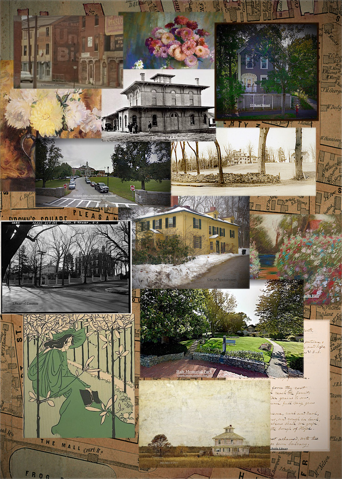
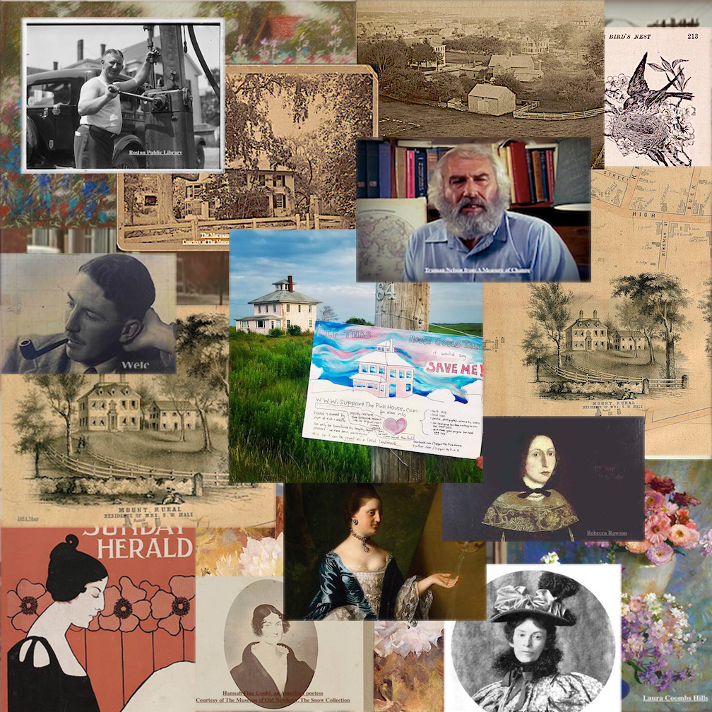
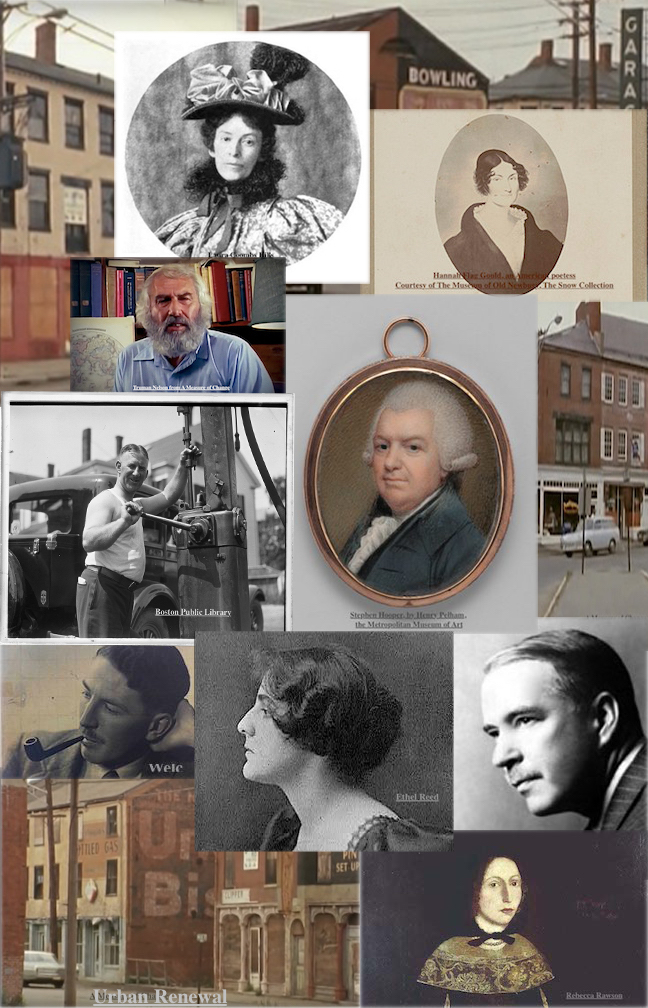
There are so many Newburyport stories that are being lost or have been lost. People are forgetting Newburyport’s history, from Urban Renewal in the late 1960s early 1970s, to Bossy Gillis, Truman Nelson, Alice Hooper Fowle Cutler, painter Laura Coombs Hills, poet Hannah Flagg Gould, Rebecca Rawson, Mt. Rural, writer John P. Marquand, Curzon Mill, artist Ethel Reed, The Old Pillsbury House.

Go to the map to find out all about these stories and where the people lived or where the stories took place in Newburyport.

The historic/story map is an outgrowth of Newburyport’s “If This House Could Talk” and all the research that has been done on stories and history for the Newburyport Blog since 2006. The concept of This House Could Talk is to collect and present local history, and historical anecdotes, through a collaborative activity in which residents and businesses post hand made signs and graphics in front of their homes and businesses, telling stories and offering information from the recent or not-so-recent past. It does not matter if the house and/or story is old or new, ordinary or rare and important. The signs have a range of information from the architectural history, to personal experiences and stories of the current or historic residents of a particular house. If This House Could Talk offers neighborhood residents a way to present historical information with a personal voice. This type of free and accessible presentation of information in public places encourages walking and exploration of a neighborhood in order to discover and learn from the signs and artworks. The hope is that the sharing of local history might bring the community together through the engagement with the stories, and contribute to building a sense of place. An increased appreciation for historical preservation can also be a byproduct. The hope is that the interactive history/story map is an ongoing continuation of this objective.

Mapping Newburyport – Keeping the Story Alive

Newburyport Map - Keeping the Story AliveHere is the link to the map: Newburyport – Keeping the Story Alive, Mapping historic stories of Newburyport, MA houses and places, with photos, paintings, videos, old maps, history and anecdotes. Created by The Newburyport Blog, Mary Baker Eaton, editor.

map.historynewburyport.com

There are so many Newburyport stories that are being lost or have been lost. People are forgetting the story of Urban Renewal in the late 1960s early 1970s. And there are so many stories that over this next year will be added to the map.

Newburyport Stories

Go to the map to find out all about these stories and where the people lived or where the stories took place in Newburyport.

The historic/story map is an outgrowth of Newburyport’s “If This House Could Talk” and all the research that has been done on stories and history for the Newburyport Blog since 2006. The concept of This House Could Talk is to collect and present local history, and historical anecdotes, through a collaborative activity in which residents and businesses post hand made signs and graphics in front of their homes and businesses, telling stories and offering information from the recent or not-so-recent past. It does not matter if the house and/or story is old or new, ordinary or rare and important. The signs have a range of information from the architectural history, to personal experiences and stories of the current or historic residents of a particular house. If This House Could Talk offers neighborhood residents a way to present historical information with a personal voice. This type of free and accessible presentation of information in public places encourages walking and exploration of a neighborhood in order to discover and learn from the signs and artworks. The hope is that the sharing of local history might bring the community together through the engagement with the stories, and contribute to building a sense of place. An increased appreciation for historical preservation can also be a byproduct. The hope is that the interactive history/story map is an ongoing continuation of this objective.

Mapping Newburyport – Keeping the Story Alive – 267 High Street, Rebecca Rawson

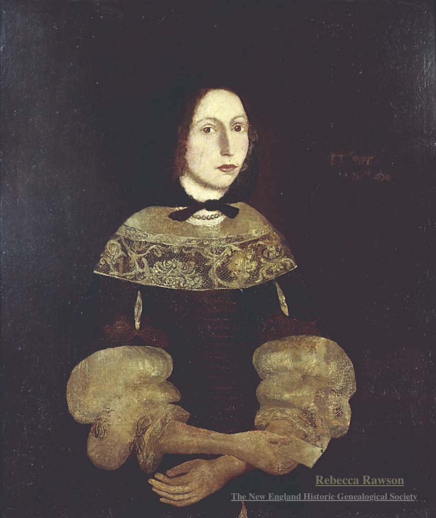
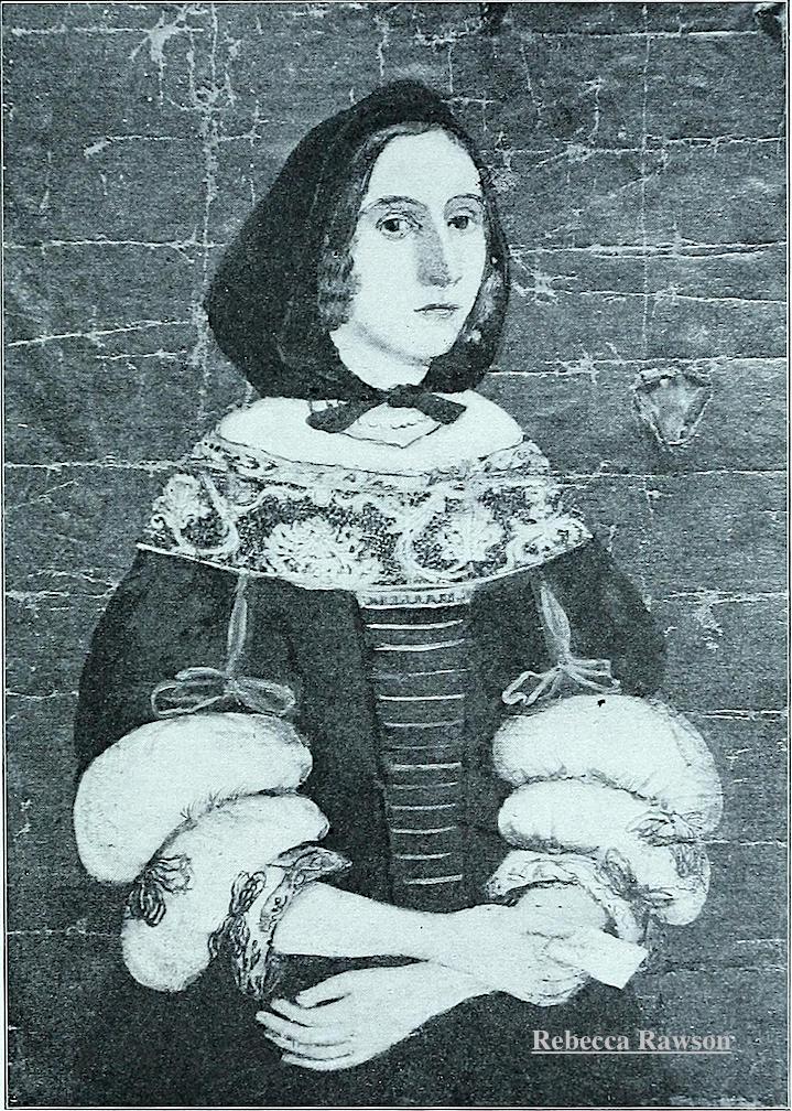
267 High Street – The tragic story of Rebecca Rawson (1656–1692)

Portrait of Rebecca Rawson c.1670, oil on canvas, courtesy of The New England Historic Genealogical Society

Portrait of Rebecca Rawson c.1670, oil on canvas, courtesy of The New England Historic Genealogical Society

The story of Rebecca Rawson is one of great love, betrayal and cruelty by a con artist and a hustler, and then even more tragedy.

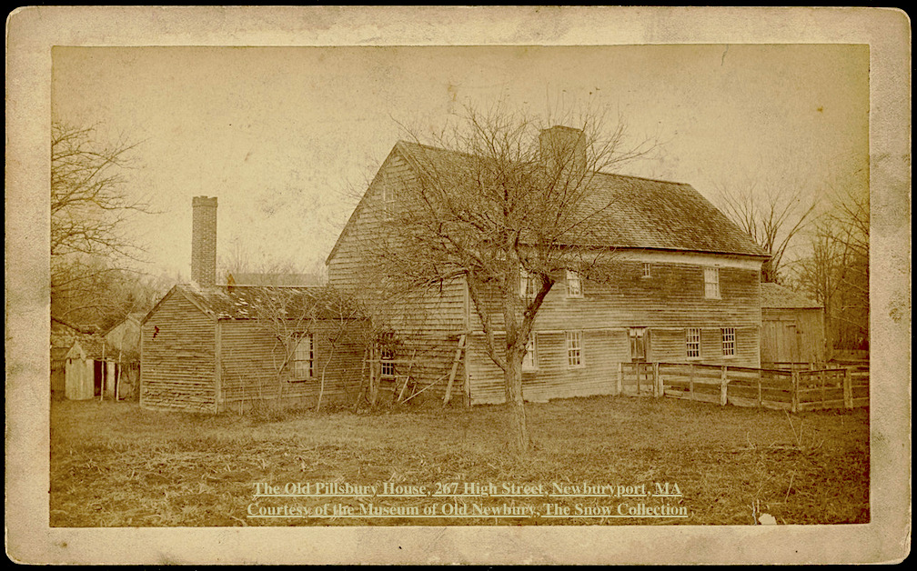
The Old Pillsbury House, 267 High Street, Newburyport, MA Courtesy of the Museum of Old Newbury, The Snow Collection

The Old Pillsbury House, 267 High Street, Newburyport, MA Courtesy of the Museum of Old Newbury, The Snow Collection

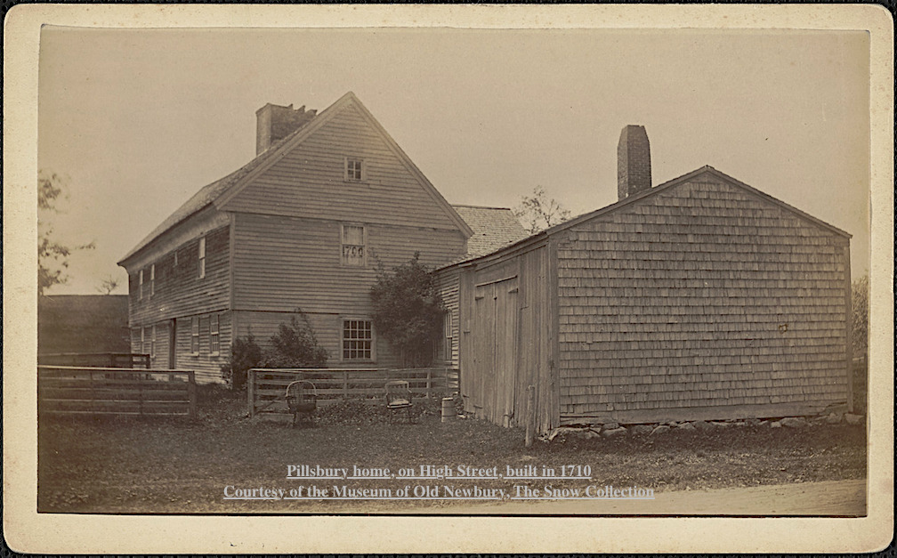
Edward Rawson, Rebecca’s father, sold his house and forty acres of land in Newbury in 1651 to William Pillsbury of Dorchester, and that is why it is known as the Pillsbury House. 

The story can be read on the History ~ Newburyport website here.

Pillsbury home, on High Street, built in 1710 Courtesy of the Museum of Old Newbury, The Snow Collection

Pillsbury home, on High Street, built in 1710
Courtesy of the Museum of Old Newbury, The Snow Collection


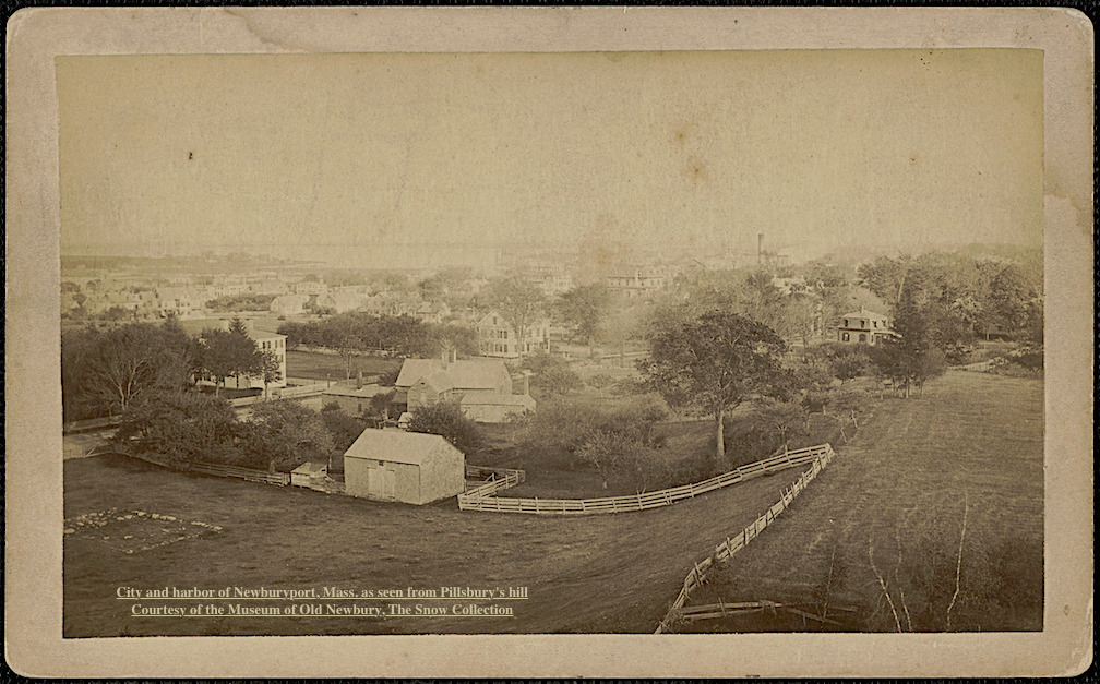
City and harbor of Newburyport, Mass. as seen from Pillsbury's hill Courtesy of the Museum of Old Newbury, The Snow Collection

City and harbor of Newburyport, Mass. as seen from Pillsbury’s hill
Courtesy of the Museum of Old Newbury, The Snow Collection

Newburyport Map - Keeping the Story AliveHere is the link to the map: Newburyport – Keeping the Story Alive, Mapping historic stories of Newburyport, MA houses and places, with photos, paintings, videos, old maps, history and anecdotes. Created by The Newburyport Blog, Mary Baker Eaton, editor.

map.historynewburyport.com

Rebecca Rawson (1656–1692)

Rebecca Rawson (1656–1692)

Mapping Newburyport – Keeping the Story Alive – John P. Marquand, 82 Curzon Mill Rd

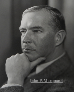
82 Curzon Mill Rd – John P. Marquand (1893-1960)

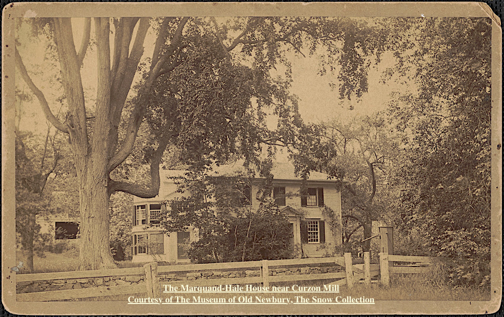
Marquand-Hale House near Curzon Mill

Marquand-Hale House near Curzon Mill
Courtesy of The Historical Society of Old Newbury, The Snow Collection

“When financial reverses broke up the family’s comfortable household, John P. Marquand was sent to Newburyport, Massachusetts, where he was raised by his eccentric aunts, who lived in a crumbling Federal Period mansion surrounded by remnants of the family’s vanished glory. Marquand’s ancestors had been successful merchants in the Revolutionary period; Margaret Fuller and other aunts had been actively involved with the Transcendentalist and abolitionist movements.

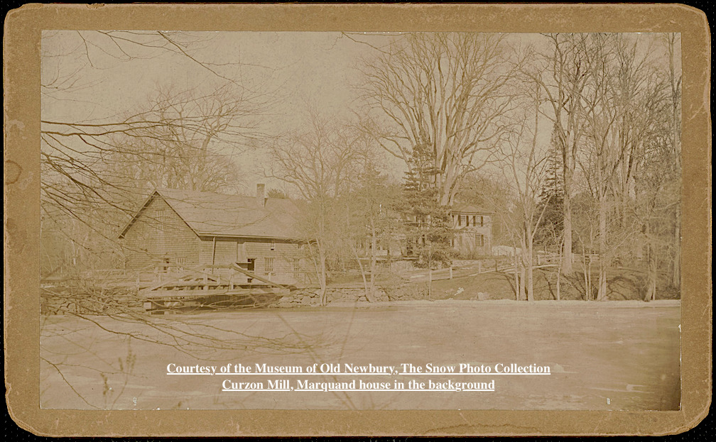
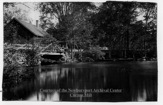
Curzon Mill, Marquand house in the background

Curzon Mill, Marquand house in the background
Courtesy of The Historical Society of Old Newbury, The Snow Collection

Marquand attended Newburyport High School, where he won a scholarship that enabled him to attend Harvard College.

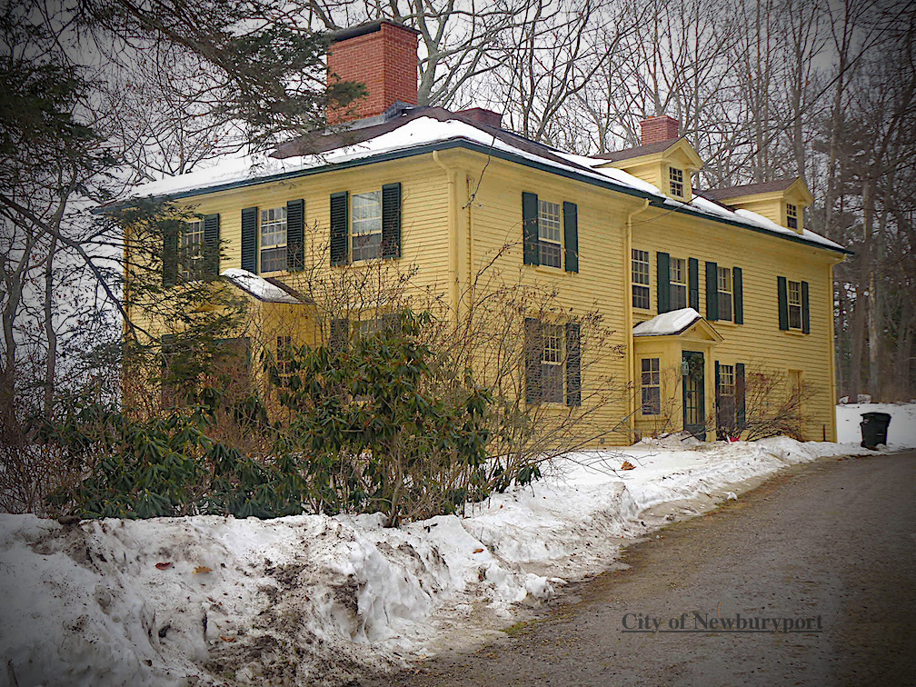
82 Curzon Mill Road, Newburyport, MA today

82 Curzon Mill Road today

In the late 1930s, Marquand began producing a series of novels on the dilemmas of class, most centered on New England. The first of these, The Late George Apley (1937), a satire of Boston’s upper class, won the Pulitzer Prize for the Novel in 1938. Other Marquand novels exploring New England and class themes include Wickford Point (1939), H.M. Pulham, Esquire (1941), and Point of No Return (1949).” ~ Wikipedia

John P. Marquand

John P. Marquand

Newburyport Map - Keeping the Story AliveHere is the link to the map: Newburyport – Keeping the Story Alive, Mapping historic stories of Newburyport, MA houses and places, with photos, paintings, videos, old maps, history and anecdotes. Created by The Newburyport Blog, Mary Baker Eaton, editor.

map.historynewburyport.com

Curzon Mill, Courtesy of the Newburyport Archival Center

Curzon Mill, Courtesy of the Newburyport Archival Center

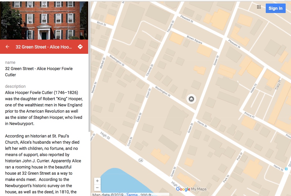
Mapping 32 Green Street home of Alice Hooper Fowle Cutler

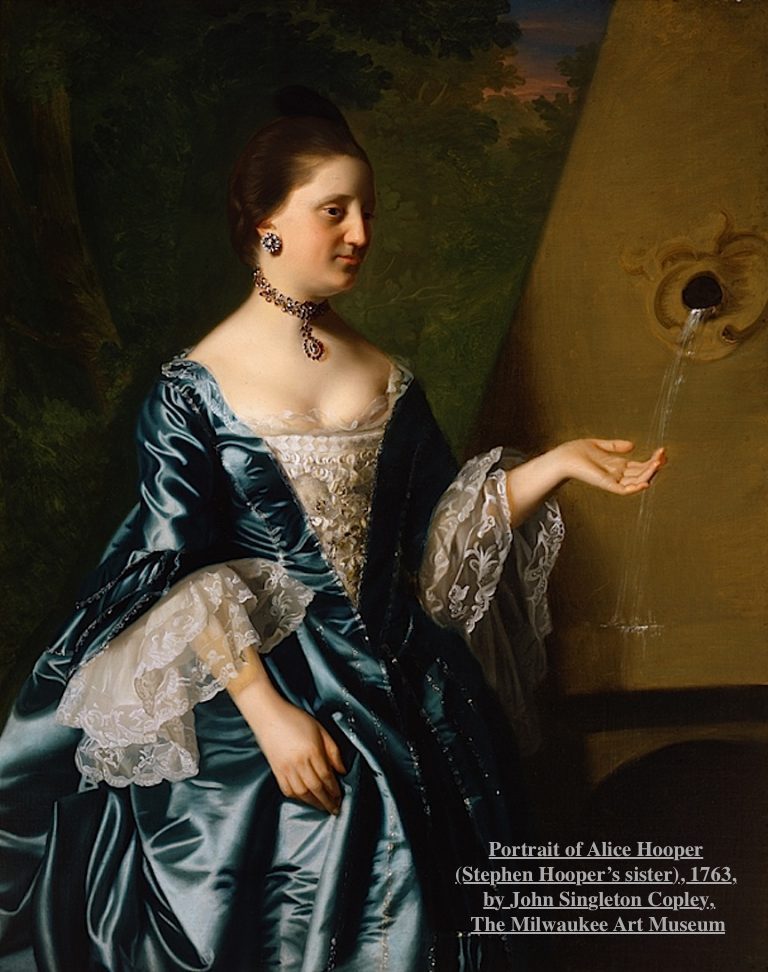
Portrait of Alice Hooper by John Singleton Copley

Portrait of Alice Hooper by John Singleton Copley

Alice Hooper Fowle Cutler (1746–1826) was the daughter of Robert “King” Hooper, one of the wealthiest men in New England prior to the American Revolution as well as the sister of Stephen Hooper, who lived in Newburyport.

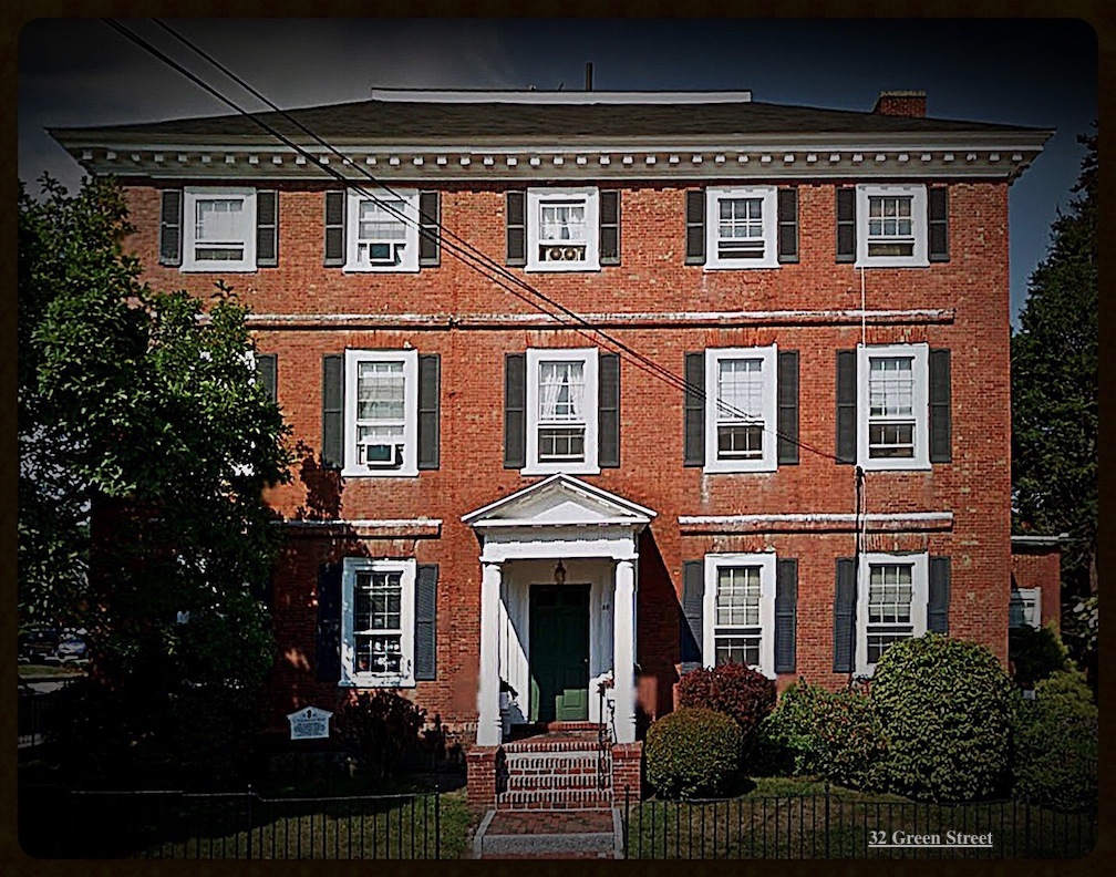
32 Green Street, Newburyport, MA

According an historian at St. Paul’s Church of Alice’s husbands when they died left her with children, no fortune, and no means of support, also reported by historian John J. Currier. Apparently Alice ran a rooming house in the beautiful house at 32 Green Street as a way to make ends meet.  According to the Newburyport’s historic survey on the house, as well as the deed, in 1810, the house was divided in two, and Alice must have lived in one half and the wife and heirs of Joseph Bartlett lived in the other half.

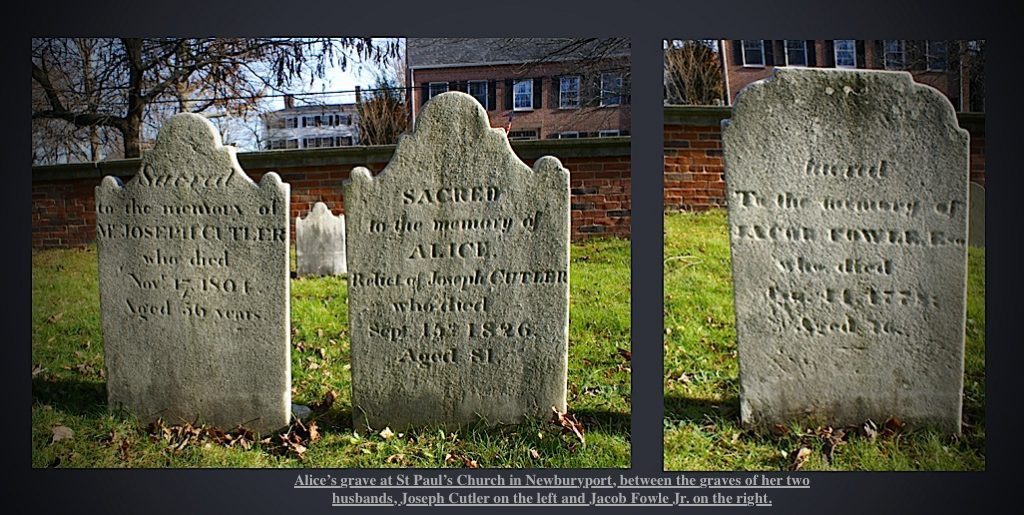
 Alice is buried at St. Paul’s church between her two husbands,

Alice is buried at St. Paul’s church between her two husbands,

Alice died in 1826 at the age of 81. Alice is buried at St. Paul’s church between her two husbands, Joseph Cutler on the left and Jacob Fowle Jr on the right. ( Joseph Cutler died in 1801 and her first husband Jacob Fowle Jr died in 1778.)

Mapping of 32 Green Street

Newburyport Map - Keeping the Story AliveHere is the link to the map: Newburyport – Keeping the Story Alive, Mapping historic stories of Newburyport, MA houses and places, with photos, paintings, videos, old maps, history and anecdotes. Created by The Newburyport Blog, Mary Baker Eaton, editor.

map.historynewburyport.com

Mapping of 32 Green Street

Mapping of 32 Green Street

Mapping Newburyport’s Historic Places, Keeping the Story Alive – Starting with Stephen Hooper

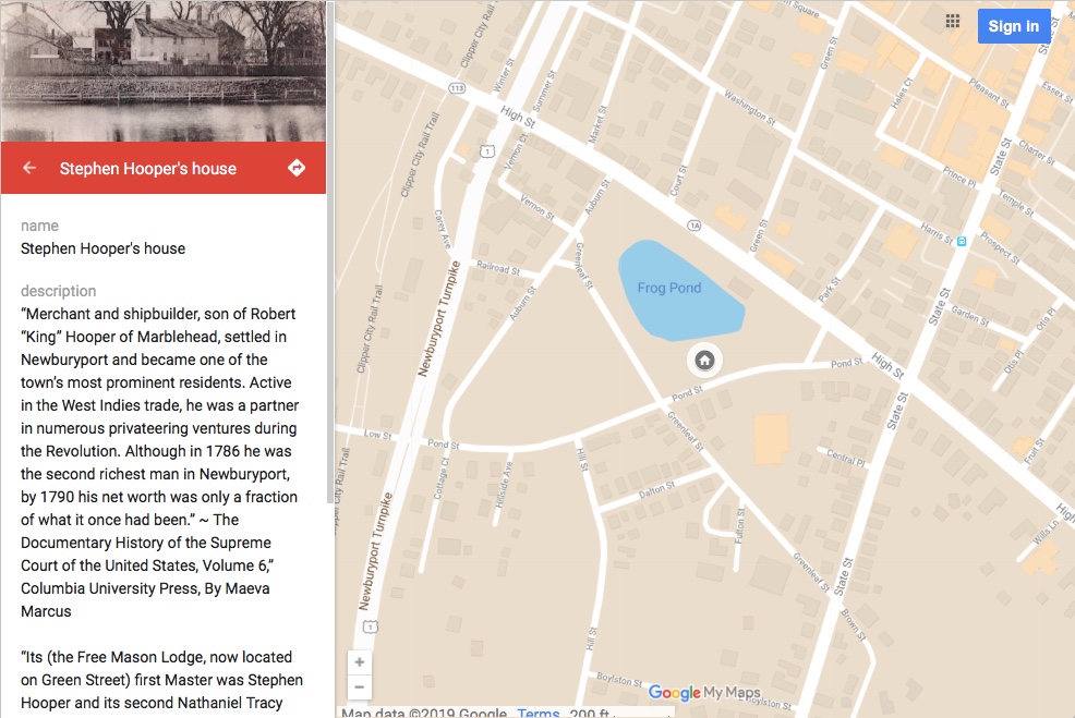
In thinking about how to keep Newburyport’s history alive, I thought I might try mapping historic places in Newburyport. I started with Stephen Hooper’s house on Frog Pong.

Mapping History of Newburyport, starting with Stephen Hooper's house

Mapping History of Newburyport, starting with Stephen Hooper’s house

“Merchant and shipbuilder, son of Robert “King” Hooper of Marblehead, settled in Newburyport and became one of the town’s most prominent residents. Active in the West Indies trade, he was a partner in numerous privateering ventures during the Revolution. Although in 1786 he was the second richest man in Newburyport, by 1790 his net worth was only a fraction of what it once had been.” ~ The Documentary History of the Supreme Court of the United States, Volume 6,” Columbia University Press, By Maeva Marcus

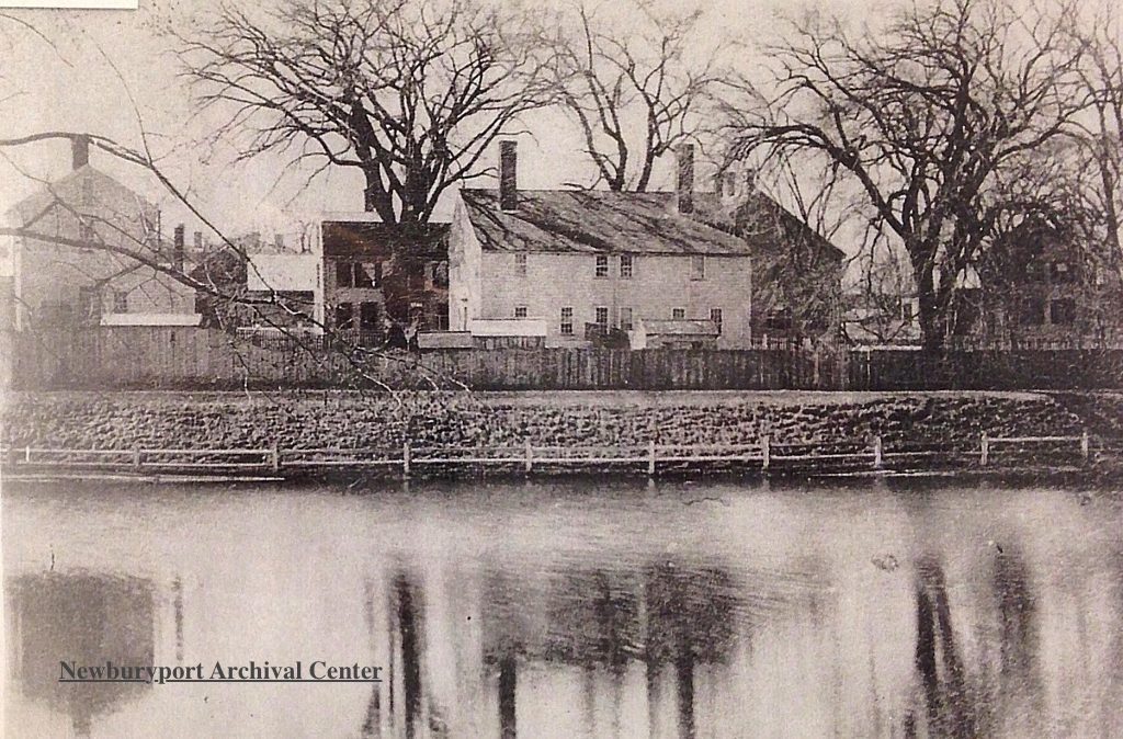
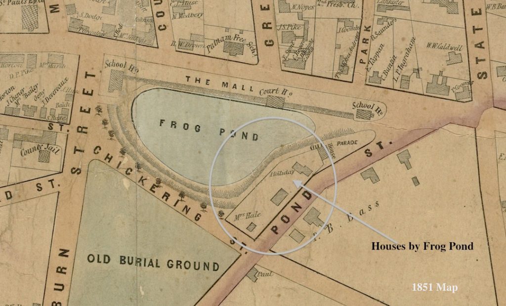
Buildings by Frog Pond - Stephen Hooper's house

Buildings by Frog Pond – Stephen Hooper’s house

 “Its (the Free Mason Lodge, now located on Green Street) first Master was Stephen Hooper and its second Nathaniel Tracy two eminent and wealthy merchants who will always be remembered in our history.” ~ The Newburyport Daily Herald 1856

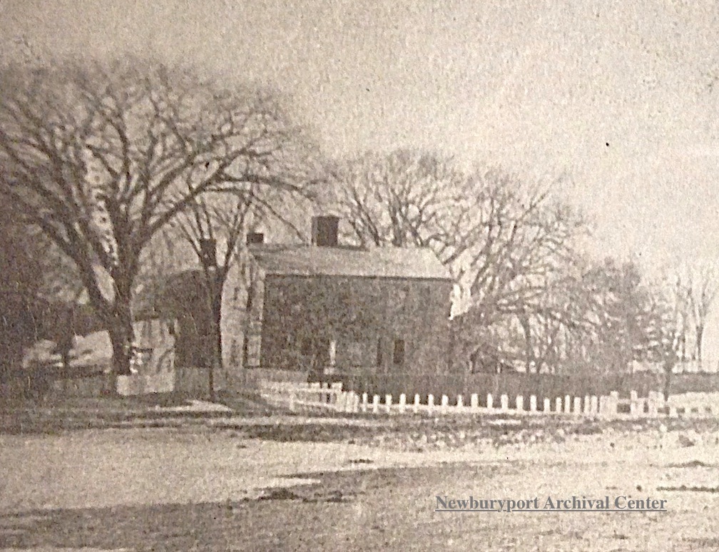
Stephen Hooper's House, Pond Street

Stephen Hooper’s House, Pond Street

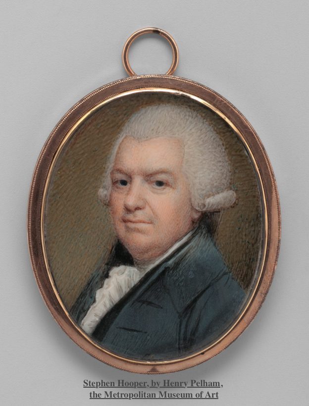
The portrait of Stephen Hooper is painted by Henry Pelham (the stepbrother of John Singleton Copley), a miniature, set in gold, 1773, a watercolor on ivory in the Metropolitan Museum of Art.

Portrait of Stephen Hooper,painted by Henry Pelham (the stepbrother of John Singleton Copley), a miniature, set in gold, 1773, a watercolor on ivory in the Metropolitan Museum of Art.

1851 Map showing building by Frog Pond

1851 Map showing building by Frog Pond

Newburyport Map - Keeping the Story AliveHere is the link to the map: Newburyport – Keeping the Story Alive, Mapping historic stories of Newburyport, MA houses and places, with photos, paintings, videos, old maps, history and anecdotes. Created by The Newburyport Blog, Mary Baker Eaton, editor.

map.historynewburyport.com

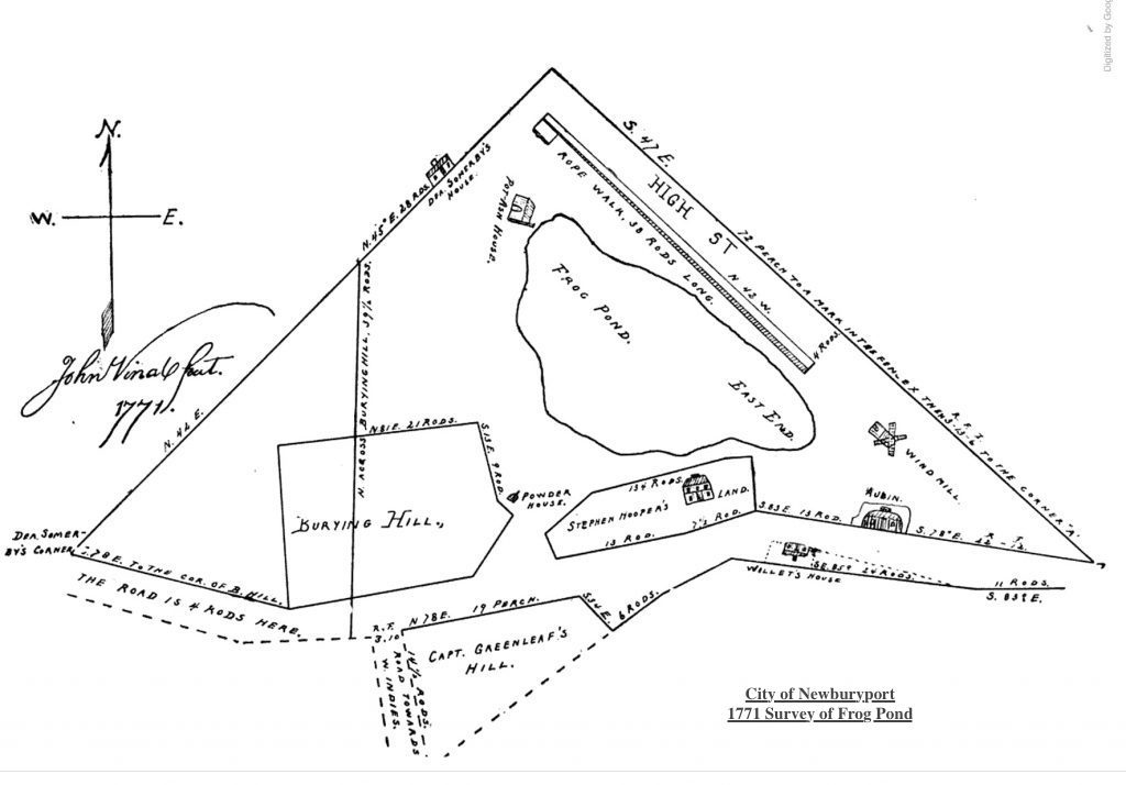
Survey of Frog Pond 1771, City of Newburyport

Survey of Frog Pond 1771, City of Newburyport