Monthly Archives: January 2020

Ocean Mills – the Industrialization and the Expansion of the North End in the 1800s is on the Newburyport History Map

Newburyport Map - Keeping the Story AliveHere is the link to the map: Newburyport – Keeping the Story Alive, Mapping historic stories of Newburyport, MA houses and places, with photos, paintings, videos, old maps, history and anecdotes. Created by The Newburyport Blog, Mary Baker Eaton, editor. (This is one of the many stories that is on the map.)
map.HistoryNewburyport.com

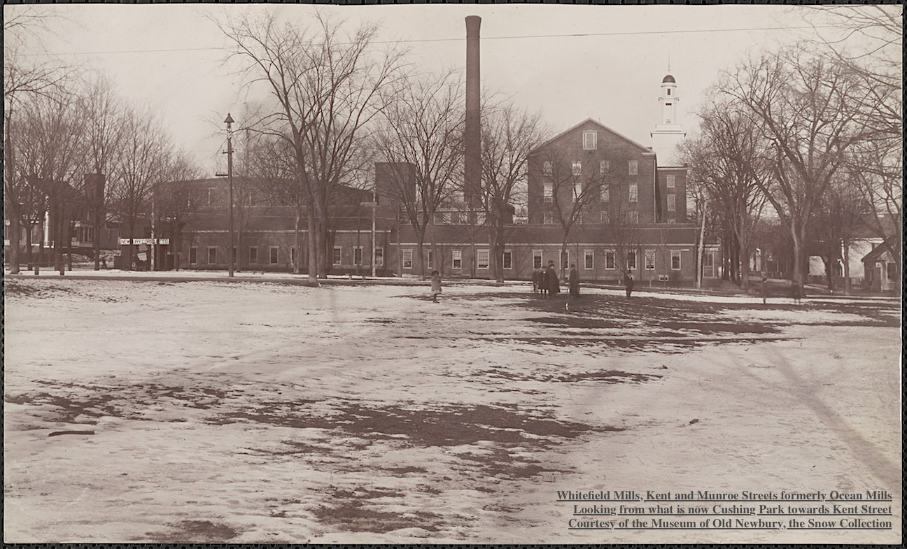
Whitefield Mills, Kent and Munroe Streets formerly Ocean Mills Courtesy of The Museum of Old Newbury, The Snow Collection

Whitefield Mills, Kent and Munroe Streets formerly Ocean Mills
Courtesy of The Museum of Old Newbury, The Snow Collection

Before 1845 the area between Munroe and High Streets was used for pasture and farming.

The Ocean Steam Mills were incorporated by the Massachusetts legislature in March 1845 by Benjamin Saunders, William Balch and Edward S. Lesley. The purpose was to manufacture of cotton cloth.

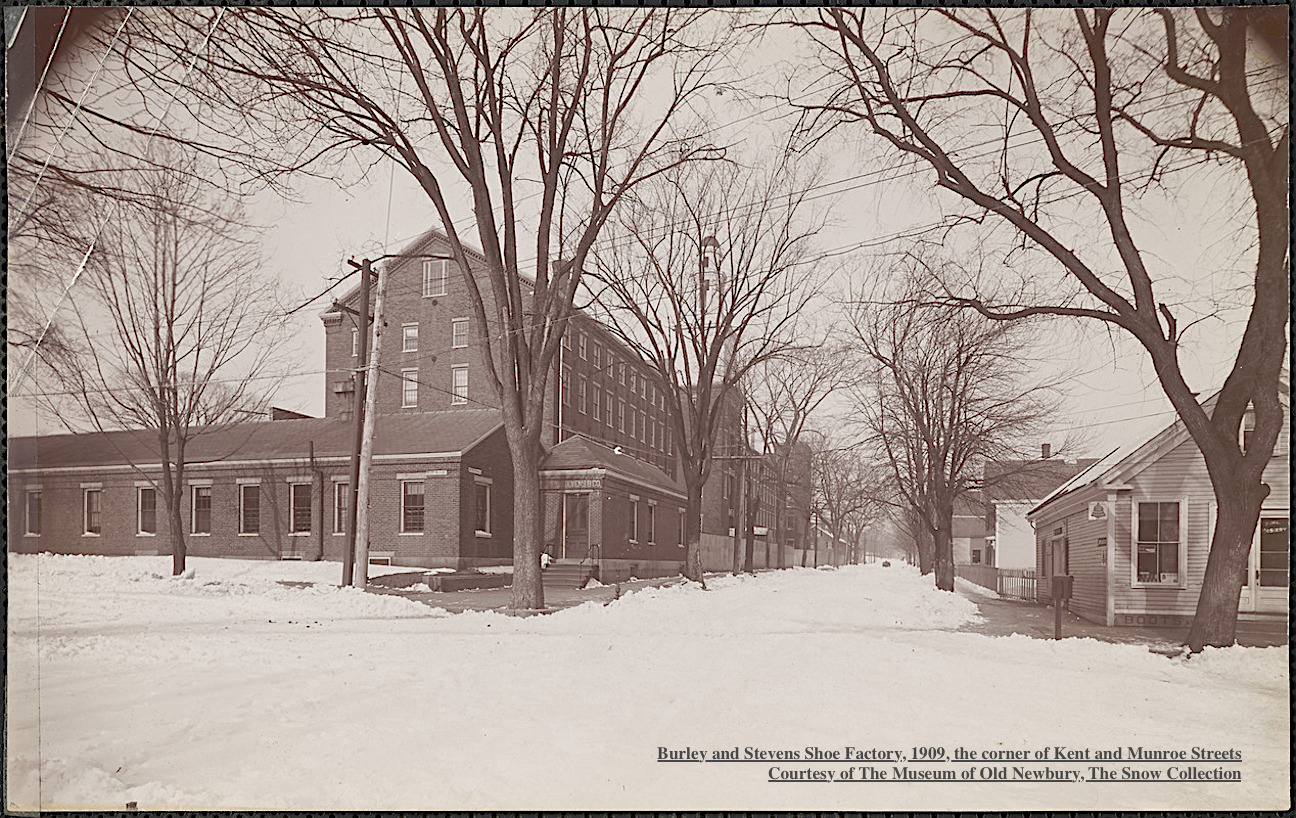
Burley and Stevens Shoe Factory, 1909 Courtesy of The Museum of Old Newbury, The Snow Collection

Burley and Stevens Shoe Factory, 1909
Courtesy of The Museum of Old Newbury, The Snow Collection

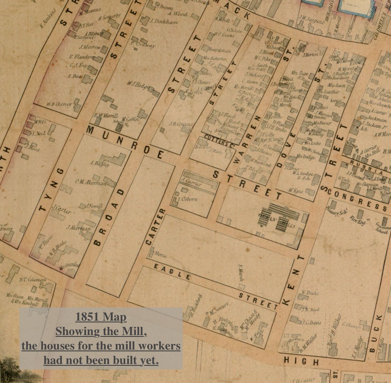
The company purchased a parcel of land on the corner of Kent and Munroe Streets extending to Carter Street. In 1845 the company started construction of a four story brick mill building between Kent and Warren Street. The mill was built by Albert Currier, a local contractor. The building was completed the next year and the manufacture of cotton sheeting and calico cloth began.

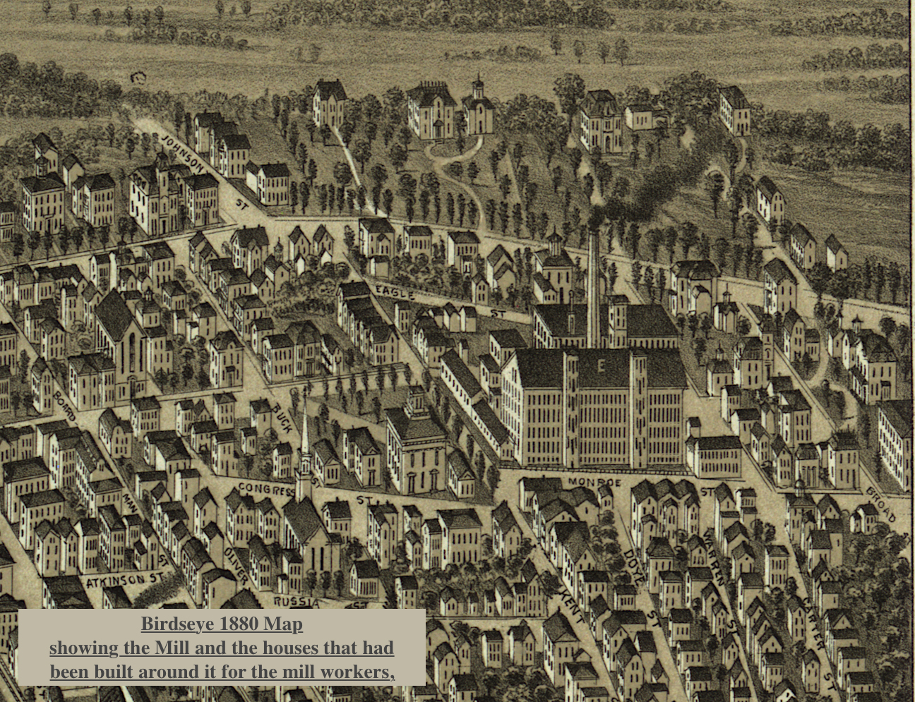
Birdseye view 1880 map showing the Mill and the houses that had been built around it.

Birdseye view 1880 map showing the Mill and the houses that had been built around it.

Around1 871 the property was sold and a new company, the Ocean Mills, continued the operation until 1878. At that time the property again changed hands and a third company, the Ocean Mills Company was formed.

1851 Map showing the Mill and that the houses around it had not yet been built.

1851 Map showing the Mill and that the houses around it had not yet been built.

In 1886 Seth Milliken of New York purchased the mills and name was changed to the Whitefield Mills. The mill did not succeed and in 1889 the machinery was sold to a Southern manufacturer.

Burley, Stevens & Co. manufactured boots and shoes leased the building as did the Bay State Cordage Company which made tarred cordage and binding twine. The Bay State Cordage Company closed in 1907, however Burley, Stevens & Co. continued. They finally closed and most of the mill was abandoned.
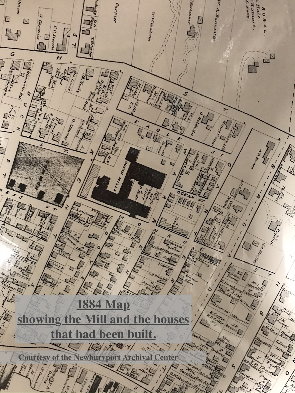
1884 Map, Courtesy of the Newburyport Archival Center, showing the Mill and the houses that had been built around it.

1884 Map, Courtesy of the Newburyport Archival Center, showing the Mill and the houses that had been built around it.

The millworkers needed homes close to their work and so there was a lot of new building on on Carter, Kent, Warren and Munroe Streets and the creation of what is now called the Ocean Mills Historic District, which is an excellent representation of a 19th Century Newburyport industrial neighborhood.

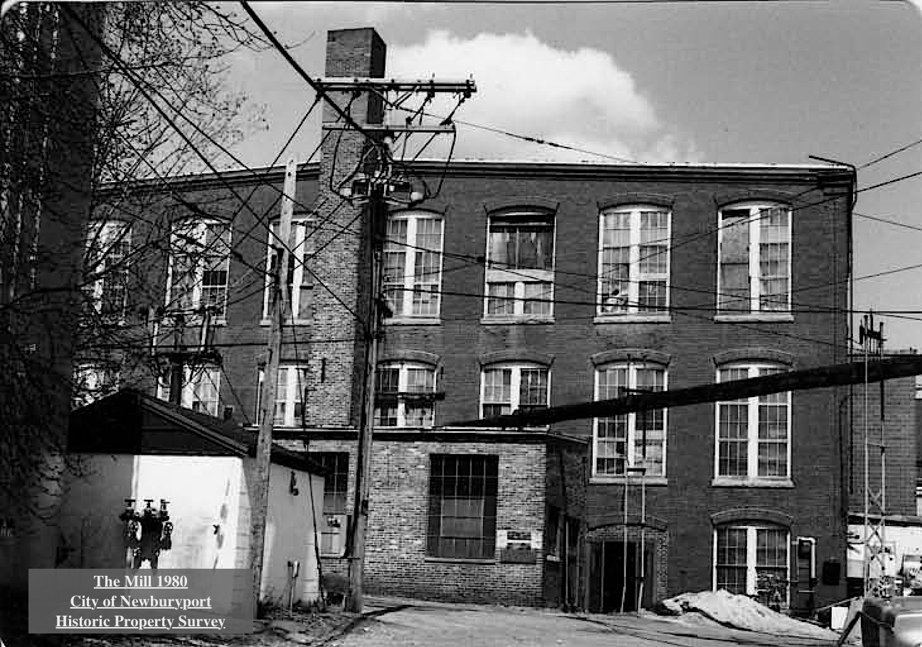
The Mill 1980, Courtesy of the City of Newburyport, Historic Property Survey

The Mill 1980, Courtesy of the City of Newburyport, Historic Property Survey

There were single family cottages, usually Greek Revival or Victorian in style, many are on Carter Street. The second type of residence was a larger home that was used as a boarding house. Three building were build on Munroe Street across from the Ocean Mill by James Blood, a real estate speculator. These house were generally Greek Revival in style. And then there were Victorian buildings and cottages with turned brackets decorating the doorways and sometime the eaves of the house. Albert Currier built one of these buildings on Munroe Street.

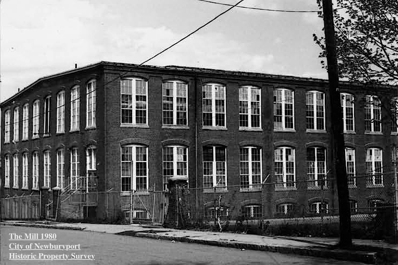
The Mill 1980, Courtesy of the City of Newburyport, Historic Property Survey

The Mill 1980, Courtesy of the City of Newburyport, Historic Property Survey

The overseers and the agents of the mill and skilled craftsmen associated with the industry also built home within this district. These homes were slightly more elaborate, as can be seen on upper Kent Street, they were often vernacular interpretations of one of the many popular Victorian styles such as Second Empire or Victorian Gothic.

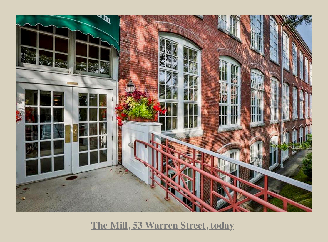
The Mill, 53 Warren Street today

The Mill, 53 Warren Street today

In 1941 the Hytron Radio and Electronics Corporation acquired the property for the manufacture of proximity fuse components and radio receiving tubes for the military, and later, television receiving tubes and cathode-ray tubes. In 1959 the factory closed with the loss of 3,000 jobs. In 1996 the building was turned in to luxury condominiums called “The Courtyard.”

History from The City of Newburyport, Historic Property Surveys “The Ocean Mills Historic District” and “53 Warren Street, Ocean Steam Mills,” John J. Currier, the History of Newburyport, and Jerry Mullins, author of the blog, Brick and Tree.

Whitefield Mills, Kent and Munroe Streets formerly Ocean Mills
Courtesy of the Museum of Old Newbury, the Snow Collection

Burley and Stevens Shoe Factory, 1909
Courtesy of the Museum of Old Newbury, the Snow Collection

The Mill 1980, Courtesy of the City of Newburyport, Historic Property Survey

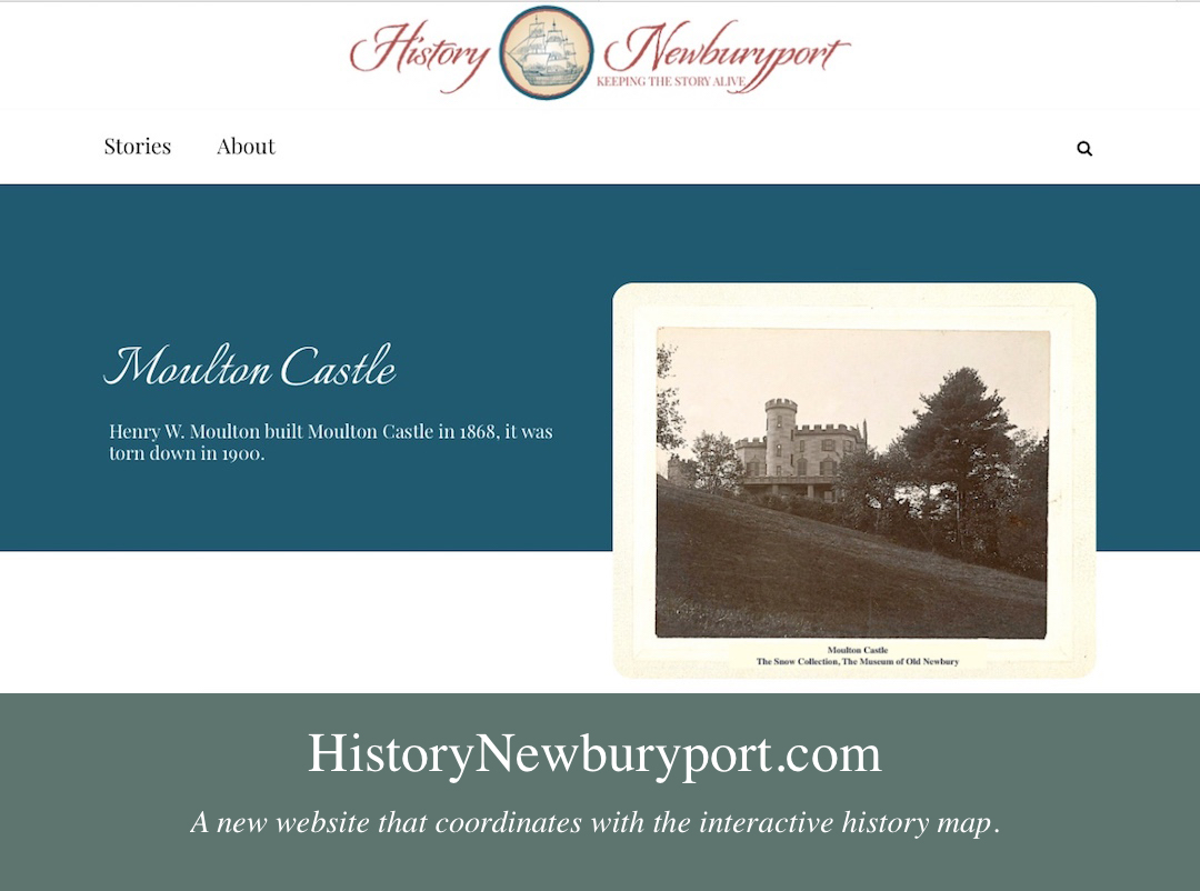
This story is also now on the new website that coordinates with the interactive history map, HistoryNewburyport.com. .

History ~ Newburyport, a new Website about Newburyport's stories

History ~ Newburyport, a new Website about Newburyport’s stories


The story on Ocean Mills can be found here at the new website History ~ Newburyport HistoryNewburyport.com.
Story on Ocean Mills on the new website, History ~ Newburyport

Story on Ocean Mills on the new website, History ~ Newburyport


Moulton Castle is on the Newburyport Interactive History-Story Map

Newburyport Map - Keeping the Story AliveHere is the link to the map: Newburyport – Keeping the Story Alive, Mapping historic stories of Newburyport, MA houses and places, with photos, paintings, videos, old maps, history and anecdotes. Created by The Newburyport Blog, Mary Baker Eaton, editor. (This is one of the many stories that is on the map.)

map.historynewburyport.com

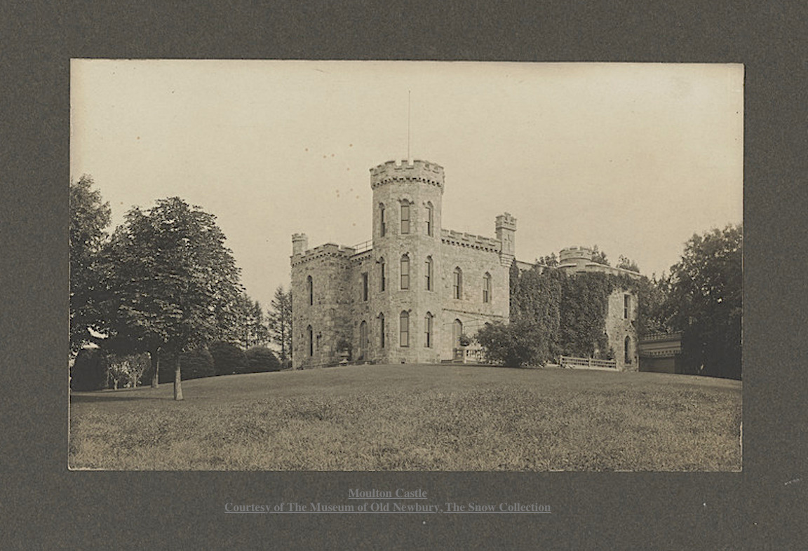
Moulton Castle Courtesy of The Museum of Old Newbury, The Snow Collection

Moulton Castle
Courtesy of The Museum of Old Newbury, The Snow Collection

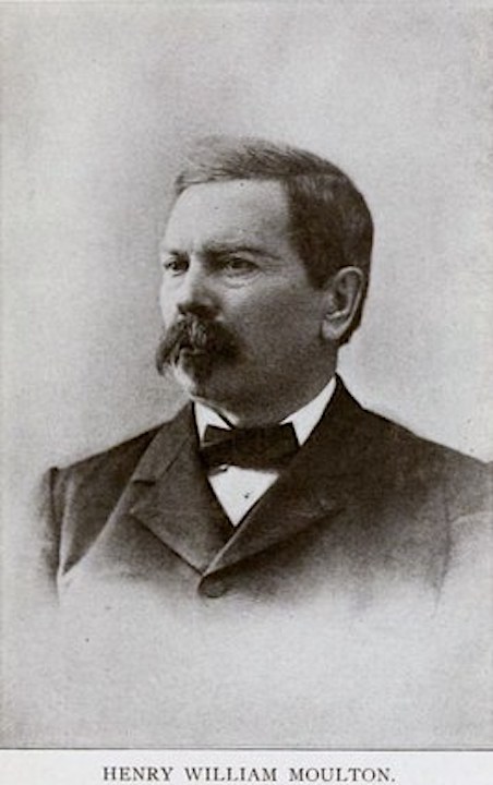
Henry William Moulton (1833 -1896)

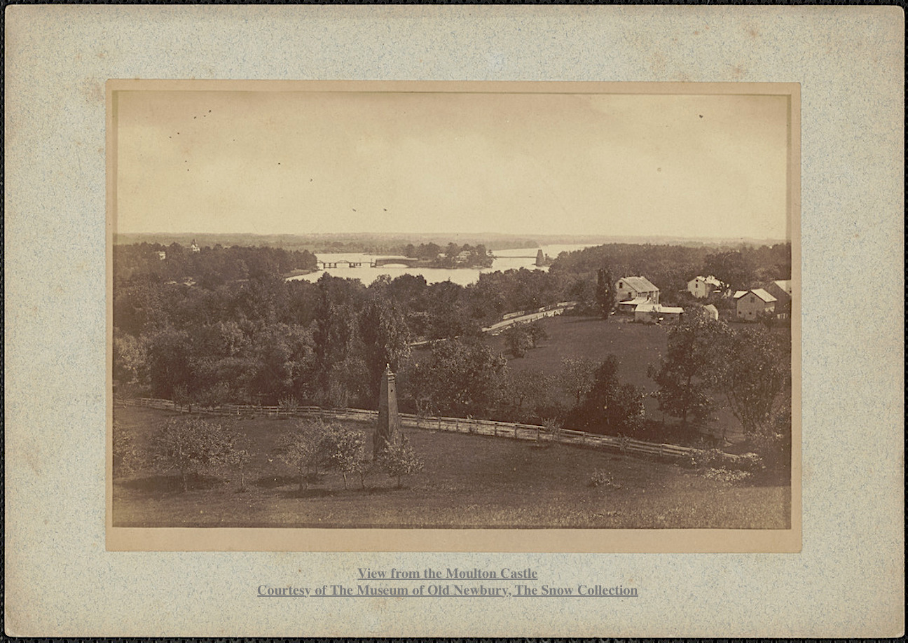
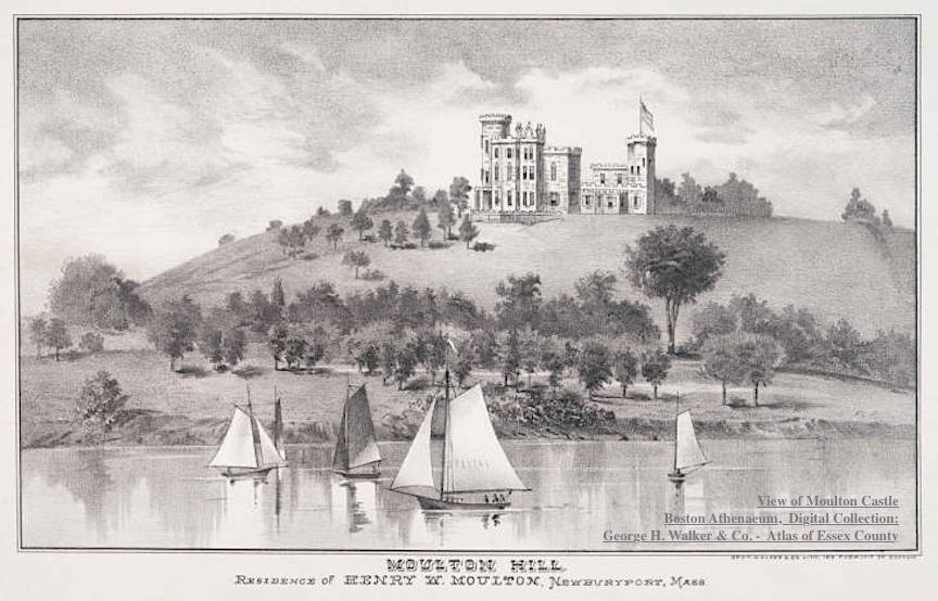
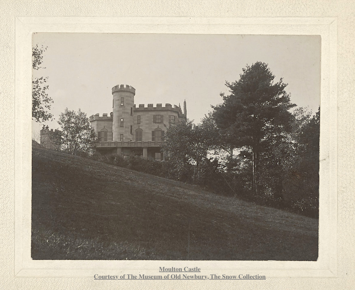
Captain Henry William Moulton returned to Newburyport after the the Civil War in 1865. He came into possession of Moulton Hill, overlooking the Merrimac River, which had been in different branches of Moulton family for six generations. The top of Moulton Hill was said to have the most beautiful landscape in all of New England. In 1868 he built a Gothic-style, 22-room wooden mansion, described as a “noble and picturesque home” on top of the hill, which became known as Moulton Castle.

View from Moulton Castle Moulton Castle Courtesy of The Museum of Old Newbury, The Snow Collection

View from Moulton Castle
Moulton Castle
Courtesy of The Museum of Old Newbury, The Snow Collection

Captain Moulton had six children, his only son died when he was less than a year and there was no son to assume his name and the estate.

View of Moulton Castle Boston Athenaeum, Digital Collection: George H. Walker & Co.'s Atlas of Essex County, Massachusetts. Boston, 1884, p. 143.

View of Moulton Castle
Boston Athenaeum, Digital Collection:
George H. Walker & Co.’s Atlas of Essex County, Massachusetts. Boston, 1884, p. 143.

Following Captain Moulton’s death in 1896, the property was bought by financier Charles W. Moseley who tore down Moulton Castle in December 1900. The site of the mansion is now known as Castle Hill and is part of Maudslay State Park.

Moulton Castle Courtesy of The Museum of Old Newbury, The Snow Collection

Moulton Castle
Courtesy of The Museum of Old Newbury, The Snow Collection

Part of the Poem called “Moulton Castle,” by Charles Clinton Jones

“It stood on a pine fringed hill-top
O’er looking the ancient town,
And the winding course of the river;
That turreted castle brown.
For more than a generation
It guarded the country-side,
The city and bay and islands,
And the marshes low and wide.”

Henry William Moulton (1833 -1896)

Henry William Moulton (1833 -1896)

History from The Moulton Family Search and the Boston Athenaeum and History of Maudslay State Park in Newburyport by Rebecca Beatrice Brooks

Photographs:
Courtesy of The Museum of Old Newbury, The Snow Collection
Boston Athenaeum, Digital Collection:
George H. Walker & Co.’s Atlas of Essex County, Massachusetts. Boston, 1884, p. 143.

This story is also now on the new website that coordinates with the interactive history map, History ~ Newburyport at  HistoryNewburyport.com.

History ~ Newburyport, a new Website about Newburyport's stories

History ~ Newburyport, a new Website about Newburyport’s stories

The story on Moulton Castle can be found here at the new website History ~ Newburyport HistoryNewburyport.com.
Story on Moulton Castle on the new website, History ~ Newburyport

Story on Moulton Castle on the new website, History ~ Newburyport