A friend and I were talking yesterday, and they asked me what did I think of the new NRA’s proposal for Newburyport’s waterfront.
And I said, “I don’t know.”
And they said, “I don’t know.”
We’ve both lived in Newburyport for over 30 years and watched the ongoing NRA waterfront saga.
We both agreed that for the “Citizens for an Open Waterfront” (COWs as they have often been referred to over the many, many decades that this has gone on) having an open waterfront is a religion. And there are many, many folks in town that I know, like and respect very much, that feel fervently that nothing ever should be built on that piece of property.
Mayor Holaday was elected some 3 years ago over James Shanley in part because she was for an “Open Waterfront.” She won, and I thought at the time, Ok we can finally get on with that idea.
But the “new” idea proposed by then candidate James Shanley (now chair of the NRA, appointed by governor Deval Partrick), of having limited building on the NRA parcel to pay for the open space has gained, yup, traction.
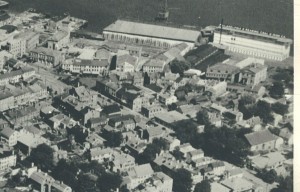
I got out the old photo I have courtesy of the Historical Society of Old Newbury, or as it’s known in Newburyport as “The HIST,” of the NRA lots, c 1920, way before Newburyport’s Urban Renewal took place (click image below to enlarge), and there is no open space at all in what once existed before the bulldozers came in the late 1960s.
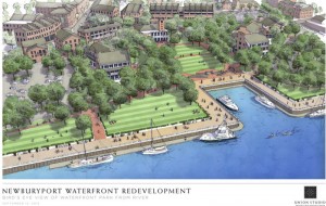
And my friend and I compared it to the new proposal by the NRA (click image below to enlarge), and we both agreed that there was a fair amount of open space, and that it looked reasonable.
NRA plans, 2012, courtesy of the NRA, press image to enlarge.
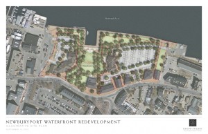
NRA site plan, aerial view, courtesy of the NRA, press image to enlarge.
I guess the question now is, “What is considered open space on Newburyport’s waterfront’s NRA lots?” Lots and lots of open space, or open space, but less open space, with a plan to pay for it (and a park would be wicked expensive).
And for me, will this NRA saga finally be resolved, which I would like a lot, or will it never be resolved in my lifetime, and continue to be a Newburyport political third rail? Hang on to your hats, we’ll find out.
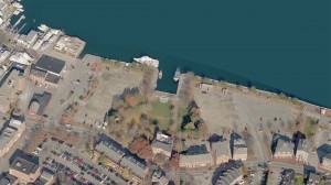
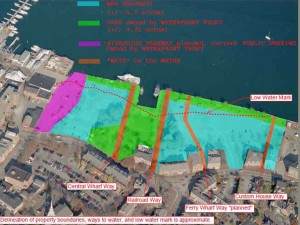
A couple of more images, courtesy of the NRA, for clarification:
An aerial view of the NRA lots as they are today, courtesy of the NRA. Press image to enlarge.
Delineation of the property boundaries, of the NRA, the Waterfront Trust and the Ways to the Water as well as an approximate low water mark. Courtesy of the NRA, press image to enlarge.
To see the entire presentation of the new plans for the NRA lots, given at the Firehouse on September 12, 2012, press here (takes a while to load).
