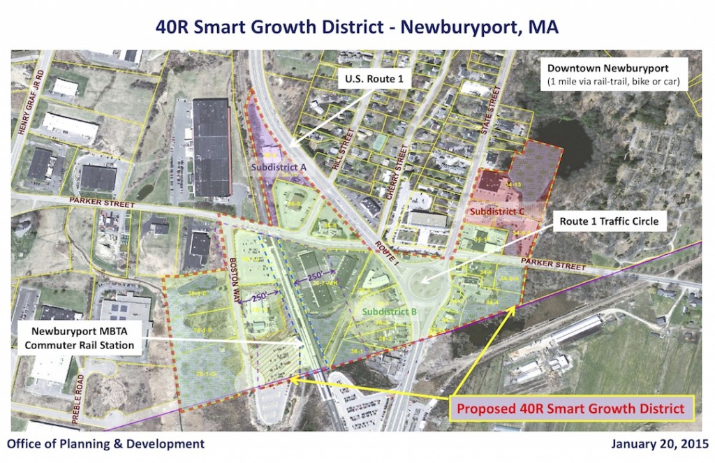
I’ve seen the first draft of the new 40R Smart Growth District around the train station.
The proposed 40R District (see previous post) would allow for mixed use buildings near the train station, traffic circle, parts of Rt 1 and the area on lower State Street between Lunt and Kelly and the edge of the cemetery. There is a new updated map (see below), the larger area subdistrict B is zoned for 4 story buildings (45 ft), Subdistricts A and C is zoned for 3 story building (35 ft), and the Minco building would be zoned for 5 stories (55 ft).
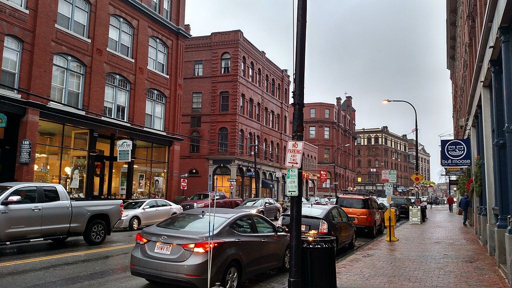
And I’ve gone on a hunt for some good looking 4 story buildings. I have found only one photo that is in the public domain, it is in Portland Maine.
I’m a little confused about Google’s copyright laws, and WordPress does not allow me to embed Google’s images, so what I’ve done is put links to 4 story buildings in Portland ME, Providence RI and Haverhill MA. Haverhill has, on Washington Street, what I think is a gorgeous, but rundown historic section of 4 story building. I love them.
And when you press on the links for the different cities, you can go on a “Google drive” through the areas and see what you thinks works and what does not work. Interesting stuff. Also, the buildings take a few seconds to show up after you press the links.
Portland Maine’s links can he found here, here, here, here and here.
Providence Rhode Island’s links can be found here, here and here.
Haverhill Mass links can be found here, here and here.
In looking at the initial 40R draft (this is just the beginning of a large process that the city will go through) a couple of things stand out.
1) The design review is outstanding. Yah!! I hope that means that the Minco building will be forced to look awesome.
2) There is extensive input into the affordable housing aspect of the district (I’m sure the affordable housing folks with Phd’s in the subject, will have lots of input). It looked great to me.
3) Parking seems a little “skimpy” to me. A residential unit only gets one parking spot. But there is “shared parking,” with businesses and residents, which use parking at different times during the day and week, the objective being not to have lots of wasted, barren parking lots. There are so many people in this city who have Phd’s in parking, and I am not one of them. I am hoping, and pretty sure that they would figure out the “Goldilocks” version of parking, “not too much, not too little, but just right.”
4) The setbacks of the buildings are puzzling to me. There are “no requirements” on setbacks on front, side and rear yards. The way it was explained to me is that there would be no requirements for setbacks for mid-block buildings, but it might be a good idea to look at the setback requirements for intersections (and there seem to me to be a whole lot of intersections). At this point, we do not have close-up renderings of what buildings would look like in different areas of the proposed 40R District.
This is one of my main questions. I can’t imagine 4 story building around the traffic circle where Dunkin’ Donuts is and where the Bird Watcher is located. I can’t imagine anyone wanting to live on that dangerous and noisy area, and being so close to a busy traffic circle. Renderings are definitely needed.
5) Not in the 1st draft, but backup information that would be arriving in the coming weeks that would include:
(1) estimated maximum dwelling units
(2) expected sewer flows (and how to pay for them)
(3) expected traffic impacts
(4) renderings/photo-simulations of new buildings
(5) expected impacts on schools
(6) expected c. 40R and c. 40S payments from the Commonwealth
(7) expected property tax revenues

