The High Street website is down. It was hosted for free for 17 years by David Mack (thank you so much David). The original website was created by Missy Chabot (thank you so much Missy). I did save the text and images and I thought it would be fun to recreate some of the website here.
The text for the High Street website is actually the the application for the Endangered Property List in 1999. The Newburyport Historical Commission played a major part in saving High Street. The chair at that time was Nana Kennedy and the text was written by Bill Steelman and Jane Carolan. The application was submitted by “Citizens to Save High Street” and High Street became the first roadway to become an Endangered Property.
High Street – An American Legacy
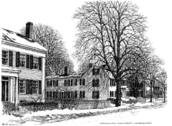 High Street, Newburyport’s signature roadway, is a linear resource extending 2.48 miles from the Newbury – Newburyport town line to a convergence with the two other roads, an area known locally as Three Roads, at which point its name becomes Storey Avenue. The resource lies entirely with the Newburyport Historic District, a National Register historic district listed in the State Register of Historic Places on August 2, 1984.
With origins in 17th century, High Street has evolved incrementally over time, from a country road that led from the first settlement of Newbury (c.1635) to inland towns and ferries landings on the Merrimack River, to a fashionable and socially prominent thoroughfare of national renown. Its development, and that of its contiguous reaches, mirrors Newburyport’s gradual transition from a small waterside entreport into a major shipbuilding center, and eventually a manufacturing town. High Street is Newburyport’s most well-known historic attribute.
High Street’s course is composed of several sections of straight road joined with long gentle curves. Side streets, connecting at right angles, mainly occur at random intervals, displaying no discernible pattern or intent as part of a grand scheme or design. Some were made wide and others narrow. Some cross High Street and some don’t, while others are off-set.
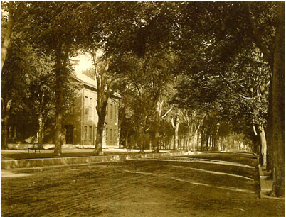
Tree-lined, granite-curbed and bounded throughout by sidewalks, High Street’s predominately residential character is defined by block after block of mostly large, well-maintained houses, many dating to the late Georgian and Federal periods. There exists a rich diversity in lot sizes, house forms (mansions to townhouses to half-houses), and in setbacks, which range from several feet to several hundred. Sidewalks and fence patters are an amalgam of design and materials.
High Street links Newburyport’s two most historic designed landscapes, the Atkinson Common (1893-1894) and the Bartlet Mall, site of the Charles Bulfinch-designed Essex County Superior Courthouse (1805). Laid out in 1801, the Bartlet Mall was redesigned in the 1880s under the direction of noted Boston landscape architect Charles Eliot, with later improvements proposed in the 1930s by Arthur Shurcliff, also of Boston. A third open space located along High Street is March’s Hill, a municipal park particularly popular in the winter as a sledding location. The Three Roads intersection and the eastern end of the Bartlet Mall each feature triangular parcels created by the confluence of streets. Both are sites of memorial monuments or public sculpture.
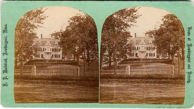
Newburyport’s only National Historic Landmark, the Caleb Cushing House (ca. 1808), home of the Historical Society of Old Newbury, is also located on High Street.
Notable non-residential structures include several historic churches and two historic schools, the Kelley School (1872) and the Newburyport High School (1937). Several buildings are individually listed on the National Register. Of the approximately 230 buildings fronting High street, fewer than ten are less than 50 years old.
High Street – An American Legacy – Setting
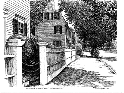 To a very significant degree, High Street remains unaltered and unchanged, maintaining the elegant and stately residential quality with which it has been equated since the late 18th century. Virtually all the physical characteristics and spatial relationships (street to buildings, sidewalks to buildings, parks to street) evident today along High Street were well-established by the late 1800s.
Federal Period houses and their historic gardens mix comfortably with those of the Greek Revival, Queen Anne, and Italianate and Mansard styles. Contributing to the aesthetic are numerous homes with large sweeping lawns and specimen trees. In fact, many properties retain their formal ensemble arrangement of house, outbuildings, gardens, lawns, and fences. High Street, and indeed Newburyport as a whole, retains a remarkable collection of period fences and well-aged brick sidewalks. Individual and subtle, important reminders of the time before the automobile remain in the form of granite hitching posts, carriage mounting steps and two horse watering troughs. The handful of 20th century houses (and two gas stations) do not materially distract from the overall effect of large scale grandeur.
The only real change has been the loss of the arching canopy of stately elm trees depicted in historic photographs. However, along some sections of the street there remain enough mature deciduous trees to maintain a semblance of the effect.
The wholly intact nature of the setting allows the High Street of today to impart the same sense of spaciousness, beauty and dignity that it did 100 years ago.
High Street – An American Legacy – Surroundings
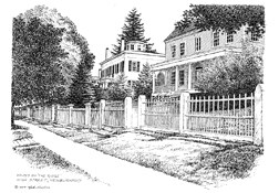 Like High Street itself, Newburyport has retained much of its historic context with few intrusions. All but built-out by the early 20th century, the layout, scale and character of the community was spared the suburban transgressions of the post-war and later periods. Indeed it was Newburyport’s steadfast refusal to succumb to the urban renewal programs of the 1960s and 70s which set the community on its course of enlightened self-awareness regarding large-scale changes in the city’s realm. A by-product has been the nurtured appreciation of not only the “high style” houses but also the vernacular elements of the city’s fabric.
The streets and neighborhoods surrounding High Street, like those throughout the majority of the city, retain their residential integrity. The housing stock of the surrounding streets is still composed of its historical mix of setbacks, building forms, massing, plans and materials. To date, the demolition and replacement of existing structures is limited. More typical, and equally troubling, is the wholesale replacement of windows and cladding.
Commercial intrusion has primarily been confined to Storey Avenue, the road that connects I-95 with High Street. Many of the High Street’s traffic and speed problems originate from Storey Avenue, as the suburban nature of the shopping plaza developments and fast-food outlets have little connection to the residential and historic qualities of nearby High Street. Visitors, in particular, are surprised by the abrupt change in ambiance when merging from Storey Avenue to High Street, and consequently have difficulty adjusting their driving style and speed.
High Street – An American Legacy – Historical Significance
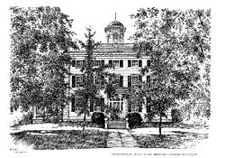 High Street is historically significant. The entire street, its curvilinear course, landscape features and connection to structures, side streets and neighborhoods, contributes greatly to the Newburyport Historic District. Acknowledging its high level of significance and intact nature, the city’s 1991 preservation plan recommends High Street as a local historic district.
The National Register district is composed of 2,576 properties, making it the second largest such district in Massachusetts (Boston’s South End is larger), and one of the largest historic districts in the United States. The statement of significance for the National Register nomination for the Newburyport Historic District states:
The Newburyport National Register Historic District possesses integrity of location, design, setting, materials, and workmanship as well as historical associations with the city’s mercantile, maritime and industrial development. Founded in the mid-seventeenth century, Newburyport has been significant throughout its history as the regional core for Northern Essex County with its greatest period of significance occurring between mid-eighteenth and mid-nineteenth century… [The proposed district contains] an especially large concentration of high-style houses and public buildings dating from the Federal period… Newburyport’s low degree of alteration and general lack of intrusion seem attributable to the stability of local population since the late nineteenth century…
In an important and meaningful way, High Street not only links, but virtually embodies, all periods of Newburyport’s considerable history.
Beyond its historical significance is its cultural and economic value to the community. High Street is Newburyport’s premier street and one of its major character-defining elements. As the principal gateway to Newburyport, it helps establish the city as an historic, attractive and welcoming place whose citizens appreciate and care for their community’s appearance.
Since the nineteenth century, High Street has been the subject of architectural historians, artists, and writers. In the 1930’s, several of its houses were documented by the Historic American Building Survey (HABS) and many are featured in John Mead Howell’s, Architectural Heritage of the Merrimack, published in 1941. The Current Michelin Guide to New England considers High Street “one of the most scenic streets in all of New England.”
It is these images of Newburyport, old and new, which draw several hundred thousand visitors to the city each year, contributing significantly to the city’s burgeoning tourism economy.
High Street – Past Threats and Future Challenges
(Editor’s Note: This was written in 2002)
The city of Newburyport is presently at a crossroads with regard to High Street.
Like many cities and towns in eastern Massachusetts, Newburyport is under assault from the automobile. Today’s healthy economy, together with Newburyport’s reputation as a desirable community within reasonable commuting distance of Boston, have conspired to put growing numbers of cars, busses and trucks onto High Street. The result is an increase in speeding, congestion, noise and dirt. It has been more than 30 years since the road surface was fully reconstructed. Repairs have been confined to a series of limited surface paving and as-needed pothole repair. The roadbed is in serious need of repaving
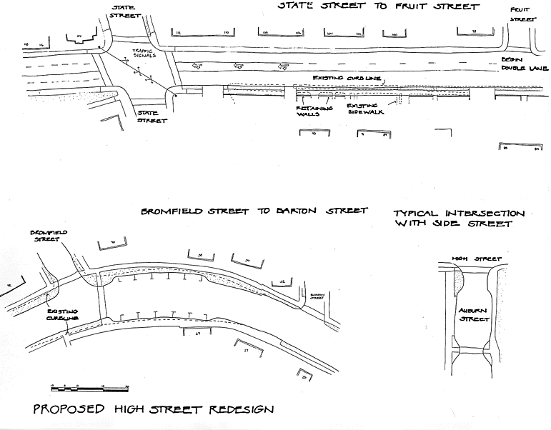
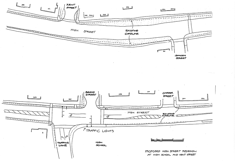
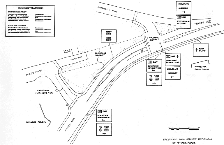
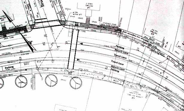
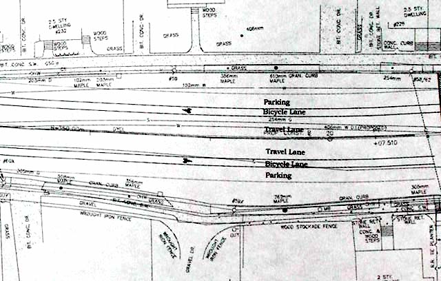
In a response to a grant request written by the City in January 1995, the solution to many of these problems was presented in the form of a proposed project from the Massachusetts Highway Department (MassHighway) (see renditions of the original plans. The MassHighway plans were presented to the City in February of 1998 and universally protested and rejected by the residents of the City. A “pave only” or “curb to curb” compromise was reached by the City and MassHighway in September of 1999 and was embraced with enthusiasm and relief
In February of 2000, Mass Highway was asked once again by the City of Newburyport to enter into negotiations and to put aside the “curb to curb” compromise which the administration felt did not “sufficiently address the significant needs of the corridor”. The city also asked MassHighway to revisit what the City called the “hazardous conditions” addressed in the original grant which had “only worsened”.
In December of 2000 the City met with MassHighway to discuss going forward to come up with a new set of plans for High Street. The Mayor has formed a review committee. On March 1, 2001 the City Council called a citywide meeting to discuss what residents would like for the future of High Street. (See Newburyport Daily News report and editorial)
Newburyport is again at a crossroads. The roadbed desperately needs to be repaired. However, one questions the wisdom of approaching MassHighway for such a historically sensitive project, especially given its past unfortunate history with the street and its rigid adherence to strict state and federal roadway standards – the reason High Street was previously named an Endangered Resource by Historic Massachusetts.
There are really two issues:
- How to preserve an historic road
- How to bring a road into the 21st Century and deal with contemporary transportation and ADA issues.
The hard fact is that these two goals are very difficult to reconcile. The danger in emphasizing bringing High Street into the 21st Century is that the historic nature of the road could be lost. If the emphasis is on preserving and enhancing High Street, the road could once again be returned to its former glory with a healthy canopy of trees, brick sidewalks, and period lighting. It would also retain all of the subtle and irreplaceable historic elements that have evolved slowly over time and tell the story of the generations that have gone before us.
The Original MassHighway Plans from 1998
Renderings of the original MassHighway plans are based on engineering drawings and Courtesy of the Newburyport Historical Commission 1999.
The Original MassHighway Plans 1998 – Bromfield Street
The Original MassHighway Plans 1998 – the High School and Kent Street
The Original MassHighway Plans 1998 – Three Roads
Historic High Street Becomes Part of a State Scenic Byway
In the Fall of 2003, High Street became part of a state Scenic Byway. Many workshops were held in Newburyport to help High Street become part of the Scenic Byway.
Press Release from the Essex National Heritage Commission
Essex National Heritage Area Scenic Byway Designated
The Essex National Heritage Area received more good news this past fall when Governor Mitt Romney signed legislation designating portions of state Routes 133 and 1A between Gloucester and Newburyport a state scenic byway. From a beginning point on Gloucester’s waterfront, the 24 mile-long Essex National Heritage Area Scenic Byway passes though the towns of Essex, Ipswich, Rowley, and Newbury, terminating midway through Newburyport.
The designation, only the sixth in the state, was sought by the ENHC following the endorsement of residents and elected officials in the six corridor communities. The designation is a critical step in the quest to access federal highway funds to protect the roadway’s scenic qualities, improve its safety features, promote economic opportunities, and develop a balanced tourism program – as determined by each byway community.
Legislation to establish the scenic byway was introduced by Senator Bruce Tarr of Gloucester and co-sponsored by Senator Steven Baddour and Representatives Michael Costello, Bradford Hill, Anthony Verga, and Harriet Stanley. We thank them for their support of this important initiative.
The High Street Master Plan
Editor’s Note:
The High Street Master Plan languishes in the Newburyport Planning Office. People were so upset when the bike lanes went down that the mayor vetoed the High Street Master Plan and the Newburyport City Council did not have the votes to override the veto. Much later the Newburyport City Council did vote for the High Street Master Plan, however, the funding had been lost and there was not “political will” to make it happen. The plans are still there in the Planning Office and they are gorgeous.
And recently the City of Newburyport has put the entire High Street Master Plan online. Here is the link: https://www.cityofnewburyport.com/sites/newburyportma/files/uploads/high_street_master_plan_0.pdf
_________________________________________________
In the spring of 2004, the City of Newburyport presented its citizens with a Master Plan for High Street. The plan was received with enthusiasm and cheers when it was presented at the public hearing held at City Hall.
The plan is a thoughtful and commonsense approach to High Street. It emphasizes preserving and enhancing High Street’s beauty and historic quality, repairing the roadway and slowing down traffic without traffic lights or stop signs.
The plan calls for brick sidewalks, planting trees along the corridor, repairing and keeping the shape of the roadway. It also calls for bicyle lanes and 11.5 wide traffic lanes to slow down traffic, keeping traffic at the speed limit without traffic lights or stop signs. The plan incorporates textured crosswalks that look like brick around critical areas such as schools, churches, parks and businesses.
In 2001 the City measured all the sidewalks along High Street and found that they were more than wide enough to meet ADA standards, enabling the City to keep the original shape of the road. The Master Plan calls for brick curb-cuts where the City feels they are appropriate (the MassHighway plan called for cement curb cuts where there were existing cement or asphalt sidewalks).
High Street’s Master Plan retains all of the subtle and irreplaceable historic elements such as hitching posts and carriage steps, as well as the varying widths of the roadway, that have evolved slowly over time and tell the story of the generations that have gone before us. In short, it is a remarkable solution to what in 1999 seemed to be an unsolvable dilemma.
An Example of the 2004 Draft of the High Street Master Plan (later altered after public input)
